Iperó
| Iperó | |
|---|---|
| Municipality | |
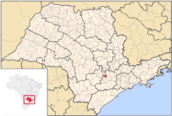 Location in São Paulo state | |
 Iperó Location in Brazil | |
| Coordinates: 23°21′1″S 47°41′19″W / 23.35028°S 47.68861°WCoordinates: 23°21′1″S 47°41′19″W / 23.35028°S 47.68861°W | |
| Country |
|
| Region | Southeast Region |
| State | São Paulo |
| Metrop. region | Sorocaba |
| Area | |
| • Total | 170.29 km2 (65.75 sq mi) |
| Elevation | 590 m (1,940 ft) |
| Population (2015) | |
| • Total | 33,367 |
| • Density | 200/km2 (510/sq mi) |
| Time zone | BRT/BRST (UTC-3/-2) |
| Postal code | 18560 |
| Area code | +55 15 |
| Website |
www |
Iperó is a municipality in the state of São Paulo in Brazil. It is part of the Metropolitan Region of Sorocaba.[1] The population is 33,367 (2015 est.) in an area of 170.29 km².[2] The elevation is 590 m. The Sorocaba River flows near Iperó. Iperó is accessed with the highway SP-280.
Population history
| Year | Population |
|---|---|
| 2001 | 18,384 |
| 2007 | 24,239 |
| 2015 | 33,367 |
Demographics
According to the 2000 IBGE Census, the population was 18,384, of which 12,649 are urban and 5,735 are rural. The average life expectancy was 72.42 years. The literacy rate was 91.8%.
References
- ↑ Governo do Estado de São Paulo, Lei Complementar nº 1.241, de 8 de maio de 2014 at the Wayback Machine (archived 18 October 2014)
- ↑ Instituto Brasileiro de Geografia e Estatística
External links
- (Portuguese) http://www.ipero.sp.gov.br
- (Portuguese) Iperó on citybrazil.com.br
This article is issued from Wikipedia - version of the 11/15/2016. The text is available under the Creative Commons Attribution/Share Alike but additional terms may apply for the media files.