Invermay, Saskatchewan
| Invermay | |
|---|---|
| Village | |
|
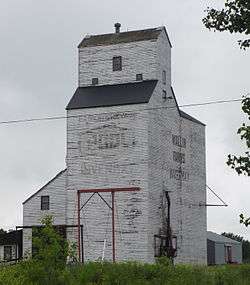
The grain elevator in Invermay, Saskatchewan | |
| Motto: "The Crossroads Centre" | |
 Invermay  Invermay Invermay in Saskatchewan | |
| Coordinates: 51°48′21″N 103°09′23″W / 51.80583°N 103.15639°WCoordinates: 51°48′21″N 103°09′23″W / 51.80583°N 103.15639°W[1] | |
| Country | Canada |
| Province | Saskatchewan |
| Region | East Central |
| Census division | 9 |
| Rural Municipality | Invermay No. 305 |
| Government | |
| • Type | Mayor-Council |
| • Body | Invermay Council |
| • Mayor | Mike Kaminski |
| Area | |
| • Urban | 1.22 km2 (0.47 sq mi) |
| Elevation[2] | 556 m (1,825 ft) |
| Population (2011)[3] | |
| • Urban | 247 |
| • Urban density | 201.8/km2 (523/sq mi) |
| Time zone | CST (UTC-6) |
| • Summer (DST) | CST (No DST)[4] (UTC-6) |
| Postal code | S0A 1M0 |
| Area code(s) | 306/639 |
| Highways |
|
| Railways | Canadian National Railway |
| [5][6][7][8] | |
Invermay is a village in the east-central region of Saskatchewan, Canada with a population of 247 in 2011.[9]
Invermay is about 75 km west of Canora or about 50 km east of Wadena on Highway 5.
Demographics
The most recent census taken in 2011 shows that Invermay continues to have a declining population with 247 residents.
| Canada census – Invermay community profile | |||
|---|---|---|---|
| 2011 | 2006 | 2001 | |
| Population: | 247 (-5.7% from 2006) | 262 (-7.7% from 2001) | 284 (-3.7% from 1996) |
| Land area: | 1.22 km2 (0.47 sq mi) | 1.22 km2 (0.47 sq mi) | 1.22 km2 (0.47 sq mi) |
| Population density: | 201.8/km2 (523/sq mi) | 214.0/km2 (554/sq mi) | 232.78/km2 (602.9/sq mi) |
| Median age: | 50.2 (M: 43.8, F: 56.0) | 55.0 (M: 50.2, F: 57.2) | 54.4 (M: 53.5, F: 54.6) |
| Total private dwellings: | 130 | 145 | 157 |
| Median household income: | |||
| References: 2011[10] 2006[11] 2001[12] | |||
See also

References
- ↑ "The Atlas of Canada Toporama". Retrieved August 20, 2014.
- ↑ "NRC - Invermay". Retrieved August 20, 2014.
- ↑ "Invermay Census Profile". Retrieved August 20, 2014.
- ↑ "Time zones & daylight saving time". National Research Council Canada. 2012-05-09. Retrieved 2014-07-16.
- ↑ National Archives, Archivia Net, Post Offices and Postmasters
- ↑ Government of Saskatchewan, MRD Home, Municipal Directory System, archived from the original (– Scholar search) on November 21, 2008
- ↑ Canadian Textiles Institute. (2005), CTI Determine your provincial constituency
- ↑ Commissioner of Canada Elections, Chief Electoral Officer of Canada (2005), Elections Canada On-line
- ↑ 2011 Community Profiles
- ↑ "2011 Community Profiles". Canada 2011 Census. Statistics Canada. July 5, 2013. Retrieved February 27, 2015.
- ↑ "2006 Community Profiles". Canada 2006 Census. Statistics Canada. March 30, 2011. Retrieved February 27, 2015.
- ↑ "2001 Community Profiles". Canada 2001 Census. Statistics Canada. February 17, 2012. Retrieved February 27, 2015.
External links
- Saskatchewan City & Town Maps
- Saskatchewan Gen Web - One Room School Project
- Post Offices and Postmasters - ArchiviaNet - Library and Archives Canada
- Saskatchewan Gen Web Region
- Online Historical Map Digitization Project
- GeoNames Query
 |
Nut Mountain | Lintlaw | Hazel Dell | |
| Margo | |
Rama | ||
| ||||
| | ||||
| Tuffnell | Sheho | Stonyview |
| Subdivisions | |
|---|---|
| Communities | |
| Cities | |
| Topics |
|
| |
This article is issued from Wikipedia - version of the 9/10/2016. The text is available under the Creative Commons Attribution/Share Alike but additional terms may apply for the media files.