Invergowrie Bay
| Invergowrie Bay | |
|---|---|
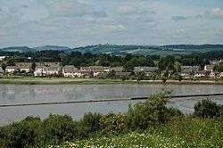 The bay near low tide | |
| Location | Firth of Tay |
| Coordinates | 56°27′N 3°04′W / 56.45°N 3.06°WCoordinates: 56°27′N 3°04′W / 56.45°N 3.06°W |
| River sources | River Tay |
| Basin countries | United Kingdom |
Invergowrie Bay is a tidal basin located near Invergowrie in eastern Scotland.[1] Also in the bay are the Gowrie Burn and the Huntly Burn. There is a 1.25 mi (2.01 km) walk along the shoreline from Invergowrie railway station to Kingoodie.[2]
References
- ↑ "Invergowrie Bay". Virtual Tenby. Retrieved 28 February 2012.
- ↑ "Invergowrie to Kingoodie shore walk". Carse of Gowrie Group. Retrieved 30 March 2012.
This article is issued from Wikipedia - version of the 6/19/2015. The text is available under the Creative Commons Attribution/Share Alike but additional terms may apply for the media files.