Interstate 95 in Rhode Island
| ||||
|---|---|---|---|---|
_map.svg.png) | ||||
| Route information | ||||
| Maintained by RIDOT | ||||
| Length: | 43.3 mi[1] (69.7 km) | |||
| Existed: | 1957 – present | |||
| Major junctions | ||||
| South end: |
| |||
|
| ||||
| North end: |
| |||
| Location | ||||
| Counties: | Washington, Kent, Providence | |||
| Highway system | ||||
| ||||
Interstate 95 (I-95) is the main north–south Interstate Highway on the east coast of the United States, running generally southwest-northeast through the U.S. state of Rhode Island. It runs from the border with Connecticut near Westerly, through Warwick and Providence, and to the Massachusetts state line in Pawtucket. It has two auxiliary routes, both of which enter Massachusetts—Interstate 195: a spur from Providence east to Cape Cod, and Interstate 295, a western bypass of the Providence-Pawtucket area.
South of Warwick, I-95 does not follow U.S. Route 1, which it generally replaced in New England. It instead takes a shorter inland route, parallel to Route 3. Route 3 was designated Route 1A in 1922, a New England Interstate Route, but it has never been a U.S. Route.
History
Southern Rhode Island

The diagonal corridor of Route 3 was a well-traveled shortcut to the older U.S. Route 1 even before any part of Interstate 95 was built. In the 1930s, a further cutoff was built in southeastern Connecticut and southwestern Rhode Island, joining Old Mystic, Connecticut to Route 3 in Hopkinton, Rhode Island. The existing Route 84 in Connecticut was rerouted to use the new road (now Route 184), and the short piece in Rhode Island was also numbered Route 84.[2] (This alignment had been the Hopkinton and Richmond Turnpike - better known as the New London Turnpike - but had fallen into disrepair.) The right of way of New London turnpike goes though the Big river management area (as a dirt road), crosses division road as a four-way intersection with the North side of the turnpike paved, has an interchange with Interstate 95 (exit 7), continues for 1.85 miles before connecting with Route 3 in West Warwick for a ¼ mile. New London Turnpike turns into New London Ave and continues straight for 2¼ miles before connecting with Providence street (RI-33). It follows Providence Street until it hits the Meshanticut Interchange.
The first section of what is now I-95 was planned as an upgrade and relocation of Route 84 and Route 3 from the state line north of Westerly to existing Route 3 of Richmond. The short Route 84 was widened to a four-lane divided road with one intersection at Gray Lane. Instead of merging with Route 3, it was modified to continue northeast, passing under Route 3 with a folded diamond interchange (modern day exit 1). The rest of the new road was designated Route 3 once it was completed on December 12, 1955. It was not built to freeway standards, only having interchanges at Route 3 in Hopkinton and Route 138 in Richmond (a cloverleaf) (modern day exit 3), as well as a bridge over the Wood River and Mechanic Street.[3][4]
A section of freeway (known as the Kent County Freeway) opened in July 1958, running from Route 3 at Kitts Corner northeast across the Big River (modern day exit 6) and east across Route 3 to Route 2 on the West Warwick-Warwick line (modern day exit 8). Its west end was a simple intersection with old Route 3, in which only northbound traffic could continue on the old road — southbound traffic had to enter the new freeway east of the Big River. The only two interchanges were with Route 3 east of the Big River (a diamond interchange) and with Route 2 at its east end (a four-ramp interchange providing half the ramps of a cloverleaf).[4][5]

The Interstate 95 designation was approved on June 27, 1958.[6] The section in southern Rhode Island was temporarily designated Route 95 until it could be upgraded to a freeway. This route ran from the Connecticut state line along what had been Route 84, continuing along the Relocated Route 3 to north of Richmond, along normal Route 3 to Kitts Corner, and along the new freeway east to Route 2. As much as possible, Route 3 was moved back to the old road; it only used the new freeway by necessity in the area near Kitts Corner and over the Big River.[7] Connecticut also renumbered their section of Route 84 to Route 95 at that time.[2]
Interstate 95 in Connecticut was finished December 12, 1964 to the Rhode Island state line, where it connected to the older Route 95 divided highway.[8] The old road from the border to Gray Lane was combined with the frontage road built when Route 84 was upgraded to form what is now known as Extension 184. The portion from the Connecticut state line to Route 3 north of Richmond was upgraded to a freeway with construction ending May 1968.[5] To the north, that freeway was connected with the Kent County Freeway by a new section, opened November 22, 1969 as the last section of I-95 in Rhode Island.[3] The connection to Route 3 at Kitts Corner was removed, and Route 3 was moved back to the old road over the Big River. Route 95 was renumbered Interstate 95, as the whole road was now a freeway.
An interchange with the New London Turnpike was added to the Kent County Freeway by 1972.[4] In 1983, a new interchange with Hopkins Hill Road opened.[3]
Pawtucket area
The people of Pawtucket feared the construction of I-95 as early as 1949. Editions of the Pawtucket Times and Providence Journal in 1949 recalls how neighbors in the Woodlawn section of Pawtucket feared the construction of the highway. According to Rhode Island Department of Transportation blueprints, the highway was originally planned for the west side of Pawtucket, avoiding the Pawtucket River. The highway was originally designed to be constructed east of the New York-New Haven railroad tracks and create underpasses on Mineral Spring Avenue, Broad Street, and Dexter Street. The highway was meant to travel east of the Pawtucket-Central Falls train station and into South Attleboro, Massachusetts.
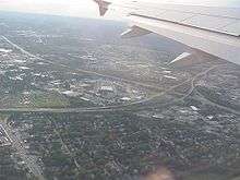
The Pawtucket River Bridge is part of Interstate 95 and has been replaced.
Exit list
Exit numbers are sequential, but are to be replaced with mileage based numbers as per MUTCD 2009 standards by 2018.[9]
| County | Location | mi[1] | km | Exit[10] | Destinations[1] | Notes |
|---|---|---|---|---|---|---|
| Washington | Hopkinton | 0.0 | 0.0 | – | Continuation into Connecticut | |
| 0.7 | 1.1 | 1 | ||||
| 4.5 | 7.2 | 2 | Hope Valley, Alton | Via Woodville Alton Road | ||
| Richmond | 6.4 | 10.3 | Rest Area and welcome center - Northbound (closed September 2011, reopened September 2016) | |||
| 7.1– 7.5 | 11.4– 12.1 | 3 | Signed as exits 3A (east) and 3B (west) | |||
| 9.0 | 14.5 | 4 | Northbound exit and southbound entrance | |||
| 10.7 | 17.2 | Parking area and weigh station | ||||
| Kent | West Greenwich | 13.6– 14.3 | 21.9– 23.0 | 5 | Signed as exits 5A (south) and 5B (north) | |
| 17.9– 18.4 | 28.8– 29.6 | 6 | ||||
| 19.6– 20.1 | 31.5– 32.3 | 6A | Hopkins Hill Road | |||
| 21.4 | 34.4 | 7 | Coventry, West Warwick | Access via New London Turnpike | ||
| Warwick | 23.7– 24.1 | 38.1– 38.8 | 8 | Signed as exits 8A (north) and 8B (south) northbound | ||
| 24.8 | 39.9 | 9 | Northbound exit is via exit 8A; northern terminus of Route 4 | |||
| 26.6– 27.2 | 42.8– 43.8 | 10 | Signed as exits 10A (east) and 10B (west) southbound | |||
| 27.6 | 44.4 | 11 | Southbound exit is via exit 12B; southern terminus of I-295 | |||
| 28.0 | 45.1 | 12 | Signed as exit 12A southbound | |||
| 28.5 | 45.9 | Signed as exit 12B southbound | ||||
| 29.2– 29.8 | 47.0– 48.0 | 13 | Access via Airport Connector Road | |||
| 30.7– 31.7 | 49.4– 51.0 | 14A | Exits 4A-B on Route 37 | |||
| 14B | ||||||
| 15 | Jefferson Boulevard | Northbound exit ramp is shared with exit 14B | ||||
| Providence | Cranston | 33.2 | 53.4 | 16 | Exits 2A-B on Route 10 | |
| 33.8 | 54.4 | No northbound exit | ||||
| Providence | 34.2 | 55.0 | 17 | Southbound exit only; other movements via Route 10 | ||
| 35.0– 35.5 | 56.3– 57.1 | 18 | ||||
| 35.7 | 57.5 | 19 | Northbound exit and southbound entrance | |||
| 36.1 | 58.1 | Eddy Street | Southbound exit only | |||
| 36.4 | 58.6 | 20 | Point Street | No southbound exit | ||
| 36.6 | 58.9 | Southern terminus of concurrency with US 6; southbound exit and northbound entrance | ||||
| 37.0 | 59.5 | 21 | Broadway | Northbound exit only | ||
| 37.3– 37.6 | 60.0– 60.5 | 21 | Atwells Avenue | Southbound exit and northbound entrance | ||
| 37.2– 37.8 | 59.9– 60.8 | 22A | Memorial Boulevard – Downtown Providence | |||
| 22B | Northern terminus of concurrency with US 6 | |||||
| 22C | Providence Place | |||||
| 38.0 | 61.2 | 23 | Northbound exit and southbound entrance; southern terminus of Route 146 | |||
| 38.5 | 62.0 | Charles Street (Route 246) to Route 146 north | Southbound exit and northbound entrance | |||
| 39.0 | 62.8 | 24 | Branch Avenue | |||
| 39.4– 40.0 | 63.4– 64.4 | 25 | Signed as exits 25A (US 1) and 25B (Route 126) northbound | |||
| Pawtucket | 40.6 | 65.3 | 26 | Northbound exit and southbound entrance | ||
| 41.1– 41.6 | 66.1– 66.9 | 27 | Southern terminus of concurrency with US 1 | |||
| 41.4– 41.9 | 66.6– 67.4 | 28 | No southbound exit | |||
| 42.1– 42.6 | 67.8– 68.6 | 29 | NB: SB: | Northern terminus of concurrency with US 1 | ||
| 42.7– 43.2 | 68.7– 69.5 | 30 | East Street / Roosevelt Avenue – Central Falls | |||
| 43.3 | 69.7 | – | Continuation into Massachusetts | |||
1.000 mi = 1.609 km; 1.000 km = 0.621 mi
| ||||||
References
- 1 2 3 Google (February 5, 2016). "Interstate 95" (Map). Google Maps. Google. Retrieved February 5, 2016.
- 1 2 "kurumi: Connecticut Route 184". Retrieved 4 October 2014.
- 1 2 3 "The Roads of Metro Boston - north–south Expressway". Retrieved 4 October 2014.
- 1 2 3 RIGIS Digital Aerial Photography
- 1 2 Rhode Island Department of Transportation, Interstate Highway Opening Dates
- ↑ Official Route Numbering for the National System of Interstate and Defense Highways, as adopted by the American Association of State Highway Officials, approved June 27, 1958
- ↑ 1961 Gousha Massachusetts-Connecticut-Rhode Island map
- ↑ "kurumi: Connecticut Interstate 95". Retrieved 4 October 2014.
- ↑ http://wpri.com/2016/03/29/ri-set-to-renumber-all-its-highway-exit-signs/
- ↑ 2014 Interstate Strip Map (PDF) (Map). Rhode Island Department of Transportation. March 2014. Retrieved February 5, 2016.
| Previous state: Connecticut |
Rhode Island | Next state: Massachusetts |
| ||