Interstate 95 in Florida
| |||||||
|---|---|---|---|---|---|---|---|
_map.svg.png) | |||||||
| Route information | |||||||
| Maintained by FDOT | |||||||
| Length: | 382.009 mi[1] (614.784 km) | ||||||
| Existed: | 1957 – present | ||||||
| Major junctions | |||||||
| South end: |
| ||||||
|
| |||||||
| North end: |
| ||||||
| Location | |||||||
| Counties: | Miami-Dade, Broward, Palm Beach, Martin, St. Lucie, Indian River, Brevard, Volusia, Flagler, St. Johns, Duval, Nassau | ||||||
| Highway system | |||||||
| |||||||
Interstate 95 (I-95) is the main Interstate Highway on the east coast of the United States; its southernmost segment serves the Atlantic coast of Florida. It begins at a partial interchange with U.S. Highway 1 (US 1) just south of downtown Miami, and heads north past Daytona Beach and Jacksonville to the Georgia state line at the St. Marys River near Becker. The route also passes through the cities of Fort Lauderdale, West Palm Beach, and Titusville.
Interstate 95 runs for 382 miles (615 km), the southernmost 12.848 miles (20.677 km) of which are unsigned as State Road 9A, and the remainder being the unsigned portion of State Road 9.[1]
Route description


The highway begins at U.S. Highway 1 near 32nd Road in southern Miami. It quickly interchanges with the Rickenbacker Causeway via the short unsigned SR 913, and then heads north into downtown. The short SR 970 freeway, mostly unsigned, distributes traffic to several downtown streets. On the north side of downtown, at the Midtown Interchange, Interstate 395 heads east to the MacArthur Causeway, and the tolled SR 836 heads west to Miami International Airport. Throughout Miami-Dade County, I-95 is designated the North–South Expressway according to some maps.[2]
After crossing I-395 and SR 836, I-95 begins to head north roughly along the alignment of Northwest 6th Avenue, lying one block east of Northwest 7th Avenue (U.S. Highway 441/SR 7). Just north of 36th Street (U.S. Highway 27/SR 25), at what has been called the 36th Street Interchange,[3] I-95 crosses Interstate 195, which goes east over the Julia Tuttle Causeway to Miami Beach, and SR 112, a toll road west to the airport. A two-way high-occupancy vehicle (HOV) roadway in the median begins at I-195 and SR 112, formed by ramps to and from SR 112. I-95 continues north, crossing and interchanging with many surface roads, most of which are State Roads, before reaching the Golden Glades Interchange.
The complicated Golden Glades Interchange provides access between I-95 and two other freeways — the original section of Florida's Turnpike (SR 91), since bypassed by the Homestead Extension (SR 821), and the Palmetto Expressway (SR 826). Ramps are also provided to and from several surface streets - SR 826 east on 167th Street to Sunny Isles Beach, U.S. Highway 441 (SR 7) south on Northwest 7th Avenue and north on Northwest 2nd Avenue, and SR 9 southwest on a limited-access roadway to Northwest 27th Avenue. I-95 north to West Palm Beach, as well as SR 9 southwest to 27th Avenue, runs parallel to the South Florida Rail Corridor, used by CSX Transportation for freight and Tri-Rail for commuter rail. At the Golden Glades Interchange, SR 9 merges with I-95, and I-95 is unsigned as State Road 9 for the remainder of its length.[1]
North of Miami, I-95 continues on to Ft. Lauderdale, where it interchanges with I-595, providing access to Fort Lauderdale-Hollywood International Airport and Port Everglades to the east, and Broward County's western suburbs as well as I-75 northbound (via Alligator Alley) across the peninsula to the Gulf Coast to the west. In West Palm Beach, I-95 provides direct access to Palm Beach International Airport as well as downtown West Palm Beach and Palm Beach Island via SR 704 (Okeechobee Blvd.). North of West Palm Beach, I-95 literally runs beside Florida's Turnpike for 17 miles (27 km), between Donald Ross Road in Jupiter and SR 713 south of Stuart. I-95 then steers west of the turnpike through Martin and St. Lucie Counties, and crosses the turnpike at Fort Pierce before the freeways eventually go separate ways north of Fort Pierce; I-95 continues directly along the coast; Florida's Turnpike turns west toward Orlando.
After an interchange with State Road 70 providing access to the Turnpike, the highway narrows to two lanes in each direction. The road soon enters Indian River County and the next major exit is with State Road 60 providing access to Vero Beach. The highway soon enters Brevard County and the Space Coast of Florida. In Palm Bay, the road widens to three lanes in each direction and continues north passing Melbourne, Viera, and Cocoa. The next major junction is State Road 528 with access to Cocoa Beach, and Cape Canaveral eastbound and tolled access to Orlando to the west. I-95 has expanded to three lanes through both exits in Titusville. I-95 continues north and enters Volusia County and the city of Daytona Beach shortly afterwards. At the junction with Interstate 4, the road widens to three lanes in each direction. The highway passes through Flagler and St. Johns counties before it enters Duval County and the city of Jacksonville.
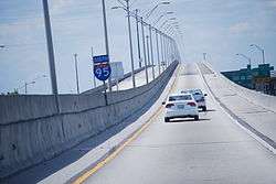
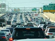
About 5 miles (8.0 km) north of the St. Johns-Duval county border, I-95 intersects the I-295 beltway at its southern end 14 miles (23 km) south of central Jacksonville, with I-95 continuing north. The interstate passes through the heart of Jacksonville, crossing the Fuller Warren Bridge over the St. Johns River, which was rebuilt from its original drawbridge incarnation in 2002. About a mile north of the bridge, at exit 351B, it intersects with the national eastern terminus of I-10, with the interchange's redesign completed in September 2010.[4] From here to exit 353B, it is concurrent with US 17 and its unsigned designation SR 15.[1] The stretch from here in Downtown Jacksonville south past the southern interchange with the Jacksonville Beltway, I-295, can be very congested during morning and evening rush hours, with traffic often grinding to a halt. Well over 100,000 cars use this section per day, with even higher traffic counts in some areas.[5] I-95 intersects I-295 again at exit 362, 11 miles (18 km) north of Downtown Jacksonville. Just north of the northern I-295 interchange, I-95 provides access to Jacksonville International Airport. From this point, I-95 continues north towards Nassau County with an exit for State Road A1A and then into Georgia, just north of mile marker 380.
Express lanes
The current HOV lanes in both directions between I-395 in Miami and Miami Gardens Drive (SR 860) In Northern Miami are converted to High Occupancy toll lanes, with two lanes in each direction. Prices vary based on congestion and peak hours and tolls are collected electronically, while registered travelers with 3 or more passengers and hybrid vehicles can drive the toll lanes for free. Both HOT lanes have been completed in both directions from I-395 to the Golden Glades Interchange (including toll gantries).[6]
History
Interstate 95 was initially signed in 1959, and the first section to be opened to traffic was in Jacksonville in 1960. A year later, a short section just north of the current I-195 in Miami opened. The Miami News in 1956 touted the construction of what would become I-95 in Miami as a "...slum clearance program."[7] Most of the construction was focused between Jacksonville and Daytona Beach in the early 1960s. At the end of the decade, the highway was complete from U.S. 17, just south of the Georgia state line to Interstate 4 in Daytona Beach (Georgia had not completed their portion of I-95 at the time of Florida's completion). The segment from Ft. Lauderdale to Miami was complete by 1970. By 1976, most of the highway was complete from the Georgia State Line to Ft. Pierce as well as Palm Beach Gardens to Miami.[8]

In 2002, I-95, along with most of Florida's interstates, switched over from a sequential exit numbering system to a mileage based exit numbering system.[9]
Missing Treasure Coast Link

The Bureau of Public Roads approved an Interstate 95 alignment that used 41 miles (66 km) of the Turnpike from PGA Boulevard (SR 786) in Palm Beach Gardens north to SR 70 in Ft. Pierce in the 1950s.[10][11] In the mid-1960s, the State Road Department authorized traffic counts be conducted to determine if the separation of Interstate 95 from the Turnpike was feasible, with arguments that using a concurrent alignment was costing Florida money for Federal Highway funding, but not without the concern of losing toll revenue.[12] Interstate 95 was given a separate alignment from Florida's Turnpike in 1973.[13]
Over time, the interstate adopted a separate route closer to U.S. Route 1, including parallel with the turnpike between Stuart and Palm Beach Gardens and was originally scheduled to be completed in 1972. However, resistance by Martin County officials due to environmental and unwanted growth concerns delayed the highway's completion for 15 years, requiring those who wanted to travel through the Treasure Coast to take either the slower US 1 or the tolled Turnpike.[14] This section opened to traffic on December 19, 1987, with I-95 running uninterrupted from Miami to the state line.[15]
Future

In Boca Raton, a new interchange is being built at Spanish River Boulevard to ease congestion on Glades Road going to Florida Atlantic University. The interchange is expected to be finished in summer of 2017.[16]
The interstate is being widened in all of the stretches that have not seen expansion to at least six lanes.
Between Exit 147 (SR 60) and the Indian River/Brevard County Line, the road is being expanded from four to six lanes, with expected completion in early 2017.[17]
Between Exit 249 (SR 44) and Exit 260 (I-4), there are plans to widen this stretch from four to six lanes and reconstruct the Spruce Creek Bridge, which started in November 2014 at a cost of $94 million. This will be the last six lane widening project to go forward, which afterward will complete the widening of the 382 miles (615 km) of Florida's Interstate 95.[18]
Finally, there are plans to reconstruct 4.41 miles (7.10 km) of Interstate 95 around the interchanges at Exit 260 (I-4) and Exit 261 (US 92), with the addition of dedicated lanes to separate entering and exiting traffic from long distance traffic in this dangerous section.[19] Namely, southbound Interstate 95 has a dangerous merge situation stemming from the fact that traffic from US 92 comes in on the left side. This merge ramp will be removed as part of this project. This project also started in November 2014 and is being combined with the widening project between mile markers 249 and 260; this construction project will cost $205 million with expected completion in summer 2018.
Exit list
| County | Location | mi[1] | km | Old exit[9] | New exit[1] | Destinations | Notes |
|---|---|---|---|---|---|---|---|
| Miami-Dade | Miami | 0.000 | 0.000 | — | — | Southern terminus; south end of concurrency with US 1 / SR 5 | |
| 0.469 | 0.755 | 1 | 1A | Rickenbacker Causeway (Southwest 26th Road / SR 913 east) – Key Biscayne, Seaquarium, Vizcaya, Science Museum, Planetarium | Southbound exit and northbound entrance | ||
| 1.558 | 2.507 | 2 | 1B | ||||
| 2.026 | 3.261 | 3 | 2A | Shares ramp with Exit 2C on I-95 south; north end of concurrency with US 1 / SR 5 | |||
| 2.026 | 3.261 | 3A | 2C | Miami Avenue – Downtown | No northbound exit | ||
| 2.3[20] | 3.7 | 4 | 2B | Northwest 2nd Street – Arena (SR 925 north) | Northbound exit and southbound entrance | ||
| 2.7[20] | 4.3 | 5A | 3B | Northwest 8th Street – Port of Miami, Marlins Park (SR 925 south) | Southbound exit and northbound entrance | ||
| 3.186 | 5.127 | 5 | 2D | Midtown Interchange; To MacArthur Causeway; I-395 exit 1 | |||
| 3.186 | 5.127 | 6 | 3A | ||||
| 4.3[20] | 6.9 | Express Lanes | northbound exit and southbound entrance | ||||
| 4.844 | 7.796 | 7 | 4 | Signed as exits 4A (east) and 4B (west) northbound; to Julia Tuttle Causeway; I-195 exit 1 | |||
| 6.227 | 10.021 | 8 | 6A | Northwest 62nd Street (Dr. Martin Luther King Jr. Boulevard) | |||
| 6.608 | 10.635 | 9A | 6B | Northwest 69th Street | Southbound exit and northbound entrance | ||
| 7.329 | 11.795 | 9 | 7 | ||||
| | 8.285 | 13.333 | 10 | 8A | Northwest 95th Street (Rev. Dr. A. Jackson Jr. Boulevard) | ||
| | 8.794 | 14.153 | 11 | 8B | |||
| | 9.799 | 15.770 | 12 | 9 | Northbound exit and southbound entrance | ||
| North Miami | 10.176 | 16.377 | 13 | 10A | |||
| 10.854 | 17.468 | 14 | 10B | ||||
| Golden Glades | 11.827 | 19.034 | 15 | 11 | Northwest 151st Street | Northbound exit and southbound entrance | |
| 12.4[20] | 20.0 | 16 | 12A | Southbound exit is part of exit 12; part of the Golden Glades Interchange | |||
| 12.848 | 20.677 | 17 | 12B | Southbound exit is part of exit 12; part of the Golden Glades Interchange | |||
| 12.848 | 20.677 | 18 | 12 | North end of SR 9A overlap; south end of SR 9 overlap; southbound exit and northbound entrance; part of the Golden Glades Interchange | |||
| North Miami Beach | 13.1[20] | 21.1 | 18 | 12C | Northbound exit and southbound entrance; part of the Golden Glades Interchange | ||
| 13.9[20] | 22.4 | Express Lanes | southbound exit and northbound entrance | ||||
| 14.377 | 23.138 | 19 | 14 | ||||
| | 16.574 | 26.673 | 20 | 16 | Northeast 203rd Street / Ives Dairy Road (CR 854) | ||
| Broward | Hallandale Beach–Pembroke Park line | 18.025 | 29.008 | 21 | 18 | ||
| Hallandale Beach–Pembroke Park– Hollywood tripoint | 18.794 | 30.246 | 22 | 19 | |||
| Hollywood | 19.816 | 31.891 | 23 | 20 | |||
| 21.384 | 34.414 | 24 | 21 | ||||
| Hollywood–Dania Beach line | 22.416 | 36.075 | 25 | 22 | |||
| Dania Beach | 23.433 | 37.712 | 26 | 23 | |||
| Fort Lauderdale | 24.803 | 39.917 | 26A | 24 | Signed as exits 26C (east) and 26D (west) southbound; also known as the Rainbow Interchange; I-595 exits 10A-B | ||
| 25.245 | 40.628 | 27 | 25 | ||||
| 26.500 | 42.648 | 28 | 26 | Former exit 26CD southbound | |||
| 27.531 | 44.307 | 29 | 27 | ||||
| 28.553 | 45.952 | 30 | 29 | Signed as exits 29A (east) and 29B (west) northbound; previous signed as exits 30A and 30B accordingly | |||
| Oakland Park | 30.713 | 49.428 | 31 | 31 | Signed as exits 31A (east) and 31B (west) northbound | ||
| 32.339 | 52.045 | 32 | 32 | ||||
| 33.553 | 53.998 | 33 | 33 | Cypress Creek Road (CR 840) | Signed as exits 33A (east) and 33B (west) northbound | ||
| Pompano Beach | 35.635 | 57.349 | 34 | 36 | Signed as exits 36A (east) and 36B (west) southbound | ||
| 37.694 | 60.663 | 35 | 38 | Copans Road | Signed as exits 38A (east) and 38B (west) southbound | ||
| Pompano Beach–Deerfield Beach line | 38.840 | 62.507 | 36 | 39 | |||
| Deerfield Beach | 40.922 | 65.858 | 36C | 41 | |||
| 41.883 | 67.404 | 37 | 42 | Signed as exits 42A (east) and 42B (west) northbound; previously signed as exits 37A and 37B accordingly | |||
| Palm Beach | Boca Raton | 44.130 | 71.020 | 38 | 44 | Palmetto Park Road (CR 798) | |
| 45.361 | 73.001 | 39 | 45 | ||||
| Under construction; to be completed summer of 2017; will ease traffic on Glades Road going to Florida Atlantic University.[21] | |||||||
| 47.818 | 76.956 | 40 | 48 | Signed as exits 48A (east) and 48B (west) northbound; previously signed as exits 40A and 40B accordingly | |||
| 49.677 | 79.947 | 40C | 50 | Congress Avenue (CR 807) | |||
| Delray Beach | 50.969 | 82.027 | 41 | 51 | Linton Boulevard (CR 782) | ||
| 52.509 | 84.505 | 42 | 52 | ||||
| Boynton Beach | 56.344 | 90.677 | 43 | 56 | Woolbright Road (CR 792) | ||
| 57.339 | 92.278 | 44 | 57 | To the Boynton Beach Mall | |||
| 58.853 | 94.715 | 44C | 59 | Gateway Boulevard | |||
| Lantana | 60.343 | 97.113 | 45 | 60 | Hypoluxo Road | ||
| 61.377 | 98.777 | 46 | 61 | Lantana Road (CR 812) | |||
| Lake Worth | 62.868 | 101.176 | 47 | 63 | 6th Avenue South | ||
| 64.178 | 103.284 | 48 | 64 | 10th Avenue North | |||
| West Palm Beach | 66.087 | 106.357 | 49 | 66 | |||
| 67.539 | 108.693 | 50 | 68 | ||||
| 68.558 | 110.333 | 51 | 69 | Signed as exits 69A (Belvedere Road) and 69B (Airport) southbound | |||
| 69.760 | 112.268 | 52 | 70 | ||||
| 71.015 | 114.288 | 53 | 71 | Palm Beach Lakes Boulevard (CR 716) | |||
| 73.799 | 118.768 | 54 | 74 | 45th Street (CR 702) | |||
| Riviera Beach | 75.549 | 121.584 | 55 | 76 | |||
| Palm Beach Gardens | 77.307 | 124.414 | 56 | 77 | Northlake Boulevard (CR 809A) | ||
| 79.503 | 127.948 | 57 | 79 | Signed as exits 79A (east) and 79B (west) northbound. To The Gardens Mall | |||
| 79.904 | 128.593 | 57C | 79C | Military Trail south (CR 809) | Southbound exit and northbound entrance | ||
| Palm Beach Gardens–Jupiter line | 82.909 | 133.429 | 58 | 83 | Donald Ross Road | ||
| Jupiter | 86.704 | 139.537 | 59 | 87 | Signed as exits 87A (east) and 87B (west); previously signed as exits 59A and 59B accordingly | ||
| Martin | | 96.064 | 154.600 | 60 | 96 | ||
| | 100.836 | 162.280 | 61 | 101 | |||
| Palm City | 102.435 | 164.853 | 61C | 102 | |||
| | 110.253 | 177.435 | 62 | 110 | |||
| St. Lucie | Port St. Lucie | 113.662 | 182.921 | — | 114 | Becker Road | Completed July 30, 2009,[22] after the exit renumbering[9] |
| 117.745 | 189.492 | 63 | 118 | Gatlin Boulevard / Tradition Parkway | former SR 716 | ||
| 119.977 | 193.084 | — | 120 | Crosstown Parkway | Opened on March 28, 2009, after the exit renumbering[9] | ||
| 121.195 | 195.044 | 63C | 121 | St. Lucie West Boulevard | |||
| 125.593 | 202.122 | 64 | 126 | ||||
| Fort Pierce | 128.858 | 207.377 | 65 | 129 | |||
| | 131.089 | 210.967 | 66 | 131 | Signed as exits 131A (east) and 131B (west); previously signed as exits 66A and 66B accordingly | ||
| | 137.561 | 221.383 | 67 | 138 | |||
| Indian River | | 146.825 | 236.292 | 68 | 147 | ||
| Fellsmere | 155.960 | 250.993 | 69 | 156 | |||
| Brevard | Palm Bay | 173.166 | 278.684 | 70 | 173 | ||
| Palm Bay–West Melbourne line | 176.163 | 283.507 | 70A | 176 | |||
| West Melbourne | 180.561 | 290.585 | 71 | 180 | 2011 daily traffic between US 192 and Malabar Road was 48,500 vehicles[23] | ||
| Melbourne | 183.430 | 295.202 | 72 | 183 | |||
| | 188.447 | 303.276 | — | 188 | Opened May 11, 2011, after the exit renumbering[9] | ||
| Viera | 191.074 | 307.504 | 73 | 191 | |||
| Rockledge | 195.707 | 314.960 | 74 | 195 | |||
| Cocoa | 201.373 | 324.078 | 75 | 201 | 2011 daily traffic between SR 520 and US 192 was 78,000 vehicles[23] | ||
| 202.545 | 325.965 | 76 | 202 | ||||
| 205.323 | 330.435 | 77 | 205A-B | 2011 daily traffic between SR 520 and SR 528 was 36,500 vehicles[23] | |||
| | 208.222 | 335.101 | 77C | 208 | Port St. John | ||
| Titusville | 211.846 | 340.933 | 78 | 212 | |||
| 215.542 | 346.881 | 79 | 215 | ||||
| 219.990 | 354.040 | 80 | 220 | ||||
| | 223.619 | 359.880 | 81 | 223 | |||
| | 231.192 | 372.067 | 82 | 231 | |||
| Volusia | Edgewater | 244.056 | 392.770 | 83 | 244 | ||
| New Smyrna Beach | 248.901 | 400.567 | 84 | 249 | Signed as exits 249A (east) and 249B (west) southbound; previously signed as exits 84A and 84B accordingly southbound | ||
| Port Orange | 255.889 | 411.813 | 85 | 256 | |||
| Daytona Beach | 260.441 | 419.139 | 86 | 260 | Signed as exits 260A (east) and 260B (west); previously signed as exits 86A and 86B accordingly; I-4 exit 132 | ||
| 261.731 | 421.215 | 87 | 261 | Signed as exits 261A (east) and 261B (west) southbound; previously signed as exits 87A and 87B accordingly southbound | |||
| 265.220 | 426.830 | 87C | 265 | Holly Hill, Daytona Beach (CR 4019) | |||
| Ormond Beach | 267.885 | 431.119 | 88 | 268 | |||
| 273.461 | 440.093 | 89 | 273 | ||||
| Flagler | | 278.348 | 447.958 | 90 | 278 | Old Dixie Highway (CR 2002) | |
| Palm Coast | 283.599 | 456.408 | 91 | 284 | |||
| 289.396 | 465.738 | 91C | 289 | Palm Coast Parkway (CR 1424) | |||
| 293 | 472 | — | 293 | Matanzas Woods Parkway | Opened March 28, 2016[24] | ||
| St. Johns | | 298.008 | 479.597 | 92 | 298 | ||
| | 305.179 | 491.138 | 93 | 305 | |||
| | 310.875 | 500.305 | 94 | 311 | |||
| | 317.512 | 510.986 | 95 | 318 | |||
| World Golf Village | 323.202 | 520.143 | 95A | 323 | International Golf Parkway | ||
| | 329.095 | 529.627 | 96 | 329 | |||
| Duval | Jacksonville | 333 | 536 | — | 333 | Opened to traffic June 13, 2016 | |
| 335.258 | 539.545 | — | 335 | Old St. Augustine Road | |||
| 337.184 | 542.645 | 97 | 337 | I-295 exit 61 | |||
| 338.482 | 544.734 | 98 | 339 | ||||
| 339.294 | 546.041 | 99 | 340 | Northbound exit and southbound entrance from southbound Southside Boulevard only | |||
| 341.215 | 549.132 | 100 | 341 | ||||
| 343.546 | 552.884 | 101 | 344 | Indirect northbound exit to westbound SR 202 via Belfort Road | |||
| 344.996 | 555.217 | 102 | 345 | Northbound exit and southbound entrance | |||
| 345.372 | 555.822 | 103 | 346 | Southbound exit and northbound entrance; signed as exits 346A (east) and 346B (west); previously signed as exits 103A and 103B accordingly | |||
| 347.179 | 558.730 | 104 | 347 | ||||
| 348.646 | 561.091 | 105 | 348 | Southbound exit to southbound Phillips Highway and northbound entrance from northbound Phillips Highway only | |||
| 349.012 | 561.680 | 106 | 349 | Southbound exit and northbound entrance; south end of SR 10 overlap (northbound only) | |||
| 349.444 | 562.376 | 107 | 350A | Acosta Bridge, Riverside Avenue, Mary Street, Main Street Bridge, Prudential Drive, Ocean Street (US 1 / US 90 / SR 5 / SR 10 west / SR 13) | Northbound exit and southbound entrance; north end of SR 10 overlap (northbound only) | ||
| 349.785 | 562.924 | 108 | 350B | San Marco Boulevard | Southbound exit and northbound entrance | ||
| 350.175– 350.649[20] | 563.552– 564.315 | Fuller Warren Bridge over St. Johns River | |||||
| 351.0[20] | 564.9 | 109 | 351A | Park Street | Northbound exit and southbound entrance | ||
| 351.186 | 565.179 | 111 | 351B | South end of US 17 / SR 15 / SR 228 overlap; southbound has two separate exits for I-10 (351A and 351B), with 352D used for the exit from the mainline to the C/D road that accesses exits 351C and 351B | |||
| 351.186 | 565.179 | 112 | 351C | Margaret Street | former southbound exit | ||
| 351.186 | 565.179 | 113 | 351C | Stockton Street | Southbound exit and northbound entrance; formerly exit 351D | ||
| 351.40[20] | 565.52 | 113 | 352A | Forest Street, Riverside Avenue - Convention Center | Southbound exit and northbound entrance; exit 352A also signed from ramp from I-10 east to I-95 north | ||
| 351.987 | 566.468 | 114 | 352B | Forsyth Street - Convention Center | Northbound exit and southbound entrance (use exit 353A southbound) | ||
| 352.18[20] | 566.78 | 115 | 352C | Monroe Street - Downtown Jacksonville | No southbound exit (use exit 353A) | ||
| 352.25[20] | 566.89 | 116 | 353A | Church Street, Myrtle Avenue, Forsyth Street | Southbound exit only | ||
| 352.487 | 567.273 | 117 | 353B | Union Street (US 17 north / US 23 south / SR 139 south / SR 228 east), Beaver Street (US 90 / SR 10) - Downtown Jacksonville, Sports Complex | North end of US 17 / SR 228 overlap | ||
| 352.60[20] | 567.45 | 118 | 353C | ||||
| 353.326 | 568.623 | 119 | 353D | ||||
| 353.929 | 569.594 | 120 | 354 | North end of SR 15 overlap; south end of SR 115 overlap; signed as exits 354A (south) and 354B (north); previously signed as exits 120A and 120B accordingly | |||
| 354.543 | 570.582 | 121 | 355 | Golfair Boulevard (SR 122) | |||
| 355.842 | 572.672 | 122 | 356 | North end of SR 115 overlap; signed as exits 356A (south) and 356B (north) northbound; previously signed as exits 122A and 122B accordingly | |||
| 356.618 | 573.921 | 123 | 357 | ||||
| 357.707– 357.989 | 575.674– 576.127 | 124 | 358 | Broward Road | Signed as 358A (SR 105/Zoo Parkway) and 358B (Broward Road); additional southbound entrance from Clark Road | ||
| 359.450 | 578.479 | 125 | 360 | ||||
| 361.544 | 581.849 | 126 | 362 | Signed as exits 362A (east) and 362B (west); previously signed as exits 126A and 126B accordingly; I-295 exit 35 | |||
| 363.081 | 584.322 | 127 | 363 | Signed as exits 363A (east) and 363B (west) northbound; previously signed as exits 127A and 127B northbound accordingly | |||
| 365.657 | 588.468 | 128 | 366 | Pecan Park Road | |||
| Nassau | Yulee | 372.789 | 599.946 | 129 | 373 | ||
| 379.407 | 610.596 | 130 | 380 | ||||
| St. Mary's River | 382.009 | 614.784 | Florida–Georgia state line | ||||
1.000 mi = 1.609 km; 1.000 km = 0.621 mi
| |||||||
Auxiliary Routes
 I-195 - Spur into Miami; Northern of the 2 spurs (Other is I-395).
 I-295 - Jacksonville Beltway.
 I-395 Spur into Miami; Southern of the two Spurs into Miami (other is I-195).
 I-595 - Spur West of I-95 to I-75 and East of I-95 to Fort Lauderdale.
 I-795 (Future) - Future Designation along Florida Route 9B.
See also
- Transportation in Florida
- Transportation in South Florida
 Florida portal
 U.S. Roads portal
References
- 1 2 3 4 5 6 Hatcher, Tina (July 18, 2011). "Illustrated Interchange Report" (PDF). Florida Department of Transportation. pp. 8–10. Retrieved November 2, 2010.
- ↑ The Road Atlas (Map). Rand McNally. 2006.
- ↑ General Highway Map, Dade County, Florida (Map). Florida Department of Transportation. September 1972.
- ↑ Construction Public Information Office. "Project Status". The Big I. Florida Department of Transportation. Retrieved December 4, 2010.
- ↑ North Florida TPO. Duval County State Roads Report (PDF). North Florida TPO http://northfloridatpo.com/images/uploads/Duval_County_State_Roads_Report_-_2014rev.pdf. Retrieved August 31, 2016. Missing or empty
|title=(help) - ↑ Staff. "Project Schedule". 95 Express. Florida Department of Transportation. Retrieved November 12, 2009.
- ↑ "Questions on Expressway? - Here Are Some Answers". The Miami News. December 19, 1956. p. 21A. Retrieved April 16, 2010.
- ↑ Droz, Robert V. (December 14, 2006). "The Interstate System: 1959 to the Present". Historic Florida Mainlines.
- 1 2 3 4 5 Kern, Arlene. "Florida's New Interstate Exit Numbers for I-95". State Traffic Engineering and Operations Office, Florida Department of Transportation. Retrieved November 18, 2010.
- ↑ "Squabbles unnecessary". Boca Raton News. May 10, 1973. p. 4A.
- ↑ "Free Roads Vs. Toll: A Secret Stall?". St. Petersburg Times. April 21, 1963. p. 1D.
- ↑ "Toll-Free I-95 In State Still A Long Way Off". St. Petersburg Times. November 11, 1967. p. 3B.
- ↑ "I-95 'Missing Link' Okayed". Lakeland Ledger. April 19, 1973. p. 4A.
- ↑ Nordheimer, Jon (December 18, 1987). "I-95 Journal; Road Completed but Debate Goes On". The New York Times.
- ↑ "Gap In I-95 To Close Saturday". Miami Herald. December 13, 1987. p. 1A.
- ↑ Streeter, Angel. "Spanish River Boulevard in Boca Raton impacted by I-95 work". Sun Sentinel. Retrieved March 3, 2016.
- ↑ FDOT. "I-95 / State Road 9 Widening, from just North of State Road 60 to the Indian River/Brevard County Line". Florida Dept of Transportation. Retrieved May 1, 2016.
- ↑ Harper, Mark. "State road officials move up project to improve safety on I-95 interchanges". The Daytona Beach News-Journal. Retrieved May 1, 2016.
- ↑ FDOT. "I-95 Widening and Systems Interchange Reconstruction Design-Build from North of SR 44 to North of US 92". Retrieved May 1, 2016.
- 1 2 3 4 5 6 7 8 9 10 11 12 FDOT straight line diagrams, accessed March 2014
- ↑ Streeter, Angel. "Spanish River Boulevard in Boca Raton impacted by I-95 work". SunSentenial. Retrieved March 3, 2016.
- ↑ Blandford, Laurie K. (July 31, 2009). "Becker Road interchange should make things easier for Port St. Lucie residents". TCPalm. Scripps Interactive Newspapers Group. Retrieved March 9, 2012.
- 1 2 3 Walker, Don (October 24, 2011). "Busy stretch closer to smooth sailing". Florida Today. Melbourne, Florida. p. 1A.
- ↑ Simmons, Jonathan (28 March 2016). "EXIT 293: New I-95 interchange opens at Matanzas Woods Parkway". Palm Coast Observer. The Observer Group Inc. Retrieved 1 May 2016.
External links
| Wikimedia Commons has media related to Interstate 95 in Florida. |
| Previous state: Terminus |
Florida | Next state: Georgia |
| ||