Interstate 495 (New York)
| ||||
|---|---|---|---|---|
|
Map of New York with I-495 highlighted in red | ||||
| Route information | ||||
| Maintained by NYSDOT, NYCDOT, MTAB&T, and PANYNJ | ||||
| Length: | 71.02 mi[1] (114.30 km) | |||
| Existed: | 1958[2] – present | |||
| Major junctions | ||||
| West end: | Queens–Midtown Tunnel portal in Manhattan | |||
|
| ||||
| East end: |
| |||
| Highway system | ||||
| ||||
.svg.png)
_map.svg.png)
Interstate 495 (I-495, also known as the LIE or simply the Expressway by locals) is an auxiliary Interstate Highway on Long Island in New York in the United States. The route extends for 71 miles (114 km) from the western portal of the Queens–Midtown Tunnel in the New York City borough of Manhattan to County Route 58 (CR 58) in Riverhead, Suffolk County. I-495 does not intersect its parent route, I-95. However, it does connect to I-95 through I-295, which it meets in Queens. The portion of I-495 in Nassau and Suffolk counties is known as the Long Island Expressway (LIE), a name commonly applied to the entirety of I-495. The section of the route from the Queens-Midtown Tunnel to Queens Boulevard is also named the Queens–Midtown Expressway west of Queens Boulevard, and the Horace Harding Expressway east of Queens Boulevard until the Queens-Nassau county line, though both names are not often used in common parlance and most signage refers only to the Long Island Expressway. The service roads which run in parallel along either side of the expressway in Queens are signed Horace Harding Expressway and also addressed as Horace Harding Boulevard; from the Queens-Nassau line to Sills Road, they are officially designated, but not signed, as New York State Route 906A and New York State Route 906B.
Route description
New York City
The expressway begins at the western portal of the Queens–Midtown Tunnel in the Murray Hill section of Manhattan. The route heads eastward, passing under FDR Drive and the East River as it proceeds through the Triborough Bridge and Tunnel Authority-maintained tunnel to Queens. Once on Long Island, the highway passes through a toll booth and becomes known as the Queens–Midtown Expressway as it travels through the western portion of the borough. A mile after entering Queens, I-495 meets I-278 (the Brooklyn–Queens Expressway) at exit 17. It continues on a generally easterly path to the Rego Park neighborhood, where it connects to New York State Route 25 (NY 25, named Queens Boulevard) and becomes the Horace Harding Expressway. I-495 heads northeast through Corona to Flushing Meadows–Corona Park, intersecting both the Grand Central Parkway and the Van Wyck Expressway (I-678) within the park limits. Because the interchanges in this area are close together, the highway employs two sets of collector/distributor roads through this area: one between 69th and 99th Streets, and one between the Grand Central Parkway and I-678.
_4.JPG)
The expressway continues east, veering to the southeast to bypass Kissena Park before curving back to the northeast to meet the Clearview Expressway (I-295) at the northern edge of Cunningham Park. Past I-295, I-495 passes by the "Queens Giant", the oldest and tallest tree in the New York metropolitan area. The tree, located just north of I-495 in Alley Pond Park, is visible from the highway's westbound lanes. To the east, the freeway connects to the Cross Island Parkway at exit 31 in the park prior to crossing into Nassau County and becoming the Long Island Expressway (LIE). Although the name officially begins here, almost all locals and most signage use "the Long Island Expressway" or "the LIE" to refer the entire length of I-495.[4]
The service roads of I-495 are called the Queens–Midtown Expressway between the Brooklyn–Queens Expressway and Queens Boulevard and the Horace Harding Expressway between Queens Boulevard and the Nassau County line, and are generally signed as such like any other city streets. It is common to refer to the service roads by these names—particularly Horace Harding—in local usage, for instance when referring to the location of a building along the road. The names may have been intended to refer to sections of the expressway proper, but current guide signs (and Queens residents) simply refer to it as the Long Island Expressway.
The Horace Harding Expressway section follows the path of Horace Harding Boulevard (also previously called Nassau Boulevard),[5][6] which was named for Horace J. Harding (1863–1929), a finance magnate who directed the New York, New Haven and Hartford Railroad and the New York Municipal Railways System. Harding used his influence to promote the development of Long Island's roadways, lending strong support to Robert Moses's "great parkway plan". Harding also urged construction of a highway from Queens Boulevard to the Nassau County Line, in order to provide better access to Oakland Country Club, where he was a member. After his death, the boulevard he helped build was named for him. Horace Harding was not related to the former President Warren G. Harding.
In 1968, a subway line along the Long Island Expressway was proposed, but was canceled due to a lack of funding.[7]
Nassau and Suffolk counties
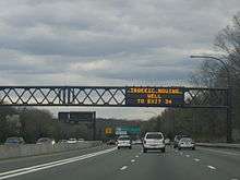
Heading into Nassau County, the expressway sports a High-Occupancy Vehicle Lane (HOV), which begins at exit 33 and runs to central Suffolk County. In its run through Nassau, it is the only major east–west highway that does not interchange with the Meadowbrook or Wantagh state parkways, both of which end to the south at the adjacent Northern State Parkway, which parallels the LIE through the county. The two highways meet three times, although it actually crosses only once at exit 46 near the county line. I-495 does, however, interchange with the Seaford–Oyster Bay Expressway (NY 135) as the east–west parkways do, and often has heavy traffic. In Suffolk County, the LIE continues its eight-lane configuration with the HOV lane to exit 64 (NY 112). At this point, the HOV lane ends and the highway narrows to six lanes; additionally, the concrete Jersey barrier gives way to a wide, grassy median, the asphalt road surface is replaced by a concrete surface, and the expressway is no longer illuminated by streetlights, reflecting the road's location in a more rural area of Long Island.
From NY 112 east, the expressway runs through more rural, woodland areas on its trek towards Riverhead. Exit 68 (William Floyd Parkway) marks the terminus of the service roads, which are fragmented by this point. Exit 70 (CR 111) in Manorville is the last full interchange, as it is the last interchange that allows eastbound traffic on, and the first to allow westbound off. After exit 71 (NY 24 / Nugent Drive), the expressway begins to narrow as it approaches its eastern terminus. Until 2008, just before exit 72 (NY 25), the three eastbound lanes narrowed to two, which in turn narrowed almost immediately to a single lane at exit 73, which lies 800 feet (240 m) east of exit 72. As of 2008, of the two lanes, one lane is designated for exit 72 and the other is for exit 73, which ends the squeeze into a single lane that formerly existed at exit 73. At exit 73, all traffic along the expressway is diverted onto a ramp leading to eastbound CR 58, marking the east end of the route.
History
Harry Chapin
On Thursday, July 16, 1981, just after noon, Chapin was driving in the left lane on the Long Island Expressway at about 65 mph (105 km/h) on the way to perform at a free concert scheduled for later that evening at Eisenhower Park in East Meadow, New York. Near exit 40 in Jericho he put on his emergency flashers, presumably because of either a mechanical or medical problem (possibly a heart attack). He then slowed to about 15 miles (24 km) per hour and veered into the center lane, nearly colliding with another car. He swerved left, then to the right again, ending up directly in the path of a tractor-trailer truck. The truck could not brake in time and rammed the rear of Chapin's blue 1975 Volkswagen Rabbit, rupturing the fuel tank as it climbed up and over the back of the car, causing it to burst into flames.
Construction
A portion of the path of the Long Island Expressway was along the former road path and right of way of a streetcar line that went from the southern part of Long Island City to southern Flushing.[8]
The Long Island Expressway was constructed in stages over the course of three decades. The first piece, the Queens–Midtown Tunnel linking Manhattan and Queens, was opened to traffic on November 15, 1940.[9] The highway connecting the tunnel to Laurel Hill Boulevard was built around the same time and named the "Midtown Highway".[10][11] The tunnel, the Midtown Highway, and the segment of Laurel Hill Boulevard between the highway and Queens Boulevard all became part of a realigned NY 24 in the mid-1940s.[11][12] In the early 1950s, work began on an eastward extension of the Midtown Highway. The road was completed to 61st Street by 1954, at which point it became known as the "Queens–Midtown Expressway".[13][14] By 1956, the road was renamed the "Long Island Expressway" and extended east to the junction of Queens (NY 24 and NY 25) and Horace Harding (NY 25D) Boulevards. NY 24 initially remained routed on Laurel Hill Boulevard (by this point upgraded into the Brooklyn–Queens Expressway) and Queens Boulevard, however.[15]

In eastern Queens and western Nassau County, the LIE was built over much of Horace Harding Boulevard and Power House Road, designated as NY 25D. The section of the highway in the vicinity of Alley Pond Park was completed by 1958.[16] Within two years time, the expressway was open from Manhattan to Roslyn Heights and entirely designated as NY 24. The old surface alignment of NY 24 south of the expressway became NY 24A.[17] However, the section of the freeway west of the Clearview Expressway was also designated as I-495 in October 1958.[2] The LIE was extended east to NY 25 in Jericho c. 1961[17][18] and to NY 110 in Melville c. 1962. Around the same time, NY 24 was removed from the LIE and reassigned to its former surface alignment to the south while the portion of the freeway east of the Clearview Expressway became NY 495.[18][19]
Over one-third of the LIE across Suffolk County—from Melville to Veterans Memorial Highway (now NY 454) near Islandia—was opened to traffic c. 1963.[19][20] Two more sections—from Islandia to exit 61 in Holbrook and from William Floyd Parkway to exit 71 near Riverhead—were completed in the mid-1960s.[21][22] The gap in the freeway between Holbrook and William Floyd Parkway was filled by 1971[23] while the last 2 miles (3.2 km) of the LIE from exit 71 to CR 58 were opened to traffic on June 28, 1972.[24]
Extensions
Across Manhattan
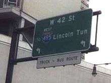
NY 495 extends 1.10 miles from the New Jersey state line on the Hudson River in the Lincoln Tunnel and the Lincoln Tunnel Expressway to 34th Street. The principal entrance and exit ramps that span from the Manhattan portal of the tunnel to West 30th Street are designated as the unsigned NY 495.
Plans for I-495 called for it to extend across Manhattan on the Mid-Manhattan Expressway to the tunnel, which it would follow into New Jersey and connect to I-95 in Secaucus. The I-495 designation was assigned to the New Jersey approach to the tunnel in anticipation of the Mid-Manhattan Expressway being completed.[21] However, the project was cancelled and the Mid-Manhattan Expressway was officially removed from I-495 on January 1, 1970.[25] The New Jersey stretch of I-495 became Route 495 in 1979.[26]
Plans for the Mid-Manhattan Expressway were first proposed in 1937 for an expressway link crossing midtown Manhattan near 34th Street, then, as now, a heavily-traveled crosstown surface street. The original idea was a pair of two-laned tunnels, the Mid-Manhattan Expressway or M.M.E. (sometimes called the Mid-Manhattan Elevated Expressway) connecting the West Side Highway on Hudson River and the Franklin D. Roosevelt East River Drive on the East River. By 1949, Robert Moses, New York City Parks Commissioner and Arterial Coordinator, proposed a six-lane elevated expressway along 30th Street. The expressway was to have two exits, to connect to the West Side Highway and the Lincoln Tunnel on the west side of Manhattan, and also to the Queens–Midtown Tunnel and FDR Drive on the east side of the island.[27] It would be constructed within a 100-foot (30 m)-wide right-of-way immediately south of 30th Street. The viaduct would require substantial demolition of high-rise buildings within Midtown Manhattan. To cover the costs of construction, Moses suggested charging tolls on the new roadway, which was estimated to cost $26 million to construct plus another $23 million for the land needed for the project.[28]
A later proposal had the roadway situated ten stories above valuable commercial real estate. Air rights above the expressway would be sold and new high-rise buildings would be constructed above the expressway; buildings would be constructed below the viaduct as well. One fanciful variation favored by then Mayor William O'Dwyer involved running the roadway through the Empire State Building itself, occupying the tenth and eleventh floors.
In 1963, plans for the expressway were finalized and it received the I-495 designation. Beginning from its elevated connections to 12th Avenue (NY 9A) or the West Side Elevated Highway, the Mid-Manhattan Expressway would begin as a six-lane depressed roadway in the center of a widened 30th Street to Tenth Avenue. At this point, it would swing to the north side of 30th Street to make connections between Tenth and Ninth Avenues, with the Lincoln Tunnel Third Tube Approaches. Traveling east from this area, it would underpass Ninth Avenue, but rise so as to overpass Eighth Avenue and ultimately continue across Manhattan as an elevated structure. In an area between Eighth and Seventh Avenues, the roadway would recross 30th Street and occupy a 100 ft (30 m) wide right-of-way immediately south of the thoroughfare. From here it would travel east as a six-lane elevated expressway route, ten stories above the city streets to allow for commercial development both above and below the skyway deck. After overpassing Second Avenue it would swing north to follow the 30th Street alignment as a four-lane elevated expressway route to connections with the East River or FDR Drive. Between First and Second Avenues, ramps would be constructed to provide access to the Queens–Midtown Tunnel. In 1971, New York Governor Nelson Rockefeller canceled the Mid-Manhattan Expressway, along with about a dozen other highway plans including I-78 through New York City, of which another crosstown highway known as the Lower Manhattan Expressway (LOMEX) was part.
Across Suffolk County
Long Island, meanwhile, lobbied to extend I-495 east over NY 495. The extension took place in the early 1980s, at which time the NY 495 signs were taken down and I-495 was extended to the east end of the LIE. The section of I-495 in the vicinity of the Lincoln Tunnel was redesignated as NY 495 at this time. The extension of I-495 to Riverhead makes the highway a spur, which should have an odd first digit according to the Interstate Highway System's numbering scheme. Even first digits are usually assigned to bypasses, connectors, and beltways, as I-495 was prior to the 1980s.[2] A proposed Long Island Crossing would have extended the LIE across Long Island Sound to I-95 in either Guilford, Connecticut, Old Saybrook, Connecticut, or Rhode Island via a series of existing and man-made islands, but a lack of funding as well as public opposition led to the demise of these proposals.[29]
CR 48 in Suffolk County was originally intended to become part of the North Fork extension of the Long Island Expressway.[30][31]
Improvements
From 1994 to 2005, High-occupancy vehicle lanes (HOV) were added to I-495. Beginning with a small section in Western Suffolk County, the lanes were added in subsequent sections until their completion on June 30, 2005. There is one HOV lane in each direction, in the median of the highway. They now run from exit 31 Cross Island Parkway to exit 64 at Medford in central Suffolk County.[2] From 6:00 am to 10:00 am and from 3:00 pm to 8:00 pm Monday through Friday, the HOV lanes are limited to buses, motorcycles, and Clean Pass vehicles without occupancy requirement and passenger vehicles with at least two occupants. Trailers and commercial trucks are always prohibited therein.[32]
I-495 lacked proper lighting along its route in Nassau and Suffolk counties for many years. Because of this, motorists would be driving into complete darkness after crossing the Queens-Nassau border. Despite constant requests from Nassau local officials, no immediate plans were made. Finally, in 1980, the first streetlights were installed in eastern Nassau county. The final streetlights were installed between exits 39 and 40 in 2002 in Nassau County.[2]
Proposed interchanges and service road configurations
As the Long Island Expressway was being built across Long Island, it was specifically designed to accommodate certain topographical conditions and proposed interchanges. Exit 30 was originally a partial cloverleaf interchange with the Cross Island Parkway. Eastbound exit 30S was for Easthampton Boulevard with a connecting ramp to the southbound Cross Island Parkway. Exit 31 was originally a westbound only interchange for Douglaston Parkway;[33] it was later combined with the exit for the Little Neck Parkway. Exit 39A was intended for the proposed extension of the Wantagh State Parkway near Powell Road in Old Westbury. It was intended to be a full Y interchange with an east-to-southbound-only off-ramp and a north-to-westbound-only on-ramp running beneath Powell Road.[34][35]
Exit 40 originally had only same-directional off-ramps under the expressway providing access to realigned sections of NY 25. When exit 41 was originally constructed, it had no south-to-west connecting ramp. Westbound access to the expressway was provided at the nearby exit 40 on-ramp at NY 25.[36] An alternate design for exit 42 called for it to be similar to the one proposed for NY 135 and Bethpage State Parkway,[37] and westbound exit 46 was originally a partial cloverleaf.[38][39] Exit 47 was intended for the extension of the Bethpage State Parkway near Washington Avenue in Plainview. This was to be a partial cloverleaf with southbound-only off-ramps and northbound-only on-ramps in both directions. The west-to-southbound ramp would also have an additional connecting ramp to a two-way frontage road for a development and an industrial area near exit 46.[40] Exit 47 is now intended as a truck inspection site between exits 46 and 48.
The original rights-of-way for the service roads between exits 48 and 49 were intended to weave around the steep Manetto Hills area of the main road, rather than running parallel to the road as it does today. The land between the service road and the main road was reserved for housing developments. The right-of-way for the original westbound service road still weaves through the development on the north side of the road.[30] Exit 49 was originally a cloverleaf interchange with the outer ramps connecting to the service roads at a point closer to NY 110. This was in preparation for NY 110's formerly proposed upgrade into the Broad Hollow Expressway. After the project was canceled in the 1970s, the west-to-northbound on-ramp was moved to nearby CR 3 (Pinelawn Road), and the original ramp was replaced with a park and ride. Other outer ramps were eventually moved further away from NY 110.
Exit 52 (Commack Road/CR 4) was intended to be moved west to an interchange with the formerly proposed Babylon–Northport Expressway (realigned NY 231) in the vicinity of the two parking areas. These ramps would have been accessible from the service roads. The westbound off-ramp and service road at exit 54 (Wicks Road/CR 7) originally terminated at Long Island Motor Parkway, east of Wicks Road. The westbound on-ramp was squeezed between the northwest corner of the Wicks Road bridge and exit 53. Excessive weaving between exits 52, 53, and 54 caused NYSDOT to reconstruct all three interchanges into one, and replace the west-to-southbound off-ramp to Sagtikos State Parkway with a flyover ramp.[41] Exit 55A was meant to be a trumpet interchange for the Hauppauge Spur of NY 347, between Long Island Motor Parkway (exit 55) and NY 111 (exit 56). The service roads were intended to go around the interchange, rather than run parallel to the main road. Ramps on the east side of Motor Parkway and west side of NY 111 would be eliminated as part of the interchange's construction. Between exits 57 and 58, there was a proposed extension of Northern State Parkway.[42][43]
Prior to the construction of the interchange with CR 97 (Nicolls Road), exit 62 was for Morris Avenue and Waverly Avenue eastbound, and Morris Avenue westbound.[44][45] Between exits 63 and 64, the eastbound service road was intended to weave around a recharge basin and replace a local residential street. Residents would have lived on both sides of the service road, similar to the segment between exits 59 and 60.[46] Exit 68 was originally planned to be built as a cloverleaf interchange without collective-distributor roads.[47] Additionally in the 1970s, Suffolk County Department of Public Works proposed an extension of East Main Street in Yaphank (CR 102) that would have terminated at the west end of this interchange.[48]
In the 1960s and 1970s, the Suffolk County Planning Department considered extending CR 55 to the Grumman Calverton Naval Air Base between exits 70 and 71. This would have provided an additional interchange known as exit 70A. Exit 71 itself was intended to be a cloverleaf interchange with CR 94 (Nugent Drive) and the Hamptons Spur of the Long Island Expressway.[49] After the Hamptons Spur proposal was cancelled, the plans for exit 71 were altered to call for a complete diamond interchange.
Exit list
The exits are numbered based on the proposed extension to New Jersey using New Jersey State Route 495.
| County | Location | mi[1] | km | Exit | Destinations | Notes |
|---|---|---|---|---|---|---|
| New York | Murray Hill | 0.00 | 0.00 | – | 34th–35th Streets / Second Avenue – Downtown 37th Street – Crosstown Third Avenue / 38th–41st Streets – Uptown | Westbound exits from the Queens Midtown Tunnel |
| – | Second Avenue / 34th Street–40th Streets | Eastbound entrances to the Queens Midtown Tunnel | ||||
| East River | 1.01 | 1.63 | Queens Midtown Tunnel ($8.00 toll[50]) | |||
| Queens | Hunters Point | 1.43 | 2.30 | 13 | Borden Avenue – Pulaski Bridge | Eastbound exit and entrance |
| 1.53 | 2.46 | 14 | Eastbound exit and westbound entrance; western terminus of NY 25A | |||
| Long Island City | 2.09 | 3.36 | 15 | Van Dam Street – Ed Koch Queensboro Bridge | Westbound exit and entrance | |
| 2.34 | 3.77 | 16 | Hunters Point Ave / Greenpoint Ave – Ed Koch Queensboro Bridge | Westbound exit and eastbound entrance | ||
| 2.61 | 4.20 | 17 | Signed as 17W (west) and 17E (east); eastbound exit and westbound entrance to I-278 east; access via collector/distributor roads | |||
| Maspeth | 3.47 | 5.58 | 18 | Maurice Avenue | Eastbound exit is part of exit 17 | |
| Elmhurst | 4.30 | 6.92 | – | 69th Street / Grand Avenue | Westbound exit and eastbound entrance; part of exit 19 | |
| 5.27 | 8.48 | 19 | No eastbound entrance from Woodhaven Boulevard | |||
| 5.58 | 8.98 | 20 | Junction Blvd | Westbound exit and eastbound entrance | ||
| Corona | 6.91 | 11.12 | 21 | 108th Street | Westbound exit is part of exit 22A | |
| Flushing Meadows–Corona Park | 7.25 | 11.67 | 22 | Signed as 22A (east) and 22B (west) eastbound | ||
| 7.35 | 11.83 | Signed as 22C (I-678 south), 22D (I-678 north), and 22E (College Point) eastbound | ||||
| Flushing | 8.45 | 13.60 | 23 | Main Street | ||
| 9.10 | 14.65 | 24 | Kissena Blvd / 164th St | Westbound access to 164th Street via exit 25 | ||
| Auburndale | 10.02 | 16.13 | 25 | Utopia Parkway / 164th Street / 188th Street – St. John's University | Westbound access to 164th Street, eastbound to 188th Street; other movements via exits 24 and 28 | |
| 11.04 | 17.77 | 26 | Francis Lewis Boulevard / Oceania Street | Eastbound exit and westbound entrance | ||
| Bayside | 11.43 | 18.39 | 27 | Signed as 27S (south) and 27N (north) | ||
| 11.93 | 19.20 | 28 | Oceania Street / Francis Lewis Boulevard / 188th Street | Westbound exit and eastbound entrance; eastbound access to 188th Street via exit 24 | ||
| 12.31 | 19.81 | 29 | Springfield Boulevard | |||
| 12.91 | 20.78 | 30 | East Hampton Boulevard / Douglaston Parkway | Eastbound exit only | ||
| Alley Pond Park | 13.27 | 21.36 | 31S | |||
| 31N | Westbound exit and eastbound entrance | |||||
| Little Neck | 14.25 | 22.93 | 32 | Little Neck Parkway / Douglaston Parkway | ||
| Nassau | Lake Success | 15.43 | 24.83 | 33 | Lakeville Road / Community Drive – Great Neck | |
| North Hills | 16.37 | 26.34 | 34 | New Hyde Park Road | ||
| 17.57 | 28.28 | 35 | Westbound exit is via exit 36 | |||
| 18.43 | 29.66 | 36 | Searingtown Road – Port Washington | |||
| Roslyn Heights | 18.95 | 30.50 | 37 | Willis Avenue – Mineola, Roslyn | ||
| East Hills | 20.14 | 32.41 | 38 | Eastbound exit and westbound entrance; exit 29A on Northern State Parkway | ||
| Old Westbury | 20.31 | 32.69 | 39 | Glen Cove Road – Hempstead, Glen Cove | ||
| Jericho | 24.07 | 38.74 | 40 | Signed as 40W (west) and 40E (east) | ||
| 25.23 | 40.60 | 41 | Signed as 41S (south) and 41N (north) | |||
| 26.05 | 41.92 | 42 | Same-directional exit ramps only; entrance ramps located west of exit 46 | |||
| Syosset | 43A | Robbins Lane | Westbound exit and eastbound entrance | |||
| 27.07 | 43.56 | 43 | South Oyster Bay Road – Bethpage, Syosset | |||
| 27.83 | 44.79 | 44 | Signed as 44S (south) and 44N (north) eastbound; exit 13 on NY 135 | |||
| Plainview | 28.17 | 45.34 | 45 | Manetto Hill Road – Plainview, Woodbury | Eastbound exit and westbound entrance | |
| 28.95 | 46.59 | 46 | Sunnyside Blvd – Plainview | |||
| 29.65 | 47.72 | Truck inspection station (eastbound only) | ||||
| Nassau–Suffolk county line | Plainview–Melville hamlet line | 29.68 | 47.77 | 48 | Round Swamp Road – Old Bethpage, Farmingdale | |
| Suffolk | Melville | 31.82 | 51.21 | 49 | Signed as 49S (south) and 49N (north), with access to Walt Whitman Road and Pinelawn Road (CR 3) via service roads | |
| Dix Hills | 34.25 | 55.12 | 50 | Bagatelle Road – Dix Hills, Wyandanch | ||
| 35.87 | 57.73 | 51 | ||||
| 38.56 | 62.06 | 52 | Westbound exit is part of exit 53 | |||
| Brentwood | 39.28 | 63.22 | 53 | Exit S1 on Sagtikos Parkway | ||
| Hauppauge | 41.72 | 67.14 | 55 | |||
| 42.66 | 68.65 | 56 | ||||
| Islandia | 44.30 | 71.29 | 57 | |||
| 45.64 | 73.45 | 58 | Old Nichols Rd – Central Islip, Nesconset, Islandia | |||
| Ronkonkoma | 47.50 | 76.44 | 59 | |||
| Lake Ronkonkoma | 48.19 | 77.55 | 60 | Ronkonkoma Ave – Lake Ronkonkoma, Sayville | Former CR 29 | |
| Holbrook | 49.62 | 79.86 | 61 | |||
| Holtsville | 51.24 | 82.46 | 62 | |||
| Farmingville | 53.04 | 85.36 | 63 | |||
| Medford | 54.29 | 87.37 | 64 | |||
| 55.44 | 89.22 | 65 | ||||
| Yaphank | 57.41 | 92.39 | 66 | |||
| 58.55 | 94.23 | 67 | ||||
| 60.17 | 96.83 | 68 | ||||
| Manorville | 64.05 | 103.08 | 69 | Wading River Rd – Wading River, Center Moriches | Former CR 25 | |
| 65.25 | 105.01 | 70 | No westbound signage for NY 27 | |||
| Calverton | 69.27 | 111.48 | 71 | Eastbound exit and westbound entrance | ||
| 70.75 | 113.86 | 72 | Eastbound exit and westbound entrance | |||
| 71.02 | 114.30 | 73 | ||||
1.000 mi = 1.609 km; 1.000 km = 0.621 mi
| ||||||
Mid-Manhattan Expressway (canceled)
The proposed exits were as follows as the route traveled across Manhattan (New York County).[27]
| mi | km | Destinations | Notes | ||
|---|---|---|---|---|---|
| 0.00 | 0.00 | Continuation into New Jersey | |||
| 0.20 | 0.32 | ||||
| 1.50 | 2.41 | ||||
| 1.65 | 2.66 | Continuation into Queens | |||
| 1.000 mi = 1.609 km; 1.000 km = 0.621 mi | |||||
See also
- 495 Productions - Reality show production company named for the highway
- L.I.E. - 2001 film whose title is based on the initials of the highway
References
- 1 2 "2008 Traffic Volume Report for New York State" (PDF). New York State Department of Transportation. June 16, 2009. pp. 239–241. Retrieved January 31, 2010.
- 1 2 3 4 5 Anderson, Steve. "Long Island Expressway". NYCRoads. Retrieved March 18, 2010.
- ↑ Popik, Barry. "Entry from June 29, 2011 World's Longest Parking Lot (Long Island Expressway". Retrieved 27 October 2013.
- ↑ "Long Island Expressway". Historical Sign Listings. New York City Department of Parks and Recreation. November 27, 2001. Retrieved April 22, 2012.
- ↑ "PLANS ARE CHANGED FOR QUEENS SUBWAY: Traffic Crossings at Nassau and Woodhaven Boulevards Altered to Avoid Congestion. VIADUCT PROJECT DROPPED Main Driveway to Be Depressed, Side Routes to Be at Grade-- New Bids Due Soon. How Plans Were Changed. Elimination Plans Received.". The New York Times. June 22, 1930. Retrieved 1 September 2015.
- ↑ "Highway Program Aids Long Island Growth". nytimes.com. The New York Times. April 27, 1930. Retrieved 27 June 2015.
- ↑ "1968 NYCTA Expansion Plans (Picture)". Second Avenue Sagas. Retrieved December 2013. Check date values in:
|access-date=(help) - ↑ "Queens Trolley in the 1930s: Future Sites of the Long Island Expressway" https://www.youtube.com/watch?v=s449jDBcyWM
- ↑ "$58,000,000 Tunnel to Queens Opened". The New York Times. November 16, 1940. p. 1. Retrieved October 11, 2009.
- ↑ New York (Map). Cartography by General Drafting. Esso. 1940.
- 1 2 New York with Pictorial Guide (Map). Cartography by General Drafting. Esso. 1942.
- ↑ Official Highway Map of New York State (Map) (1947–48 ed.). Cartography by General Drafting. State of New York Department of Public Works.
- ↑ New York (Map). Cartography by Rand McNally and Company. Sunoco. 1952.
- ↑ New York with Special Maps of Putnam–Rockland–Westchester Counties and Finger Lakes Region (Map) (1955–56 ed.). Cartography by General Drafting. Esso. 1954.
- ↑ New York with Special Maps of Putnam–Rockland–Westchester Counties and Finger Lakes Region (Map) (1957 ed.). Cartography by General Drafting. Esso. 1956.
- ↑ New York with Special Maps of Putnam–Rockland–Westchester Counties and Finger Lakes Region (Map) (1958 ed.). Cartography by General Drafting. Esso. 1958.
- 1 2 New York and New Jersey Tourgide Map (Map). Cartography by Rand McNally and Company. Gulf Oil Company. 1960.
- 1 2 New York and Metropolitan New York (Map) (1961–62 ed.). Cartography by H.M. Gousha Company. Sunoco. 1961.
- 1 2 New York with Sight-Seeing Guide (Map) (1962 ed.). Cartography by General Drafting. Esso. 1962.
- ↑ New York Happy Motoring Guide (Map) (1963 ed.). Cartography by General Drafting. Esso. 1963.
- 1 2 New York (Map). Cartography by Rand McNally and Company. Mobil. 1965.
- ↑ New York (Map) (1969–70 ed.). Cartography by General Drafting. Esso. 1968.
- ↑ New York Thruway (Map). Cartography by Rand McNally and Company. New York State Thruway Authority. 1971.
- ↑ Eichel, Larry (June 29, 1972). "It's the End of the Road for the LIE". Newsday. New York City.
- ↑ State of New York Department of Transportation (January 1, 1970). Official Description of Touring Routes in New York State (PDF). Retrieved June 25, 2010.
- ↑ "Route 495 Straight Line Diagram" (PDF). Internet Archives WayBack Machine. New Jersey Department of Transportation. 2006. Archived from the original (PDF) on March 21, 2006. Retrieved September 13, 2014.
- 1 2 Anderson, Steve. "Mid-Manhattan Expressway (I-495, unbuilt)". NYCRoads. Retrieved April 29, 2013.
- ↑ Ingraham, Joseph C. (December 30, 1949). "Mid-City Toll Road Backed By Moses". The New York Times. p. 1. Retrieved April 4, 2010.
- ↑ Anderson, Steve. "Eastern Long Island Sound Crossings". NYCRoads. Retrieved March 18, 2010.
- 1 2 Atlas of Suffolk County, New York (Map). Hagstrom Map. 1969.
- ↑ Atlas of Suffolk County, New York (Map). Hagstrom Map. 1973.
- ↑ "HOV Lane Information". MetroPool Long Island. Retrieved November 6, 2010.
- ↑ Saltzman, Jeff. "LIE/Cross Island Interchange Reconstruction 2001". Retrieved June 25, 2010.
- ↑ Anderson, Steve. "Wantagh State Parkway". NYCRoads. Retrieved March 18, 2010.
- ↑ "Long Island Expressway near proposed Wantagh Parkway Extension (WikiMapia)". Retrieved 4 October 2014.
- ↑ "Long Island Expressway & Jericho Turnpike Interchange (WikiMapia)". Retrieved 4 October 2014.
- ↑ Map of Nassau County, Long Island, New York (Map). Hagstrom Map. 1940. Retrieved June 25, 2010.
- ↑ "Long Island Expressway and Sunnyside Boulevard (Original exit 46)". Retrieved 4 October 2014.
- ↑ NY 135/LIE Interchange project – Recommended Modified Alternative (Map). New York State Department of Transportation. Retrieved June 25, 2010.
- ↑ "Long Island Expressway at the vicinity of formerly proposed Bethpage State Parkway Interchange (WikiMapia)". Retrieved 4 October 2014.
- ↑ Vincent, Stuart (March 30, 1988). "Unsnarling a Dangerous Interchange; Remedies eyed for Commack troublespot". Newsday. New York City.
- ↑ Anderson, Steve. "Northern State Parkway". NYCRoads. Retrieved March 18, 2010.
- ↑ Map of proposed interchange (Map). Suffolk County Department of Public Works. 1963.
- ↑ Aerial Photo by Lockwood, Kessler & Bartlett, Incorporated Consulting Engineers of Syosset, New York (Pre-1971 Nicolls Road)
- ↑ Street Map of Lake Ronkonkoma, Holbrook, Farmingville, and Vicinity (Map). Mooney, Frank J. 1971–72.
- ↑ [1975 NYSDOT Map (but other evidence exists)]
- ↑ Proposed Park and Ride Center at Yaphank (Map). Suffolk County Department of Planning.
- ↑ "County Road System – County of Suffolk, New York" (PDF). Suffolk County Department of Public Works. December 29, 2005. Retrieved June 25, 2010.
- ↑ Proposed Park and Ride Center at Calverton (Map). Suffolk County Department of Planning.
- ↑ "MTA Bridges and Tunnels Crossing Charges". Metropolitan Transportation Authority. December 30, 2010. Retrieved January 14, 2011.
External links
| Wikimedia Commons has media related to |
- Interstate 495 at Alps' Roads • New York Routes
- Interstate 495 - New York (AARoads.com)
- I-495 (Greater New York Roads)
- Long Island's Official Online Community & LIE Relief Site
- Long Island Expressway @ NYC Road Geek
| ||