Interstate 480 (Ohio)
| ||||
|---|---|---|---|---|
|
Outerbelt South Freeway Senator John Glenn Highway[1] | ||||
_map.svg.png) | ||||
| Route information | ||||
| Auxiliary route of I-80 | ||||
| Maintained by ODOT | ||||
| Length: | 41.77 mi[2] (67.22 km) | |||
| Existed: | 1971 – present | |||
| Major junctions | ||||
| West end: |
| |||
|
| ||||
| East end: |
| |||
| Highway system | ||||
| ||||

Interstate 480 (I-480) is a 41.77-mile-long (67.22 km) auxiliary Interstate Highway of I-80 that bypasses the city of Cleveland, Ohio, in the United States. I-480 is one of 13 auxiliary Interstate Highways in Ohio. The western terminus of I-480 is an interchange with I-80 in North Ridgeville. Starting east through suburban Lorain County, I-480 enters Cuyahoga County. I-480 then approaches the Cleveland Hopkins International Airport, which serves as the primary airport for the Greater Cleveland area. After traversing Brooklyn and crossing the Cuyahoga River on the Valley View Bridge, the highway continues east towards the communities of Bedford and Twinsburg toward its eastern terminus at I-80 in Streetsboro. On its route, I-480 crosses interstates I-77 and I-271. In 1998, the Governor of Ohio, George Voinovich, gave I-480 the additional name of the "Senator John Glenn Highway", in honor of the former NASA astronaut and a U.S. Senator from Ohio for 24 years.[1]
Parts of I-480 were to have been I-271 and/or Interstate 80N.[3]
Route description
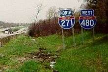
The freeway is concurrent with I-271 for two miles. I-271 and I-480 are the only two three-digit interstates in the nation that run concurrently with each other for any distance. This is because I-80 was concurrent with I-271 until 1971, when I-80 was routed back on to the turnpike and replaced by I-480.
Due to the convergence of these high traffic roads traffic jams are common during peak times. They run concurrent through Bedford Heights, Bedford, and Oakwood in Cuyahoga County.
The Valley View Bridge, which is 212 feet (65 m) high and spans 4,150 feet (1,260 m),[4] carries I-480 across the Cuyahoga River valley.
Exit list
| County | Location | mi | km | Exit | Destinations | Notes |
|---|---|---|---|---|---|---|
| Lorain | North Ridgeville | 0.00 | 0.00 | — | Exit 151 on I-80/Ohio Tpk. | |
| 0.90 | 1.45 | Ohio Turnpike Toll Plaza | ||||
| 1.16 | 1.87 | 1 | Western end of SR 10 concurrency; westbound exit and eastbound entrance | |||
| 2.03 | 3.27 | 2 | Eastern end of SR 10 concurrency | |||
| Cuyahoga | North Olmsted | 3.67 | 5.91 | 3 | Stearns Road | |
| 6.15 | 9.90 | 6 | Signed as exits 6A (south) and 6B (north) westbound | |||
| 7.57 | 12.18 | 7 | Clague Road – Westlake, Fairview Park | Westbound exit and eastbound entrance | ||
| Cleveland | 9.44 | 15.19 | 9 | Eastbound ramps to SR 17; westbound to Grayton Road | ||
| 10.17 | 16.37 | 11 | Eastbound exit and westbound entrance; exit 238 on I-71 | |||
| 10.17 | 16.37 | 10 | Westbound exit and eastbound entrance | |||
| 10.71 | 17.24 | 11 | No eastbound exit; exit 238 on I-71. | |||
| 11.60 | 18.67 | 12A | West 150th Street — Brook Park | Westbound exit only | ||
| 12.71 | 20.45 | 12B | West 130th Street / West 150th Street — Brook Park | 150th Street signed eastbound only; signed as exit 12 eastbound | ||
| Brooklyn | 13.79 | 22.19 | 13 | Tiedeman Road — Brooklyn | ||
| Cleveland | 15.21 | 24.48 | 15 | |||
| 16.49 | 26.54 | 16 | ||||
| 17.76 | 28.58 | 17A | Jennings Freeway; signed as exit 17 eastbound | |||
| Brooklyn Heights | 18.03 | 29.02 | 17B | Westbound exit and eastbound entrance | ||
| Independence | 20.05 | 32.27 | 20 | Exit 156 on I-77; signed as exits 20A (south) & 20B (north). | ||
| Garfield Heights | 21.72 | 34.95 | 21 | Transportation Boulevard / East 98th Street | ||
| 22.92 | 36.89 | 22 | Eastbound exit and westbound entrance; no entrance from SR 17 east | |||
| 23.85 | 38.38 | 23 | ||||
| Cleveland | 24.58 | 39.56 | 24 | Lee Road – Maple Heights | Westbound exit and eastbound entrance | |
| Warrensville Heights | 26.03 | 41.89 | 25A-B | Warrensville Road — Bedford, Warrensville Heights | Eastbound exit and westbound entrance; split into exits 25A (south) and 25B (north); C/D lanes provide access to Northfield Rd. exit | |
| Warrensville Heights–Bedford Heights line | 26.03– 26.55 | 41.89– 42.73 | 25C | Eastbound access via C/D lanes originating from Warrensville Rd. exit | ||
| 26.31 | 42.34 | 26 | Eastbound left exit and westbound left entrance; access via unsigned I-480N | |||
| Bedford Heights | 27.94 | 44.97 | 26A | Rockside Road | Westbound exit and eastbound entrance | |
| 28.02 | 45.09 | — | Western end of I-271 concurrency; westbound left exit and eastbound left entrance; I-271 exits 26A-B | |||
| Oakwood | 30.99 | 49.87 | 23 | Western end of SR 14 concurrency | ||
| 32.06 | 51.60 | — | Eastern end of I-271 concurrency; eastbound exit and westbound entrance; I-271 exit 21 | |||
| Summit | Twinsburg | 36.30 | 58.42 | 36 | ||
| 36.99 | 59.53 | 37 | ||||
| Portage | Streetsboro | 41.63 | 67.00 | 41 | Frost Road | |
| 42.45 | 68.32 | — | Eastern end of SR 14 concurrency; SR 14 exit 42 | |||
| Exit 187 on I-80/Ohio Tpk. | ||||||
1.000 mi = 1.609 km; 1.000 km = 0.621 mi
| ||||||
Interstate 480N
| |
|---|---|
| Location: | Maple Heights–Warrensville Heights |
| Length: | 1.99 mi[5] (3.20 km) |
| Existed: | 1974–present |
The spur freeway connecting I-480 to I-271 and US 422 is officially designated as Interstate 480N, by the Ohio Department of Transportation.[6][7] It is rarely referred by this name. It is currently unsigned, with the exception of mile markers.
Major intersections
The entire route is in Cuyahoga County.
| Location | mi[5] | km | Exit | Destinations | Notes |
|---|---|---|---|---|---|
| Maple Heights | 0.00 | 0.00 | – | Western terminus; exit 26 on I-480 | |
| North Randall | 0.53– 0.78 | 0.85– 1.26 | 1 | Miles Road – North Randall, Bedford Heights | |
| Warrensville Heights | 1.29 | 2.08 | — | Eastbound exit and westbound entrance | |
| 1.63 | 2.62 | 13A | Westbound left exit and eastbound entrance; exit based on US 422 mileage; I-271 exit 27A | ||
| — | Eastbound left exit and westbound entrance; I-271 exit 27B | ||||
| 1.99 | 3.20 | Eastern terminus; exit 13B on US 422 | |||
| 1.000 mi = 1.609 km; 1.000 km = 0.621 mi | |||||
References
- 1 2 McIntyre, Michael K. (September 22, 1998). "I-480 Is Renamed in Honor of Glenn". The Plain Dealer. Cleveland, OH. Retrieved April 12, 2010 – via Newsbank.
- ↑ Staff (October 31, 2002). "Table 2: Auxiliary Routes of the Dwight D. Eisenhower National System of Interstate and Defense Highways as of October 31, 2002". Route Log and Finder List. Federal Highway Administration. Retrieved October 5, 2014.
- ↑ Staff. "1957–1958 Biennial Report excerpt". Ohio Department of Highways. Retrieved April 2, 2008 – via Roadfan.com.
- ↑ Interstate 480
- 1 2 Staff. "Technical Services Straight Line Diagrams". Ohio Department of Transportation. Retrieved April 25, 2013.
- ↑ Staff. "Technical Services Straight Line Diagram for I-480N" (PDF). Ohio Department of Transportation.
- ↑ "Cuy". ODOT Routes in Cuyahoga County. Retrieved December 31, 2015.
External links
| Wikimedia Commons has media related to Interstate 480 (Ohio). |
| ||