Interstate 290 (New York)
| ||||
|---|---|---|---|---|
| Youngmann Memorial Highway | ||||
|
Map of Erie County in western New York with I-290 highlighted in red | ||||
| Route information | ||||
| Maintained by NYSDOT | ||||
| Length: | 10.24 mi[1] (16.48 km) | |||
| Existed: | 1958[2] – present | |||
| History: | Completed mid-1960s[3][4] | |||
| Major junctions | ||||
| West end: |
| |||
|
| ||||
| East end: |
| |||
| Highway system | ||||
| ||||
.svg.png)
_Map.svg.png)
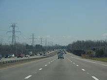
Interstate 290 (I-290) runs for 10 miles (16 km) near Buffalo, New York from I-90 to I-190. It connects Buffalo with its northern suburbs of Amherst and Tonawanda, and provides a route to Niagara Falls and Canada that bypasses the city of Buffalo. I-290 also connects to I-990, and through this connection, provides access to the Amherst Campus of the University at Buffalo. Its official name is the Youngmann Memorial Highway, but locally, it is colloquially referred to as "the two-ninety" and "the Youngmann". The route provides the fastest road link between Toronto (Canada's largest city) and the heavily populated Northeastern United States via I-90.
Route description
I-290 begins at a semi-directional T interchange with I-190 within view of the Niagara River in an industrial sector of the Buffalo suburb of Tonawanda. The freeway heads east from I-190 into more residential areas of Tonawanda, where it meets New York State Route 384 (NY 384) at a three-quarter cloverleaf interchange. The two missing portions of the cloverleaf, both ramps leading to NY 384 from I-290 eastbound, are replaced by an exit to Elmwood Avenue located slightly west of the NY 384 exit. To the east of NY 384 (and adjacent to the southeasternmost point in the city of Tonawanda), I-290 interchanges with the Twin Cities Memorial Highway (NY 425).
The Youngmann continues east through Tonawanda to the Amherst town line, where it meets U.S. Route 62 (US 62) at a second three-quarter cloverleaf interchange. Unlike the interchange with NY 384, all connections are possible between I-290 and US 62 due to a modified ramp linking I-290 westbound to US 62. Past US 62 in Amherst, I-290 turns to the southeast ahead of a semi-directional T interchange with I-990, a spur to Lockport. Farther east, I-290 meets NY 263 (Millersport Highway) at a cloverleaf interchange and NY 324 and NY 240 at a modified diamond interchange south of the University at Buffalo's Amherst Campus.

Near Williamsville, I-290 turns southward and intersects NY 5 (Main Street) at a modified cloverleaf interchange. I-290 terminates at a semi-directional T interchange with the New York State Thruway (I-90) a half-mile to the south on the Amherst-Cheektowaga town line. This interchange is colloquially referenced as "The Blue Water Tower" due to its proximity to a large blue water tower on the Amherst-Cheektowaga town line.
History
What is now I-290 was originally intended to be designated I-190. The route was renumbered I-290 in 1958 to better reflect the future highway's routing as a connector between two Interstate Highways (or a bypass of Buffalo) rather than a spur.[2] Construction on the expressway began c. 1962 when work commenced on the section between NY 263 and the New York State Thruway.[5][6] This section was finished by the following year, by which time work had begun on the remainder of the freeway.[7] The section between NY 263 and US 62 was opened to traffic c. 1964[7][8] while the rest was finished in the mid-1960s.[3][4] The interchange with what is now I-990 was built in 1983.[9]
The expressway was originally named the Power Line Expressway for the high tension power lines that parallel the expressway. It was renamed in the early 1960s[6][8] to serve as a memorial to Elmer G. H. Youngmann, a project engineer who died while the road was being built.[2] The official name of the freeway became the Youngmann Memorial Highway;[4] however, the name Youngmann Expressway has also been frequently used over the years.[8]
Exit list
The entire route is in Erie County.
| Location | mi[1] | km | Exit | Destinations | Notes |
|---|---|---|---|---|---|
| Town of Tonawanda | 0.00 | 0.00 | Western terminus; I-190 exit 16 | ||
| 1 | Elmwood Avenue (CR 119) | Eastbound exit and entrance | |||
| 2.58 | 4.15 | 1 | Signed as 1A (south) and 1B (north); no eastbound exit | ||
| 3.65 | 5.87 | 2 | Southern terminus of NY 425 | ||
| Tonawanda–Amherst town line | 5.24 | 8.43 | 3 | Signed as 3A (south) and 3B (north) eastbound | |
| Amherst | 6.19 | 9.96 | 4 | Southern terminus of I-990 | |
| 7.31 | 11.76 | 5 | Signed as 5A (south) and 5B (north) | ||
| 8.06 | 12.97 | 6 | |||
| 9.75 | 15.69 | 7 | Signed as 7A (west) and 7B (east) | ||
| 10.24 | 16.48 | Eastern terminus; I-90 exit 50 | |||
| 1.000 mi = 1.609 km; 1.000 km = 0.621 mi | |||||
See also
- Aurora Expressway (NY 400)
- Kensington Expressway (NY 33)
- Skyway (Buffalo) (NY 5)
- Scajaquada Expressway (NY 198)
References
- 1 2 "2008 Traffic Volume Report for New York State" (PDF). New York State Department of Transportation. June 16, 2009. p. 207. Retrieved February 1, 2010.
- 1 2 3 "Interstate 290". Kurumi. September 7, 2004. Retrieved July 18, 2010.
- 1 2 New York (Map). Cartography by Rand McNally and Company. Mobil. 1965.
- 1 2 3 New York (Map) (1969–70 ed.). Cartography by General Drafting. Esso. 1968.
- ↑ New York and Metropolitan New York (Map) (1961–62 ed.). Cartography by H.M. Gousha Company. Sunoco. 1961.
- 1 2 New York with Sight-Seeing Guide (Map) (1962 ed.). Cartography by General Drafting. Esso. 1962.
- 1 2 New York Happy Motoring Guide (Map) (1963 ed.). Cartography by General Drafting. Esso. 1963.
- 1 2 3 New York and Metropolitan New York (Map). Cartography by Rand McNally and Company. Sinclair Oil Corporation. 1964.
- ↑ National Bridge Inventory, a database compiled by the United States Department of Transportation Federal Highway Administration, available at www.nationalbridges.com. Accessed October 30, 2007.
External links
| Wikimedia Commons has media related to Interstate 290 (New York). |
- Interstate 290 at Alps' Roads • New York Routes • Upstate New York Roads
| ||