Interstate 20 in South Carolina
| ||||
|---|---|---|---|---|
| J. Strom Thurmond Freeway | ||||
_map.svg.png) | ||||
| Route information | ||||
| Maintained by SCDOT | ||||
| Length: | 141.51 mi[1][2] (227.74 km) | |||
| Existed: | 1964 – present | |||
| Major junctions | ||||
| West end: |
| |||
|
| ||||
| East end: |
| |||
| Location | ||||
| Counties: | Aiken, Lexington, Richland, Kershaw, Lee, Darlington, Florence | |||
| Highway system | ||||
| ||||

Interstate 20 (I-20) is a major thoroughfare cutting across the state of South Carolina, linking the state with important transportation and business hubs to the north, west and south, including Atlanta, Georgia, Charlotte, North Carolina (via I-77), Savannah, Georgia (via I-95) and Washington, D.C. (via I-95).
Route description
I-20 enters the Palmetto State after crossing the Savannah River from Augusta, Georgia. Known as the J. Strom Thurmond Freeway, the highway heads northeastward, bypassing Aiken and Lexington before reaching the state capital of Columbia. It was constructed in various stages beginning in late 1963, with the final section between SC-340 and the Business Spur opening in August 1975.
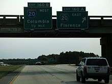
At Columbia, I-20 crosses the Saluda and Broad rivers and travels through the northern part of the city and turns eastward, bypassing Fort Jackson and Camden before reaching Florence. It is at Florence where I-20 sees its eastern terminus at I-95. However, for about 2 miles (3.2 km), the highway continues to downtown Florence as Business Spur 20.
History
I-20 first appeared between 1964-1967, with its first section completed from SC 6, south of Lexington, to Spears Creek Church Road (S-40-53), south of Pontiac.[3][4] A second section, from the Georgia state line to US 25 / SC 121 was completed in 1967. [5] In 1968 or 1969, I-20 was extended east from Spears Creek Church Road (S-40-53) to US 601, south of Camden.[6] In 1971, I-20 combined the two segments by completing the gap between US 25 / SC 121 to SC 6.[7] In 1973, I-20 was extended east to US 521. In 1974, it extended east again to US 15. In 1975, another extension east to US 401. And finally, in 1976, I-20 reached its destination with I-95 and the city of Florence.[8] Also same year exit numbers were installed.
In the late 1980s, I-20 was widened to six lanes between US 378 and I-77.
Proposed extension
The first proposal to extend I-20 was at the time of its designation in the state, and consisted of plans to extend it east from Florence to Myrtle Beach. However, because Myrtle Beach was not yet the tourist destination it later became, the state eventually widened US 76, US 501 and established SC 576 connecting the two U.S. Highways in the 1970s.[9]
In 2003, North Carolina Governor Mike Easley pushed forward a proposal to extend I-20 eastward from Florence to Wilmington, which became part of NCDOT's strategic transportation plan. The proposed routing would overlap I-20 along I-95 to the I-74 / US 74 interchange, then travel east (concurrently with US 74) into Wilmington. In 2005, this proposal became part of the SAFETEA-LU transportation legislation, North Carolina received $5 million for a feasibility study for this extension.
While the extension had support in North Carolina, with justification that a direct route from Atlanta to the Port of Wilmington could be a boom to the economy, this view was not shared by officials in South Carolina. In 2009, soon after Governor Mike Easley left office, the proposed routing was removed from all NCDOT plans and was officially dropped. The proposal was never officially discussed with SCDOT nor submitted to AASHTO and FHWA for consideration.[10]
Exit list
| County | Location | mi[2] | km | Exit | Destinations | Notes |
|---|---|---|---|---|---|---|
| Aiken | North Augusta | 0.0 | 0.0 | Continuation into Georgia | ||
| 1.2 | 1.9 | 1 | ||||
| 4.9 | 7.9 | 5 | ||||
| 5.6 | 9.0 | 6 | ||||
| | 11.1 | 17.9 | 11 | Bettis Academy Road – Graniteville | ||
| Aiken | 17.7 | 28.5 | 18 | |||
| 21.9 | 35.2 | 22 | ||||
| | 29.3 | 47.2 | 29 | Wire Road | ||
| | 32.4 | 52.1 | 33 | |||
| Lexington | | 38.7 | 62.3 | 39 | ||
| | 44.1 | 71.0 | 44 | Road 34 – Gilbert | ||
| | 50.8 | 81.8 | 51 | Longs Pond Road | ||
| Lexington | 54.8 | 88.2 | 55 | Signed as exits 55A (east) and 55B (west) westbound | ||
| 57.5 | 92.5 | 58 | To Columbia Airport | |||
| 61.1 | 98.3 | 61 | ||||
| Richland | Columbia | 63.2 | 101.7 | 63 | Bush River Road | |
| 64.0 | 103.0 | 64 | Signed as exits 64A (east) and 64B (west) | |||
| 65.0 | 104.6 | 65 | ||||
| 68.2 | 109.8 | 68 | ||||
| 69.6 | 112.0 | 70 | ||||
| 71.0 | 114.3 | 71 | ||||
| 72.1 | 116.0 | 72 | ||||
| 72.7 | 117.0 | 73 | Signed as exits 73A (south) and 73B (north) | |||
| 73.9 | 118.9 | 74 | ||||
| 75.5 | 121.5 | 76 | Westbound signed as exit 76A (I-77) and exit 76B (Alpine Road); eastbound exit Alpine Road to I-77 north | |||
| | 79.8 | 128.4 | 80 | Clemson Road | ||
| | 81.5 | 131.2 | 82 | Spears Creek Church Road – Pontiac | ||
| Kershaw | | 86.7 | 139.5 | 87 | White Pond Road – Elgin | |
| Lugoff | 91.5 | 147.3 | 92 | |||
| Camden | 97.5 | 156.9 | 98 | To Camden Military Academy | ||
| | 101.2 | 162.9 | 101 | Road 329 | ||
| Lee | | 107.5 | 173.0 | 108 | Jamestown Road – Manville | |
| Bishopville | 115.8 | 186.4 | 116 | |||
| 119.7 | 192.6 | 120 | ||||
| | 122.4 | 197.0 | 123 | Road 22 – Lamar | To Lee State Park | |
| Darlington | | 130.6 | 210.2 | 131 | ||
| | 137.0 | 220.5 | 137 | |||
| Florence | Florence | 141.2 | 227.2 | 141 | Signed as exits 141A (north) and 141B (south) | |
| 141.5 | 227.7 | Continuation beyond I-95 | ||||
| 1.000 mi = 1.609 km; 1.000 km = 0.621 mi | ||||||
Related routes
I-20 has one auxiliary Interstate within South Carolina. Numbered I-520, it runs between North Augusta and Augusta, Georgia. Originally a spur, it serves as a partial beltway of the Augusta area, split between Georgia and South Carolina.
Interstate 20 Business
| |
|---|---|
| Location: | Florence, South Carolina |
| Length: | 2.0 mi[11] (3.2 km) |
| Existed: | 1970–present |
Interstate 20 Business (I-20 Bus) is a 2.0-mile (3.2 km) four-lane boulevard grade business spur of I-20 along David H. McLeod Boulevard, between I-95 and Palmetto Street (US 76). Construction began by 1969, completed in 1970, it has remained unchanged since inception.[12]
The entire route is in Florence, Florence County.
| mi[11] | km | Destinations | Notes | ||
|---|---|---|---|---|---|
| 0.0 | 0.0 | Continuation as I-20 | |||
| 2.0 | 3.2 | To Francis Marion University | |||
| 1.000 mi = 1.609 km; 1.000 km = 0.621 mi | |||||
See also
-
 South Carolina portal
 -
 U.S. Roads portal
 - Central Savannah River Area
References
- ↑ "Table 1". Route Log and Finder List. Federal Highway Administration. Retrieved September 26, 2007.
- 1 2 Google (June 5, 2014). "Interstate 20 in South Carolina" (Map). Google Maps. Google. Retrieved June 5, 2014.
- ↑ General Highway Map, Richland County, South Carolina (PDF) (Map). Cartography by SCDOT. South Carolina Department of Transportation. 1963. Retrieved June 5, 2014.
- ↑ General Highway Map, Richland County, South Carolina (PDF) (Map). Cartography by SCDOT. South Carolina Department of Transportation. 1967. Retrieved June 5, 2014.
- ↑ General Highway Map, Aiken County, South Carolina (PDF) (Map). Cartography by SCDOT. South Carolina Department of Transportation. 1967. Retrieved June 5, 2014.
- ↑ General Highway Map, Richland County, South Carolina (PDF) (Map). Cartography by SCDOT. South Carolina Department of Transportation. 1970. Retrieved June 5, 2014.
- ↑ General Highway Map, Aiken County, South Carolina (PDF) (Map). Cartography by SCDOT. South Carolina Department of Transportation. 1973. Retrieved June 5, 2014.
- ↑ General Highway Map, Florence County, South Carolina (PDF) (Map). Cartography by SCDOT. South Carolina Department of Transportation. 1976. Retrieved June 5, 2014.
- ↑ Grainger, Kyle (February 19, 2009). "Why Interstate 73 and not I-20 to Myrtle Beach?". WMBF-TV. Myrtle Beach, SC. Retrieved June 5, 2014.
- ↑ "My Reporter Column Question on I-20 Going to Wilmington". StarNewsOnline.com. Retrieved October 4, 2014.
- 1 2 Google (May 19, 2013). "Business Spur 20" (Map). Google Maps. Google. Retrieved May 19, 2013.
- ↑ General Highway Map, Florence County, South Carolina (PDF) (Map). Cartography by SCDOT. South Carolina Department of Transportation. 1970. Retrieved June 5, 2014.
External links
 Media related to Interstate 20 in South Carolina at Wikimedia Commons
- Mapmikey's South Carolina Highways Page: I-20
- South Carolina @ Southeast Roads.com - Interstate 20
- I-20 in NC discussion on I-74 in North Carolina Progress Page, accessed October 4, 2005.
| Previous state: Georgia |
South Carolina | Next state: Terminus |
1Cancelled | ||