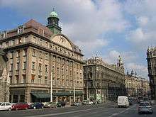
Inner City (Budapest)


Inner City (Hungarian: Belváros; German: Innenstadt) is part of (and more or less equivalent with) the historic old town of Pest. Until 1949, Inner City was the 4th District. Today it is one of the two neighbourhoods of the District V of Budapest, Hungary, the other one being Lipótváros ("Leopold Town") which is the political and financial centre of Hungary. Budapest's main shopping street, Váci utca ("Váci Street") is located in the District V, as is the large part of the city's commercial life, banks and travel agencies.[1] Many tourists start sightseeing there.
Today a colloquial definition of inner city (or city centre, both with lower case letters) also exists according to which the city centre of Budapest in a broader sense is bordered by the Grand Boulevard on Pest side of the city. In Buda (if it is also included), it is bordered by the continuation of Grand Boulevard by Margit körút, Krisztina körút, Budaörsi út and Bocskai út.[2] The broader sense of the city center comprises the whole 5th district and some areas of the 6th, 7th, 8th, 9th and 13th districts on the Pest side, while sometimes even some areas of Buda is also included, like part of the 1st, 2nd, 11th and 12th districts.
Location

orange: broader colloquial definition of inner city (inside the Nagykörút)
yellow: even broader definition
The Inner City is situated on the banks of the Danube, Its borders follow the line of the old city walls.
The borders of Belváros are bounded by Vigadó tér ("Vigadó Square") in the north, Deák Ferenc utca ("Ferenc Deák Street") in the north, the Small Boulevard streets of Károly körút ("Charles Boulevard"), Múzeum körút ("Museum Boulevard") and Vámház körút ("Vámház Boulevard"), and the River Danube.
Neighbours of the Inner City are (clockwise from north):
- Lipótváros ("Leopold Town"), the other neighbourhood in the 5th District
- 7th District: Erzsébetváros ("Elizabeth Town")
- 8th District: Józsefváros ("Joseph Town")
- 9th District: Ferencváros ("Francis Town")
- river Danube
Administration
Pest was granted the Charter of Free Royal Town in 1704. The core of the city was first called Belváros (German: Innenstadt) during the 18th century, when suburbs grew up around it. After the unification of Budapest in 1873, Belváros became the 4th district of the capital. On 1 January 1950 it was merged with neighbouring Lipótváros to form the 5th District. Since 1990 the district has officially called "Belváros-Lipótváros".[3]
Transport
The three Budapest Metro lines converge at Ferenc Deák Square where the Blue and Red lines meet the Millennium Underground Railway (yellow). There are several bus, tram and trolleybus lines in this area.
Landmarks

- Inner City Parish Church
- University Church
- Evangelical Church on Ferenc Deák Square
- Pilvax Café
- Váci Street
See also
References
- ↑ "Budapest", Encyclopædia Britannica
- ↑ "City centre and Districts", Budapest Corner
- ↑ Buza, Peter; Meszaros, Gyorgy; Radey, Mihaly (1998), Budapest teljes utcanévlexikona (List of Street Names of Budapest) (in Hungarian), p. 35, ISBN 978-963-657-176-4
External links
| Wikimedia Commons has media related to Downtown, Budapest. |
- The Inner City of Budapest (Budapest Pages)
- Erzébetváros and the Jewish quarter of Pest
Coordinates: 47°29′53″N 19°02′24″E / 47.498°N 19.040°E