Ingleside, Illinois
| Ingleside | |
| Unincorporated community | |
| Country | United States |
|---|---|
| State | Illinois |
| County | Lake |
| Coordinates | 42°22′51″N 88°08′19″W / 42.38083°N 88.13861°WCoordinates: 42°22′51″N 88°08′19″W / 42.38083°N 88.13861°W |
| Area | 11.98 sq mi (31.03 km2) |
| - land | 11.44 sq mi (30 km2) |
| - water | 0.54 sq mi (1 km2), 4.51% |
| Population | 9,286 (2000) |
| Density | 811.89/sq mi (313.5/km2) |
| Timezone | CST (UTC-6) |
| - summer (DST) | CDT (UTC-5) |
|
Location of Ingleside within Illinois | |
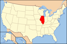
 Location of Illinois in the United States | |
Ingleside is an unincorporated community in Lake County, Illinois, United States. Ingleside is between Fox Lake, Round Lake Heights and Lake Villa.
Geography
Ingleside is on Squaw Creek (also called Indian River) between Long Lake, Duck Lake, and Fox Lake.
Ingleside lies below the Long Lake Dam and above Fox Lake. Duck lake and most of the Long Lake area are part of Ingleside. Ingleside also goes northwest to Lake Villa, Illinois.
The Old Grant Township Hall (home of the Grant Township Museum), The Long Lake Dam, The Fox Lake bike trail, Dry Dock Laundromat and Dog-n-Suds. Dog-n-Suds is a 1950s-style drive-up complete with intercoms for ordering and car-hops to bring customers their food. They have a weekly classic car night and are open Tuesday–Sunday seasonally.
The primary elementary school district is Gavin School District 37.
In the 1960s, mammoth bones were found there. They are on display at the Lakes Region Historical Society Museum in Antioch, Illinois.
In 2008, the Long Lake Dam was rebuilt and modernized. The dam was built in 1930 and reinforced in 1968 and 2008. The Long Lake Dam allows the control of water flowing from Long Lake to Fox Lake and allows pleasure boat traffic from Long Lake to the rest of the Chain of Lakes.
Transportation
Ingleside is served by Metra commuter train's Milwaukee District/North Line connecting to downtown Chicago.
Demographics
As of the census[1] of 2000, there were 9,286 people residing in the village. The population density was 811.89 people per square mile (313.5/km²). There were 3,660 housing units. The racial makeup of the village was 75.1% White, 12.3% African American, 0.9% Native American, 3.6% Asian, 0.1% Pacific Islander, 5.5% from other races, and 2.4% from two or more races. Hispanic or Latino of any race were 4.2% of the population.
Notable people
- William J. Stratton, Illinois Secretary of State
- William Stratton, 32nd Governor of Illinois (1953-1961)
- Daniel Dennis, Olympic Wrestler (2016)