Indianapolis Metropolitan Airport
| Indianapolis Metropolitan Airport | |||||||||||
|---|---|---|---|---|---|---|---|---|---|---|---|
 | |||||||||||
| IATA: none – ICAO: KUMP – FAA LID: UMP | |||||||||||
| Summary | |||||||||||
| Airport type | Public | ||||||||||
| Owner | Indianapolis Airport Authority | ||||||||||
| Operator | Tom Wood Aviation | ||||||||||
| Serves | Indianapolis, Indiana | ||||||||||
| Location | Fishers, Indiana | ||||||||||
| Elevation AMSL | 811 ft / 247 m | ||||||||||
| Coordinates | 39°56′07″N 086°02′42″W / 39.93528°N 86.04500°W | ||||||||||
| Map | |||||||||||
 UMP  UMP Location of airport in Indiana/United States | |||||||||||
| Runways | |||||||||||
| |||||||||||
| Statistics | |||||||||||
| |||||||||||
Indianapolis Metropolitan Airport (ICAO: KUMP, FAA LID: UMP) is a public airport 2 miles (3.2 km) southwest of Fishers, in Hamilton County, Indiana. It is 8 miles (13 km) northeast of downtown Indianapolis, is owned by the Indianapolis Airport Authority and is a reliever airport for Indianapolis International Airport.[1]
Most U.S. airports use the same three-letter location identifier for the FAA and IATA, but Indianapolis Metropolitan Airport is UMP to the FAA and has no IATA code.[2]
Facilities and aircraft
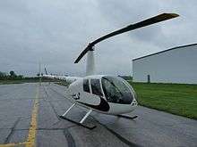
Indianapolis Metropolitan Airport covers 445 acres (180 ha); its one runway, 15/33, is 3,848 x 100 ft (1,172 x 30 m) asphalt. Tom Wood Aviation is the FBO (Fixed Based Operator), with full-service Shell fueling of 100LL and Jet-A, FAA Certified aircraft charter, full service aircraft management, pilot service, flight instruction, aircraft repair, maintenance and alterations, aircraft sales. The facilities include coffee, ice, pilots' lounge with TV, executive conference rooms, public restrooms, catering services and more. Rental vehicles are available through Tom Wood Nissan, Hertz and Enterprise. In the year ending June 15, 2006 the airport had 58,008 aircraft operations, average 158 per day: 79% general aviation, 18% air taxi and 3% military. In September 2016, there were 133 aircraft based at the airport: 109 single-engine, 14 multi-engine, 5 jet and 5 helicopter. [1]
References
- 1 2 3 FAA Airport Master Record for UMP (Form 5010 PDF), effective Sep 15, 2016.
- ↑ Great Circle Mapper: KUMP - Indianapolis, Indiana - Indianapolis Metropolitan Airport
External links
- Indianapolis Metropolitan Airport, official page from Indianapolis Airport Authority
- Tom Wood Aviation, Inc., the fixed-base operator (FBO)
- Aerial photo from Indiana Department of Transportation
- FAA Terminal Procedures for UMP, effective December 8, 2016
- Resources for this airport:
- FAA airport information for UMP
- AirNav airport information for UMP
- FlightAware airport information and live flight tracker
- SkyVector aeronautical chart for UMP
- Gatewood Airport - History of Indianapolis Metropolitan Airport - 1960–1967. (Available on www.lulu.com)