Indianapolis Downtown Heliport
| Indianapolis Downtown Heliport | |||||||||||
|---|---|---|---|---|---|---|---|---|---|---|---|
 | |||||||||||
| IATA: - – ICAO: - – FAA LID: 8A4 | |||||||||||
| Summary | |||||||||||
| Airport type | Public | ||||||||||
| Owner | Indianapolis Airport Authority | ||||||||||
| Serves | Indianapolis | ||||||||||
| Elevation AMSL | 732 ft / 223 m | ||||||||||
| Coordinates | 39°45′57″N 86°08′56″W / 39.765876°N 86.148875°WCoordinates: 39°45′57″N 86°08′56″W / 39.765876°N 86.148875°W | ||||||||||
| Website | Indianapolisairport.com - Heliport | ||||||||||
| Map | |||||||||||
 8A4  8A4 Location of heliport in Indiana/United States | |||||||||||
| Helipads | |||||||||||
| |||||||||||
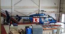
Indianapolis Downtown Heliport is a heliport located in the city centre of Indianapolis. The heliport was opened in 1969 as a private use heliport under the name Beeline Heliport and in 1979 was turned into a public facility. In 1983 the FAA picked the heliport to be part of its National Prototype Demonstration Heliport Program, a project launched to illustrate the usefulness and viability of full-service downtown heliports in the United States, and as a result it received considerable funding for improvements and expansion. It currently has one main pad for landing, an apron and two hangars. IFR approaches are possible.
External links
This article is issued from Wikipedia - version of the 11/7/2016. The text is available under the Creative Commons Attribution/Share Alike but additional terms may apply for the media files.