Imha Dam
| Imha Dam | |
|---|---|
 Spillway of the dam | |
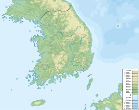 Location of Imha Dam in South Korea | |
| Country | South Korea |
| Location | Andong |
| Coordinates | 36°32′15″N 128°53′00″E / 36.53750°N 128.88333°ECoordinates: 36°32′15″N 128°53′00″E / 36.53750°N 128.88333°E |
| Status | Operational |
| Construction began | 1987 |
| Opening date | 1991 |
| Owner(s) | Korea Water Resources Corporation |
| Dam and spillways | |
| Type of dam | Embankment, rock-fill |
| Impounds | Banbyeoncheon River |
| Height | 73 m (240 ft) |
| Length | 515 m (1,690 ft) |
| Dam volume | 3,423,000 m3 (4,477,115 cu yd) |
| Reservoir | |
| Total capacity | 595,000,000 m3 (482,374 acre·ft) |
| Catchment area | 1,361 km2 (525 sq mi) |
| Surface area | 26.4 km2 (10 sq mi) |
| Power station | |
| Turbines | 2 x 25 MW |
| Installed capacity | 50 MW |
The Imha Dam is an embankment dam on the Banbyeoncheon River, a tributary of the Nakdong River, 14 km (9 mi) east of Andong in Gyeongsangbuk-do province, South Korea. The purpose of the dam is flood control, water supply and hydroelectric power generation. Construction on the dam began in 1987 and it was complete in 1991. The 73 m (240 ft) tall rock-fill, central earth-core dam creates a reservoir with a capacity of 595,000,000 m3 (482,374 acre·ft) and supplies a 50 MW power station with water.[1] It supplies water for both municipal and industrial uses to Gumi, Dagu, Masan, Changwon, Jinhae, Woolsan, and Busan.[2]
See also
References
- ↑ "Imha Multipurpose Dam Project" (PDF). Japan International Cooperation Agency. Retrieved 4 August 2011.
- ↑ "Andong & Imha Reservoirs". LakeLove. Retrieved 4 August 2011.
| Wikimedia Commons has media related to Imha Dam. |
This article is issued from Wikipedia - version of the 10/23/2015. The text is available under the Creative Commons Attribution/Share Alike but additional terms may apply for the media files.