Imbaba
| Imbaba | |
|---|---|
|
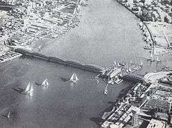
An old photo of the Imbaba bridge | |
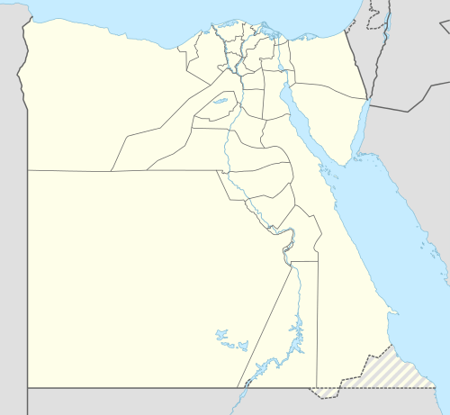 Imbaba Location in Egypt | |
| Coordinates: 30°5′33″N 31°12′2″E / 30.09250°N 31.20056°ECoordinates: 30°5′33″N 31°12′2″E / 30.09250°N 31.20056°E | |
| Country |
|
| Governorate | Giza Governorate |
| Population | |
| • Total | 373,000 |
| Time zone | EST (UTC+2) |
Imbaba (Egyptian Arabic: إمبابه, IPA: [emˈbæːbæ]) is a neighbourhood in northern Giza, Egypt, located west of the Nile and northwest of and near Gezira Island and downtown Cairo, within the Giza Governorate. The district is located near (southeast of) 30°5′33″N 31°12′2″E / 30.09250°N 31.20056°E, in the historic upper Nile Delta, and is part of the Greater Cairo metropolitan area.
Imbaba is also the name of an adjacent administrative centre (مركز) in rural Giza Governorate, which has 19 villages in its jurisdiction.
History
For centuries Imbaba was the final destination for camels brought from as far as Sudan and the Horn of Africa, to be sold in the village's Friday market. The market still exists, but is no longer as important as it was up to the turn of 20th century due to increasing urbanisation.
The Siege of Imbaba
In late 1992, the "Islamic Group" (al-Gama'a al-Islamiyya) expanded its influence in parts of Imbaba. In November, the group purportedly announced the establishment of the "Emirate of Imbaba" (some accounts claim that foreign news media coined the term, not the group itself). This challenge to the sovereignty of the Egyptian state triggered the siege of Imbaba, beginning on December 8, 1992. In its course, the government deployed over 12,000 police and State Security forces, along with one hundred personnel carriers and bulldozers, all of which put an end to the Emirate.[1][2][3]
The Battle of the Pyramids
The Battle of the Pyramids, also known as the Battle of Embabeh, was a battle fought on July 21, 1798 between the French army in Egypt under Napoleon Bonaparte, and local Mamluk forces. It occurred during France's Egyptian Campaign and was the battle where Napoleon put into use one of his significant contributions to tactics, the massive divisional square. Napoleon named the battle after the Egyptian pyramids, although they were only faintly visible on the horizon when the battle took place.
Name origins
The origin of the name Imbaba is not certain; however, the word specifically pronounced "Embaba" in the Tigre language and Tigrinya language means flower. So it is possible that the area was called so by Tigre speaking camel merchants and herders to describe the place where they met to do business.
See also
References
- ↑ Singerman, Diane. “The Siege of Imbaba, Egypt’s Internal ‘Other,’ and the Criminalization of Politics.” In Cairo Contested: Governance, Urban Space, and Global Modernity, ed. Diane Singerman, 111-144. New York, NY: The American University in Cairo Press, 2009. Pages 112-114.
- ↑ "Church burning deepens tumult of Egypt transition". Fox News. Cairo. Associated Press. 8 May 2011. Retrieved 9 May 2011.
Islamic extremists declared the crowded district a state within a state in 1990s, calling it "the Islamic Republic of Imbaba," one of the country's hottest spots of Islamic militancy.
- ↑ Lindsey, Ursula (4 March 2010). "And then Cairo turned itself inside out". The National. Retrieved 9 May 2011.
At around the same time, the Islamist group Jama'a Islamiya took de facto control of Imbaba - creating what the foreign press quickly dubbed 'the Islamic Republic of Imbaba'. The government dispatched more than 12,000 soldiers to carry out a six-week siege, round up the Islamists, and reimpose its authority.
External links
| Wikimedia Commons has media related to Imbaba. |
- "Few Focus on Religion in One Cairo Neighborhood" by Anthony Shadid, New York Times February 15, 2011.
- Imbaba Journal; Camels and Men: All Is Changing and Unchanged
- the November/December 1989 print edition of Saudi Aramco World: '"Imbaba"
Districts and suburbs of Greater Cairo | ||||||||||||||||
|---|---|---|---|---|---|---|---|---|---|---|---|---|---|---|---|---|
| Cairo Governorate |
| |||||||||||||||
| Giza Governorate |
| |||||||||||||||
| Qalyubia Governorate |
| |||||||||||||||