Imamganj
| Imamganj(Shriramganj) shriramganj Shreeramganj | |
|---|---|
| city | |
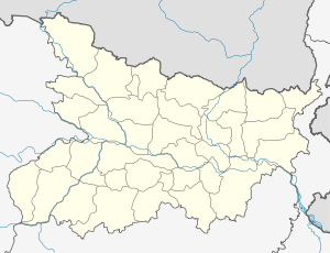 Imamganj(Shriramganj) Location in Bihar, India | |
| Coordinates: 24°27′09″N 84°35′05″E / 24.452521°N 84.584727°ECoordinates: 24°27′09″N 84°35′05″E / 24.452521°N 84.584727°E | |
| Country |
|
| State | Bihar |
| Region | Magadha |
| Division | Magadh Division |
| District | Gaya |
| Founded by | Maharshi shri Ramanand trivedi |
| Named for | In the name of god Rama |
| Elevation[1] | 182 m (597 ft) |
| Time zone | IST (UTC+5:30) |
| PIN | 824206 |
| Telephone code | 06331 |
| Website |
www |
Imamganj is a city and a block headquarter in Gaya district of Bihar state, India.[2] It is also a Bihar Legislative Assembly constituency in the Magadh division, part of the Aurangabad Lok Sabha constituency.[3] It is located on the border of Jharkhand state, 65 km towards west from District headquarters Gaya, Bihar.
The Imamganj block is spread over 61708.52 sq acres and includes 7 village panchayat and 195 villages.[4] In 2011 Indian census, it had a population of 1,864, including 951 males and 913 females.[5]
The original name of the city was shriramganj in the name of Hindu god lord Ram.It was founded by maharshi shri Ramanand trivedi in 10th century.But after that city is named after Imam Baksh Khan, son Ghulam Husain Khan, local feudal ruler of Sherghati, just as Raniganj is named after his wife Umda Rani. The city has been affected by Maoist insurgency, who caused damage to public buildings and cell towers in the area in 2011.
Muslims constitute 13 per cent of the population in Imamganj.[6] The population of the city is increasing day by day as the people from the rural area is settling in imamganj.Imamganj has a CRPF camp in the block campus.Two rivers surrounding imamganj flow namely Morhar And sorhar, they together meet at bhaghar and is called domuhan.[7][8] However, in the Indian general election, 2014, the local voters defied the Maoists and voted heavily.[9] Noted bestselling author Satyapal Chandra[10] belongs to this place.
References
- ↑ "Maps Imamganj, India". falling rain. Retrieved 2014-06-18.
- ↑ "Chaudhary elected new Bihar assembly Speaker". Rediff.com. 2005-11-30. Retrieved 2014-06-18.
- ↑ "Magadh region hogs political limelight". The Times of India. May 21, 2014. Retrieved 2014-06-18.
- ↑ "Imamganj, Public Health Centre". Retrieved 2014-06-18.
- ↑ "Imamganj". Census of India: Population Finder, Ministry of Home Affairs. Retrieved 2014-06-18.
- ↑ "Will the Muslim militia polarise community on caste lines in Bihar's Imamganj?".
- ↑ "Maoists blast school building in Bihar`s Gaya District". Sify.com. 2011-03-16. Retrieved 2014-06-18.
- ↑ Banerjee, Shoumojit (June 16, 2011). "Maoists blast six cell towers, torch part of railway station". The Hindu. Retrieved 2014-06-18.
- ↑ "Villagers defy Maoists in Bihar's Aurangabad to vote". The Times of India. 2014-04-11. Retrieved 2014-06-18.
- ↑ http://www.deccanherald.com/content/277387/on-write-track-maoist-land.html