Illinois Route 83
| ||||
|---|---|---|---|---|
| Kingery Highway | ||||
| Route information | ||||
| Maintained by IDOT | ||||
| Length: | 92.22 mi[1] (148.41 km) | |||
| Existed: | 1941[2] – present | |||
| Major junctions | ||||
| South end: |
| |||
| North end: |
| |||
| Location | ||||
| Counties: | Cook, DuPage, Lake | |||
| Highway system | ||||
| ||||

Illinois Route 83 (IL 83) is a major north–south state road in northeast Illinois. It stretches from U.S. Route 30 (US 30, Lincoln Highway) by Lynwood and Dyer, Indiana, north to the Wisconsin border by Antioch at Highway 83. This is a distance of about 92 miles (148 km).
Route description
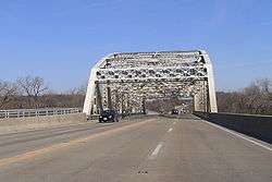
Illinois 83 passes through Cook County, DuPage County, and Lake County. It begins as part of Glenwood-Dyer Road in Lynwood, and then follows Torrence Avenue though Lansing, 147th Street/Sibley Blvd though Calumet City, Dolton, Harvey, Dixmoor, then north on Cicero, and then northwest on Cal Sag Road through Cook County. It then becomes known as the Kingery Highway through DuPage County, and then follows Busse Road, Oakton Street and Elmhurst Road in northern Cook County. In Lake County it is named McHenry Road in Buffalo Grove, Ivanhoe Road north of Mundelein, Barron Blvd. in Grayslake and Milwaukee Avenue in Lake Villa. Illinois 83 ranges from a width of two thru lanes at either terminus to six lanes through DuPage County. It is the main north–south arterial route falling between Interstates 355 and 294 for the central portion of its routing.
History
SBI Route 83 was modern Illinois Route 17 from New Boston to Galva. In 1941 it was changed to the Lynwood-to-Antioch routing, replacing Illinois Route 52 and Illinois Route 54. In 1998, Illinois 83 was routed slightly north onto 127th Street, from Cal Sag Road.[2] The renumbering was part of a major reconstruction project of the Illinois Route 50 intersection with Interstate 294 (Tri-State Tollway).
As part of sign replacement accompanying the renumbering, Illinois 83 was added to the northbound Illinois 50 exit from southbound I-294, as the new northbound Illinois 50 ramp leads directly to Illinois 83 first. However, Illinois 83 overlaps Illinois 50 southbound at the center of the interchange, so southbound Illinois 50 traffic also joins Illinois 83 at the end of the ramp. This is not reflected in the current signage on the tollway.
A $13.4 million construction project was completed in northern Lake County by improving a 4-mile section of Illinois 83 from Petite Lake Road to the Wisconsin state line. Improvements included adding a center turn lane and intersection modernizations at Grass Lake Road, Illinois Route 173, and North Avenue. The project was completed in fall 2010.[3]
Major intersections
| County | Location | mi | km | Destinations | Notes |
|---|---|---|---|---|---|
| Cook | Lynwood | Southern terminus of IL 83 | |||
| Lansing | Southern end of US 6 concurrency | ||||
| Calumet City | Northern end of US 6 concurrency | ||||
| Dolton | |||||
| Harvey | |||||
| Posen | |||||
| Interchange opened October 25, 2014 | |||||
| Midlothian | Southern end of IL 50 concurrency | ||||
| Alsip | Northern end of IL 50 concurrency | ||||
| Palos Heights | |||||
| Palos Hills | Interchange | ||||
| Lemont | Southern end of IL 171 concurrency | ||||
| Northern end of IL 171 concurrency | |||||
| DuPage | Darien | ||||
| Hinsdale | Interchange | ||||
| Oak Brook | Interchange | ||||
| Oakbrook Terrace | |||||
| Oakbrook Terrace–Elmhurst city line | |||||
| Elmhurst | |||||
| Addison–Elmhurst village line | |||||
| Bensenville | |||||
| Cook | Elk Grove Village | Western end of IL 72 concurrency | |||
| Eastern end of IL 72 concurrency | |||||
| Eastern terminus of IL 62 | |||||
| Mount Prospect | |||||
| Wheeling | |||||
| Lake | Long Grove | Northern terminus of IL 53 | |||
| Mundelein | |||||
| Southern end of IL 60 concurrency | |||||
| Northern end of IL 60 concurrency | |||||
| Grayslake | Western terminus of IL 137 | ||||
| Lake Villa | |||||
| Antioch | |||||
| Wisconsin state line | |||||
1.000 mi = 1.609 km; 1.000 km = 0.621 mi
| |||||
External links
References
- ↑ Illinois Technology Transfer Center (2006). "T2 GIS Data". Retrieved 2007-11-08.
- 1 2 Carlson, Rick. Illinois Highways Page: Routes 81 through 100. Last updated March 15, 2005. Retrieved March 29, 2006.
- ↑ "Illinois Route 83 Project FAQ". Illinois Department of Transportation. Retrieved 2009-10-23.