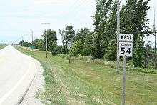
Illinois Route 54
| ||||
|---|---|---|---|---|
| Route information | ||||
| Maintained by IDOT | ||||
| Length: | 109.35 mi[1] (175.98 km) | |||
| Existed: | 1972[2] – present | |||
| Major junctions | ||||
| West end: |
| |||
|
| ||||
| East end: |
| |||
| Location | ||||
| Counties: | Champaign, De Witt, Ford, Iroquois, Logan, McLean, Sangamon | |||
| Highway system | ||||
| ||||

Illinois Route 54 is an east–west highway in east-central Illinois. It passes through the cities of Clinton, Gibson City, and Onarga. Its western terminus is at Interstate 55 in Springfield. Its eastern terminus is at U.S. Route 45 at Onarga, one mile (1.6 km) east of Interstate 57. This is a distance of 109.35 miles (175.98 km).[1]
Route description
Illinois 54 runs southwest-to-northeast from Springfield. It is now mainly a local road, as Interstates 55 and 57 have become preferred for long distance travel in the region.
History
Until 1972, Illinois 54 was signed as U.S. Route 54. U.S. 54 now terminates between Pittsfield and Griggsville at mile marker 35 on Interstate 72/U.S. Route 36. The U.S. 54 alignment between this point and Illinois 54's current western terminus has since been replaced by the combined Interstate 72/U.S. 36 freeway and Interstate 55. This is a gap of 78 miles (126 km).
Major intersections
| County | Location | mi | km | Destinations | Notes |
|---|---|---|---|---|---|
| Sangamon | Springfield | Sangamon Avenue – Abraham Lincoln Capital Airport | |||
| Logan | Mt. Pulaski | ||||
| DeWitt | | ||||
| Clinton | West end of IL 10 overlap | ||||
| East end of IL 10 overlap | |||||
| | |||||
| Farmer City | |||||
| McLean | | ||||
| Ford | Gibson City | West end of IL 9 / IL 47 overlap | |||
| East end of IL 47 overlap | |||||
| East end of IL 9 overlap | |||||
| Roberts | West end of IL 115 overlap | ||||
| East end of IL 115 overlap | |||||
| Iroquois | | ||||
| Onarga | |||||
1.000 mi = 1.609 km; 1.000 km = 0.621 mi
| |||||
References
- 1 2 Illinois Technology Transfer Center (2006). "T2 GIS Data". Retrieved 2007-11-08.
- ↑ Carlson, Rick. Illinois State Highways: Routes 41-60. Last update March 15, 2006. Retrieved March 20, 2006.