Ilion, Greece
| Ilion Ίλιον | |
|---|---|
 | |
 Ilion | |
|
Location within the region 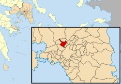 | |
| Coordinates: 38°2′N 23°42′E / 38.033°N 23.700°ECoordinates: 38°2′N 23°42′E / 38.033°N 23.700°E | |
| Country | Greece |
| Administrative region | Attica |
| Regional unit | West Athens |
| Government | |
| • Mayor | Nikos Zenetos |
| Area | |
| • Municipality | 9.453 km2 (3.650 sq mi) |
| Elevation | 150 m (490 ft) |
| Population (2011)[1] | |
| • Municipality | 84,793 |
| • Municipality density | 9,000/km2 (23,000/sq mi) |
| Time zone | EET (UTC+2) |
| • Summer (DST) | EEST (UTC+3) |
| Postal code | 131 xx, 133 xx |
| Area code(s) | 210 |
| Vehicle registration | IB |
| Website | www.ilion.gr |
Ilion (Greek: Ίλιον, before 1994: Νέα Λιόσια, Nea Liosia[2]) is a northern suburb of Athens, Greece. With 85,000 inhabitants (2011), it is one of the largest suburbs of Athens.
Geography
Ilion lies southeast of the mountain Aigaleo, 6 km (4 mi) northwest of Athens city centre. The municipality has an area of 9.453 km2.[3] Neighbouring municipalities are Agioi Anargyroi-Kamatero to the north and east, Petroupoli to the northwest and Peristeri to the south. The main streets are Fylis Avenue, Thivon Avenue, Idomeneos Street and Protesilaou Street.
Sites of interest
- National Sports Center of Nea Liosia
- Environmental Awareness Park "Antonis Tritsis"
Historical population
| Year | Population |
|---|---|
| 1951 | 5,460 |
| 1961 | 31,810 |
| 1971 | 56,127 |
| 1981 | 72,427 |
| 1991 | 78,326 |
| 2001 | 80,859 |
| 2011 | 84,793 |
Sports
Ilion hosts many athletic clubs in several sports.[4] The most of them play in the amateur divisions. Presence or earlier presence in the higher divisions in their sport have the clubs Olympiakos Neon Liosion and Enosi Iliou.
| Notable sport clubs based in Ilion | |||
|---|---|---|---|
| Club | Founded | Sports | Achievements |
| Olympiakos Neon Liosion | 1952 | Football | Earlier presence in Beta Ethniki |
| Enosi Iliou | 2002 | Basketball | Presence in Beta Ethniki, basketball |
International relations
Ilion, Greece is twinned with:
References
- ↑ "Απογραφή Πληθυσμού - Κατοικιών 2011. ΜΟΝΙΜΟΣ Πληθυσμός" (in Greek). Hellenic Statistical Authority.
- ↑ Ilion municipality website
- ↑ "Population & housing census 2001 (incl. area and average elevation)" (PDF) (in Greek). National Statistical Service of Greece.
- ↑ "Αθλητικοί Σύλλογοι". ilion.gr. Retrieved 18 September 2015.
External links
- September 1999 earthquake in Nea Liosia
- (Greek) Municipality of Ilion
- (Greek) From Nea Liosia to Ilion
 |
Ano Liosia | Kamatero | | |
| Petroupoli | |
Agioi Anargyroi | ||
| ||||
| | ||||
| Peristeri | Peristeri |
Administrative division of the Attica Region | ||
|---|---|---|
| Regional unit of Central Athens | 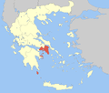 | |
| Regional unit of North Athens | ||
| Regional unit of West Athens | ||
| Regional unit of South Athens | ||
| Regional unit of Piraeus | ||
| Regional unit of East Attica | ||
| Regional unit of West Attica | ||
| Regional unit of Islands | ||
| ||