Interstate 20
| |
|---|---|
 | |
| Route information | |
| Length: | 1,539.38 mi[1] (2,477.39 km) |
| Existed: | 1957 – present |
| Major junctions | |
| West end: |
|
| |
| East end: |
|
| Location | |
| States: | Texas, Louisiana, Mississippi, Alabama, Georgia, South Carolina |
| Highway system | |
Interstate 20 (I‑20) is a major east–west Interstate Highway in the Southern United States. I‑20 runs 1,535 miles (2,470 km) beginning near Kent, Texas, at I-10 to Florence, South Carolina, at I-95.[2] Between Texas and South Carolina, I‑20 runs through northern Louisiana, central Mississippi, western and north-central Alabama, and north-central Georgia. I‑20 intersects seven of the ten primary north–south Interstates (all except I‑5, I‑15, and I‑25) and also the east-west Interstates 10 and 30.
From its terminus at I‑95, the highway continues about 2 miles (3.2 km) eastward into the city of Florence as Business Spur 20.
Route description
| mi[1] | km | |
|---|---|---|
| TX | 636.08 | 1023.67 |
| LA | 189.87 | 305.57 |
| MS | 154.61 | 248.82 |
| AL | 214.7 | 345.5 |
| GA | 202.61 | 326.07 |
| SC | 141.51 | 227.74 |
| Total | 1539.4 | 2477.4 |
Texas
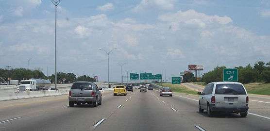
I-20 begins 10 miles (16 km) east of Kent at a fork with I-10. From there, the highway travels east-northeastward through Odessa, Midland, and Abilene before turning eastward towards Dallas/Fort Worth. The La Entrada al Pacifico corridor runs along I-20 between U.S. Route 385 (US 385) and Farm to Market Road 1788 (FM 1788). Between Monahans and I-10, I-20 has an 80 miles per hour (130 km/h) speed limit.
From the highway's opening in the 1960s through 1971, I-20 originally went through the heart of the Metroplex via the Dallas-Fort Worth Turnpike. This old route is now signed I-30 (Dallas-Fort Worth Turnpike), US 80 (former stretch between I-635 and Terrell) and Texas Spur 557 (bypass around Terrell).
In 1987, I-20 was rerouted to go through the southern sections of Fort Worth, Arlington, Grand Prairie, Dallas, and Mesquite before rejoining its original route at Terrell. Part of I-20 in Dallas is named the Lyndon B. Johnson Freeway and used to be signed as I-635.
I-20 continues eastward from Terrell, bypassing Tyler, Marshall, and Longview, before crossing the Louisiana border near Waskom.
Louisiana
In Louisiana, I-20 roughly parallels U.S. Route 80 through the northern part of the state.
Entering the state from near Waskom, Texas, the highway immediately enters the Shreveport-Bossier City metropolitan area, intersecting I-49 near downtown Shreveport and passing close to Barksdale Air Force Base in Bossier City.
From that area, the highway traverses mainly rural, hilly terrain, bypassing Minden, Ruston and Grambling before reaching Monroe.
From Monroe, I-20 enters flatter terrain as it approaches the Mississippi River. Before crossing the Mississippi, the highway passes Tallulah. At the Mississippi River, I-20 leaves Louisiana and enters Vicksburg, Mississippi.
Mississippi

Upon entering Mississippi by crossing the Mississippi River, I-20 immediately enters Vicksburg. Between Edwards and Clinton, the highway mostly follows the original two-lane routing of US 80. In Jackson, I-20 sees a short concurrency with both I-55 and US 49. Also in Jackson is an unusually expansive stack interchange, at the junction of I-20, I-55 North and US 49 South. The interchange replaces a former directional interchange at I-55 North and a cloverleaf at Highway 49. From the Stack, I-20 continues eastward to Meridian, where it begins the nearly 160-mile (260 km) overlap with I-59.
The route of the Mississippi section of I-20 is defined in Mississippi Code § 65-3-3.
Alabama
I-20 (along with I-59) crosses the Alabama state line near York, and it stays conjoined as it passes through western Alabama and Tuscaloosa. At Birmingham, the two highways pass through downtown together before splitting at Exit 130 just east of the Birmingham airport. I-20 continues eastward through Oxford/Anniston, Alabama, and the Talladega National Forest, passing by the Talladega Superspeedway in the process, which is visible from the highway.
Also in Birmingham, the intersection of I-20 / I-59 and I-65 is known as a Malfunction Junction because of the interchange's somewhat-confusing design, and the number of traffic accidents that occur there.
Georgia
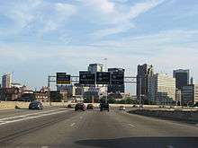
I-20 enters Georgia near Tallapoosa and after passing through western Georgia, it enters the Atlanta metropolitan area. On clear days, eastbound motorists get their first view of downtown Atlanta as they come over the top of the Six Flags Hill. The Six Flags Over Georgia amusement park is easily visible off exit 46 eastbound. The highway then passes through the center of Atlanta, meeting with I-75 and I-85, which share a common expressway (the "Downtown Connector"). It continues through Metropolitan Atlanta eastward and through the eastern half of Georgia until it exits the state, crossing the Savannah River at Augusta.
Throughout the state, I-20 is conjoined with unsigned State Route 402 (SR 402). Also, I-20 from the Alabama state line to I-285 in Atlanta is named the "Tom Murphy Freeway", but it is called the "Ralph David Abernathy Freeway" within I-285. The Interstate Highway is also named the Purple Heart Highway from I-285 in DeKalb County to US 441 in Madison, Georgia, and it is called the Carl Sanders Highway from US 441 to the South Carolina state line.
South Carolina
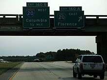
Upon leaving Augusta, I-20 crosses the Savannah River and enters the Palmetto State and heads northeastward, bypassing Aiken and Lexington before reaching the state capital of Columbia, which can be reached most directly by taking I-26 east at Exit 64 ("Malfunction Junction"), then, almost immediately, I-126 / US 76.
At Columbia, I-20 bypasses the city to the north and again turns northeastward, bypassing Fort Jackson and Camden. After crossing the Wateree River, it turns due east, passes by tiny Bishopville, before reaching the Florence area. It is near Florence where I-20 sees its eastern terminus at Interstate 95. However, for about two miles (3 km), the highway continues into Florence as Business Spur 20.
I-20 in the Palmetto State is known as either the J. Strom Thurmond Freeway or John C. West Freeway. The first section to be completed was the bridge over the Savannah River in 1965; the last, the section between US 401 and I-95 (including the business spur), opened in August 1975.
History
Exit numbers of I-20 were changed in Georgia in 2000.[3]
Future
 |
 |
In 2003, the North Carolina Department of Transportation proposed extending I-20 eastward from Florence to Wilmington at the behest of North Carolina Governor Mike Easley and his 'Strategic Transportation Plan' for the southeast portion of the state.[4][5] The proposed route would follow US 76 east from Florence to Whiteville, North Carolina, then parallel US 74 / US 76 into Wilmington.[6] Part of this route is already designated the future eastern extension of I-74. As part of the 2005 SAFETEA-LU transportation legislation, North Carolina received $5 million for a feasibility study for this extension.[4] While this extension has considerable support among towns in southeastern North Carolina, the South Carolina DOT has stated that they have no interest in upgrading their portion of US 76 to an interstate. Instead, South Carolina is concentrating their efforts on plans to build I-73 that will terminate near Myrtle Beach. This proposed extension has not been approved by the Federal Highway Administration or the AASHTO, so any construction remains far in the future, but NCDOT maintains the routing in its Strategic Highway Corridors maps.[7]
Junction list
- Texas
-
 I‑10 east-northeast of Kent
 -
 US 285 in Pecos
 -
 US 385 in Odessa
 -
 US 87 in Big Spring
 -
 US 84 east of Roscoe. The highways travel concurrently to the Tye–Abilene city line.
 -

 US 83 / US 277 in Abilene
 -
 US 283 in Baird
 -
 US 183 in Cisco
 -
 US 281 south-southeast of Brazos
 -
 US 180 in Hudson Oaks
 -
 I‑30 northeast of Aledo
 -
 I‑820 in Fort Worth
 -
 US 377 in Benbrook
 -
 I‑35W in Fort Worth
 -
 I‑820 / US 287 in Fort Worth. I-20/US 287 travels concurrently to Arlington.
 -
 US 67 in Dallas
 -
 I‑35E on the Dallas–Lancaster city line
 -
 I‑45 on the Dallas–Hutchins city line
 -
 US 175 on the Dallas–Balch Springs city line
 -
 I‑635 in Balch Springs
 -
 US 69 in Lindale
 -
 US 271 south-southeast of Winona
 -
 US 259 northeast of Kilgore. The highways travel concurrently to Longview.
 -
.svg.png)
 Future I‑369 / US 59 in Marshall
 -
 US 80 west-southwest of Jonesville. The highways travel concurrently to west of Waskom.
 - Louisiana
-
 US 79 / US 80 in Greenwood
 - US 80 in Shreveport
-
 I‑220 in Shreveport
 -
 US 171 in Shreveport
 - US 79 / US 80 in Shreveport
-
 I‑49 in Shreveport
 -
 US 71 in Shreveport. The highways travel concurrently to Bossier City.
 - I‑220 in Bossier City
-
 US 371 in Dixie Inn. The highways travel concurrently to Minden.
 - US 80 southeast of Minden
-

 US 63 / US 167 in Ruston
 - US 80 east-northeast of Calhoun
-
 US 165 in Monroe
 -
 US 425 in Rayville
 -
 US 65 in Tallulah
 - US 80 in Delta. The highways travel concurrently to Clinton, Mississippi.
- Mississippi
-
 US 61 in Vicksburg. The highways travel concurrently through Vicksburg.
 -
 I‑220 / US 49 in Jackson. I-20/US 49 travels concurrently to Pearl.
 -

 I‑55 / US 51 in Jackson. I-20/I-55 travels concurrently to Richland
 - US 80 in Brandon
- US 80 in Brandon
- US 80 east-southeast of Lake
- US 80 west-southwest of Meridian. The highways travel concurrently to Meridian.
-
 I‑59 in Meridian. The highways travel concurrently to Birmingham.
 -
 US 11 in Meridian. The highways travel concurrenty through Meridian.
 -
 US 45 in Meridian
 - US 11 / US 80 west-northwest of Kewanee
- Alabama
-
 US 11 / US 43 south of Knoxville
 -
 I‑359 / US 11 in Tuscaloosa
 -
 US 82 in Tuscaloosa
 - US 11 in Tuscaloosa
- US 11 in Tuscaloosa
- US 11 south of Lake View. The highways travel concurrently to Bessemer.
-
 I‑459 southwest of McCalla
 -
 US 78 in Birmingham
 -
 I‑65 in Birmingham
 -

 US 31 / US 280 in Birmingham
 - US 11 in Birmingham
- I‑459 in Irondale
- US 78 in Leeds
-
 US 411 on the Leeds–Moody line
 - US 78 northwest of Cooks Springs. The highways travel concurrently to Pell City.
-
 US 231 in Pell City
 - US 78 in Riverside
-
 US 431 east of Oxford
 - Georgia
-
 US 27 in Bremen
 -
 I‑285 in Atlanta
 -
 I‑75 / I‑85 in Atlanta
 -


 US 23 / US 19 / US 29 / US 41 in Atlanta
 - I‑285 on the Panthersville–Candler-McAfee CDP line
-
 US 278 southeast of Lithonia. The highways travel concurrently to Covington.
 - US 278 in Social Circle
-

 US 129 / US 441 in Madison
 - US 278 in Barnett
-
 US 221 south of Appling
 -
 I‑520 in Augusta
 - South Carolina
-
 US 25 in North Augusta
 - I‑520 in North Augusta
-
 US 1 north-northeast of Aiken
 -
 US 178 southeast of Batesburg-Leesville
 - US 1 east of Lexington
-
 US 378 north of Oak Grove
 -

 I‑26 / US 76 on the Seven Oaks–St. Andrews CDP line
 -
 US 176 in St. Andrews
 -
 US 321 north of Columbia
 -
 US 21 in Columbia
 - US 1 in Dentsville
-
 I‑77 on the Dentsville–Woodfield CDP line
 -
 US 601 in Lugoff
 -
 US 521 in Camden
 -
 US 15 southwest of Bishopville
 -
 US 401 northeast of Lamar
 -
 I‑95 in Florence
Auxiliary routes
Two I-420s were planned, but never completed or built. One was to be a bypass around Monroe, Louisiana, but was never built. The other I-420 was planned as a bypass to the south of downtown Atlanta. Due to anti-freeway sentiments, this I-420 was never completed, and the already-built portion has been signed as GA 154 / GA 166, named Langford Parkway (formerly the Lakewood Freeway).
- Shreveport, Louisiana - I-220
- Jackson, Mississippi - I-220
- Augusta, Georgia - I-520
- Fort Worth, Texas - I-820
1Cancelled | ||
See also
 U.S. Roads portal
References
- 1 2 "Route Log and Finder List — Interstate System: Table 1". FHWA. Retrieved 2007-09-26.
- ↑ Google (2008-02-15). "overview map of I‑20" (Map). Google Maps. Google. Retrieved 2008-02-15.
- ↑ "Interstate exit signs to get new numbers in Georgia". Jacksonville. Retrieved 17 January 2015.
- 1 2 Robert Malme. "Interstate 20 in North Carolina?". I-73/I-74 in North Carolina. Retrieved 2009-07-07.
- ↑ "Strategic Highway Corridors". NCDOT. Retrieved 2009-07-07.
- ↑ "Strategic Highway Corridors Vision Plan" (PDF). Strategic Highway Corridors. NCDOT. 2008-07-10. Retrieved 2009-07-07.
- ↑ "Strategic Highway Corridors Vision Plan, Southeastern NC" (PDF). Strategic Highway Corridors. NCDOT. 2004-09-02. Retrieved 2009-07-07.
- Georgia Department of Transportation, Office of Transportation Data (2003), Interstate Mileage Report (438 Report) (PDF), archived from the original (PDF) on February 18, 2006
External links
| Wikimedia Commons has media related to Interstate 20. |
| Signed | |||||||||||
|---|---|---|---|---|---|---|---|---|---|---|---|
| Unsigned | |||||||||||
| Lists |
| ||||||||||
Major Interstates highlighted | |||||||||||