Hutchesontown
| Hutchesontown | |
| Scottish Gaelic: Baile MacUisdein | |
| Scots: Hutchesontoun | |
 Hutchesontown |
|
| OS grid reference | NS594636 |
|---|---|
| Council area | Glasgow City Council |
| Lieutenancy area | Glasgow |
| Country | Scotland |
| Sovereign state | United Kingdom |
| Post town | GLASGOW |
| Postcode district | G5 |
| Dialling code | 0141 |
| Police | Scottish |
| Fire | Scottish |
| Ambulance | Scottish |
| EU Parliament | Scotland |
| UK Parliament | Glasgow Central |
| Scottish Parliament | Glasgow Shettleston |
Coordinates: 55°50′42″N 4°14′50″W / 55.845056°N 4.247110°W
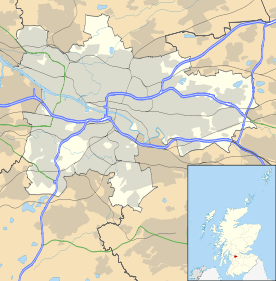
Hutchesontown is a district in the Scottish city of Glasgow. It is situated south of the River Clyde and forms part of the Gorbals.
In McNeill Street, Hutchesontown has one of Glasgow's original Carnegie libraries, deftly designed by the Inverness born architect James Robert Rhind. The area is linked to Glasgow Green public park on the north side of the river by St. Andrew's Suspension Bridge and King's Bridge.
Following the Second World War, Hutchesontown was declared a Comprehensive Development Area (CDA) in the aftermath of the Bruce Report. This called for the mass gentrification of the area which took the form of slum clearance and the replacement of overcrowded, insanitary tenement housing with new homes in high rise tower blocks.
Hutchesontown was in effect used as a testing ground for similar schemes around the city. It was decided to divide the area into five "zones" which were given to different architects to implement a mixture of different schemes.
Area A – on the northern side of Hutchesontown, was devoted to conventional maisonette style housing.
Area B – Nowadays known as the Riverside estate, was given to architect Robert Matthew. His Waddell Court 16-storey blocks – built in 1964 - on the banks of the River Clyde still stand, and are widely regarded as the most successful of the Gorbals high-rises and have received numerous refurbishments in their lifetime.
Area C – was the responsibility of Basil Spence, and became the most infamous of the five schemes. The Queen Elizabeth Square blocks encountered numerous structural and social problems, and were demolished in 1993.
Area D – was developed by the newly created Scottish Special Housing Association and consisted of four 24 storey blocks (Caledonia Road) and an estate of smaller maisonettes and 8-storey "mini-multis". Two of the towers were demolished in 2006. The remaining two were refurbished. This sector is close to Oatlands and the Southern Necropolis cemetery.
Area E consisted of an estate of five storey deck-access blocks and two 24-storey towers (Sandiefield Road) constructed in 1968. Within a few years, however, the low-rise buildings became badly affected by dampness and condensation problems and were presently declared unfit for habitation. They were finally demolished in 1987. The two towers were condemned in 2010 and were blown-down on 21 July 2013 at around 2pm.
- James Stokes, recipient of the Victoria Cross, was from Hutchesontown