Huntington Woods, Michigan
| Huntington Woods, Michigan | |
|---|---|
| City | |
| City of Huntington Woods | |
| Nickname(s): The City of Homes | |
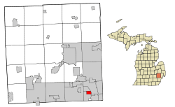 Location of Huntington Woods, Michigan | |
| Coordinates: 42°28′50″N 83°10′01″W / 42.48056°N 83.16694°WCoordinates: 42°28′50″N 83°10′01″W / 42.48056°N 83.16694°W | |
| Country | United States |
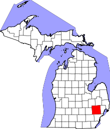
| State | Michigan |
| County | Oakland |
| Incorporated (village) | 1926 |
| Incorporated (city) | 1932 |
| Government | |
| • Type | Council-Manager |
| • Mayor | Bob Paul |
| • City Manager | Amy Sullivan |
| Area[1] | |
| • Total | 1.47 sq mi (3.81 km2) |
| • Land | 1.47 sq mi (3.81 km2) |
| • Water | 0 sq mi (0 km2) 0% |
| Elevation | 663 ft (202 m) |
| Population (2010)[2] | |
| • Total | 6,238 |
| • Estimate (2012[3]) | 6,288 |
| • Density | 4,243.5/sq mi (1,638.4/km2) |
| Time zone | EST (UTC-5) |
| • Summer (DST) | EDT (UTC-4) |
| ZIP code | 48070 |
| Area code(s) | 248 |
| FIPS code | 26-40000[4] |
| GNIS feature ID | 0628842[5] |
| Website | City of Huntington Woods |
Huntington Woods is a suburb of Detroit, located in southeastern Oakland County, Michigan. The population was 6,238 at the 2010 census.[6] Huntington Woods is situated along the Woodward Corridor and is bounded by Ten and Eleven Mile Roads to the north and south, and by Woodward Avenue and Coolidge Highway to the east and west. The city is widely known as the "City of Homes", as it consists mostly of residences.[7] Rackham Golf Course is located along the southern end of the city. The western portion of the Detroit Zoo is located within the city limits and is a contributor to its tax base. In 2013, Huntington Woods was ranked the #10 best suburb to live in by Market Watch.[8]
Geography
According to the United States Census Bureau, the city has a total area of 1.47 square miles (3.81 km2), all land.[1] Rackham Golf Course, owned by the city of Detroit, makes up 20% (0.3 square miles) of the total area of the city.[9]
Demographics
| Historical population | |||
|---|---|---|---|
| Census | Pop. | %± | |
| 1930 | 655 | — | |
| 1940 | 1,705 | 160.3% | |
| 1950 | 4,949 | 190.3% | |
| 1960 | 8,746 | 76.7% | |
| 1970 | 8,536 | −2.4% | |
| 1980 | 6,937 | −18.7% | |
| 1990 | 6,419 | −7.5% | |
| 2000 | 6,151 | −4.2% | |
| 2010 | 6,238 | 1.4% | |
| Est. 2015 | 6,340 | [10] | 1.6% |
2010 census
As of the census[2] of 2010, there were 6,238 people, 2,354 households, and 1,784 families residing in the city. The population density was 4,243.5 inhabitants per square mile (1,638.4/km2). There were 2,429 housing units at an average density of 1,652.4 per square mile (638.0/km2). The racial makeup of the city was 96.0% White, 1.0% African American, 0.2% Native American, 1.3% Asian, 0.5% from other races, and 1.1% from two or more races. Hispanic or Latino of any race were 1.6% of the population.
There were 2,354 households of which 38.0% had children under the age of 18 living with them, 66.9% were married couples living together, 6.4% had a female householder with no husband present, 2.5% had a male householder with no wife present, and 24.2% were non-families. 19.8% of all households were made up of individuals and 9.1% had someone living alone who was 65 years of age or older. The average household size was 2.65 and the average family size was 3.08.
The median age in the city was 42 years. 27.4% of residents were under the age of 18; 3.8% were between the ages of 18 and 24; 23.6% were from 25 to 44; 31.6% were from 45 to 64; and 13.6% were 65 years of age or older. The gender makeup of the city was 49.2% male and 50.8% female.
2000 census
As of the census[4] of 2000, there were 6,151 people, 2,381 households, and 1,802 families residing in the city. The population density was 4,196.0 people per square mile (1,615.6/km²). There were 2,416 housing units at an average density of 1,648.1 per square mile (634.6/km²). The racial makeup of the city was 96.96% White, 0.68% African American, 0.05% Native American, 1.41% Asian, 0.26% from other races, and 0.63% from two or more races. Hispanic or Latino of any race were 0.88% of the population.
There were 2,381 households out of which 37.6% had children under the age of 18 living with them, 67.2% were married couples living together, 7.0% had a female householder with no husband present, and 24.3% were non-families. 19.5% of all households were made up of individuals and 7.8% had someone living alone who was 65 years of age or older. The average household size was 2.58 and the average family size was 3.01.
In the city the population was spread out with 26.6% under the age of 18, 3.3% from 18 to 24, 27.8% from 25 to 44, 29.7% from 45 to 64, and 12.7% who were 65 years of age or older. The median age was 41 years. For every 100 females there were 95.3 males. For every 100 females age 18 and over, there were 91.0 males.
The median income for a household in the city was $87,086, and the median income for a family was $97,055. Males had a median income of $73,750 versus $43,565 for females. The per capita income for the city was $45,264. About 1.8% of families and 2.6% of the population were below the poverty line, including 3.2% of those under age 18 and 2.3% of those age 65 or over.
Education
All residents live within Berkley School District boundaries.
A portion of land in the city is zoned to Ferndale Public Schools.[12]
Many residents also attend local private schools, such as University of Detroit Jesuit High School, Detroit Country Day School, Shrine Catholic High School, The Roeper School, Akiva Hebrew Day School, and Cranbrook-Kingswood School.
Notable people
- Kristen Bell, actress[13]
- Rachel Jacobs, social entrepreneur
- Jef Mallett, Draws the syndicated comic strip Frazz, current resident
- Ellen Sandweiss, actress
- Ron Gillham, former mayor, held the position 34 years before retiring in November 2015. He served the City of Huntington Woods continuously from 1975 to 2015.
See also
References
- 1 2 "US Gazetteer files 2010". United States Census Bureau. Archived from the original on January 24, 2012. Retrieved 2012-11-25.
- 1 2 "American FactFinder". United States Census Bureau. Retrieved 2012-11-25.
- ↑ "Population Estimates". United States Census Bureau. Archived from the original on June 17, 2013. Retrieved 2013-06-03.
- 1 2 "American FactFinder". United States Census Bureau. Archived from the original on September 11, 2013. Retrieved 2008-01-31.
- ↑ U.S. Geological Survey Geographic Names Information System: Huntington Woods, Michigan
- ↑ "Race, Hispanic or Latino, Age, and Housing Occupancy: 2010 Census Redistricting Data (Public Law 94-171) Summary File (QT-PL), Huntington Woods city, Michigan". U.S. Census Bureau, American FactFinder 2. Archived from the original on September 11, 2013. Retrieved August 19, 2011.
- ↑ Ballard, C. Ray (1993). The history of Huntington Woods: The city of homes. Huntington Woods Study Club.
- ↑ "The 10 best U.S. suburbs to live in". Market Watch. Retrieved 2016-06-17.
- ↑ Detroit updates Huntington Woods on Rackham status, Micki Steele / The Detroit News, 19 January 2011
- ↑ "Annual Estimates of the Resident Population for Incorporated Places: April 1, 2010 to July 1, 2015". Retrieved July 2, 2016.
- ↑ "Census of Population and Housing". Census.gov. Archived from the original on May 11, 2015. Retrieved June 4, 2015.
- ↑ "SCHOOL DISTRICT REFERENCE MAP (2010 CENSUS): Oakland County, MI" (Archived 2015-06-29 at WebCite). U.S. Census Bureau. Retrieved on June 29, 2015.
- ↑ "Kristen Bell's yard gets a makeover." The Detroit News. March 24, 2007. Retrieved on October 28, 2009.
External links
- City of Huntington Woods official website
- City of Huntington Woods official map
- Huntington Woods zoning map
- Huntington Woods precinct Map
| Topics |  | |
|---|---|---|
| Detroit | ||
| Municipalities over 80,000 | ||
| Municipalities 40,000 to 80,000 | ||
| Cultural enclaves | ||
| Satellite cities | ||
| Counties in MSA | ||
| Counties in CSA | ||