Huntington, Vermont
| Huntington, Vermont | |
|---|---|
| Town | |
|
Huntington Library | |
 Location in Chittenden County and the state of Vermont. | |
 Huntington, Vermont Location in the United States | |
| Coordinates: 44°18′14″N 72°58′48″W / 44.30389°N 72.98000°WCoordinates: 44°18′14″N 72°58′48″W / 44.30389°N 72.98000°W | |
| Country | United States |
| State | Vermont |
| County | Chittenden |
| Area | |
| • Total | 38.0 sq mi (98.5 km2) |
| • Land | 38.0 sq mi (98.3 km2) |
| • Water | 0.1 sq mi (0.3 km2) |
| Elevation | 771 ft (235 m) |
| Population (2010) | |
| • Total | 1,938 |
| • Density | 51/sq mi (19.7/km2) |
| Time zone | Eastern (EST) (UTC-5) |
| • Summer (DST) | EDT (UTC-4) |
| ZIP code | 05462 |
| Area code(s) | 802 |
| FIPS code | 50-34600[1] |
| GNIS feature ID | 1462121[2] |
| Website |
huntingtonvt |


Huntington is a town in Chittenden County, Vermont, United States. The population was 1,938 at the 2010 census.[3]
History
The town was originally called "New Huntington", but the name was changed to "Huntington" in October of 1795.[4] It was named for landholders Josiah, Charles and Marmaduke Hunt.[5]
Geography
Huntington is in southeastern Chittenden County, bordered to the southwest by Addison County and to the east by Washington County. The town is located on the west side of the Green Mountains and is centered on the valley of the Huntington River, a north-flowing tributary of the Winooski River. The 4,083-foot (1,244 m) summit of Camel's Hump is in Huntington's northeast corner, on the town boundary with Duxbury.
According to the United States Census Bureau, the town of Huntington has a total area of 38.0 square miles (98.5 km2), of which 38.0 square miles (98.3 km2) is land and 0.1 square miles (0.3 km2), or 0.26%, is water.[3]
Demographics
As of the census[1] of 2000, there were 1,861 people, 692 households, and 512 families residing in the town. The population density was 48.8 people per square mile (18.8/km2). There were 744 housing units at an average density of 19.5 per square mile (7.5/km2). The racial makeup of the town was 97.47% White, 0.38% African American, 0.16% Native American, 0.48% Asian, 0.16% from other races, and 1.34% from two or more races. Hispanic or Latino of any race were 0.38% of the population.
There were 692 households out of which 40.0% had children under the age of 18 living with them, 65.0% were married couples living together, 5.9% had a female householder with no husband present, and 26.0% were non-families. 16.9% of all households were made up of individuals and 3.8% had someone living alone who was 65 years of age or older. The average household size was 2.68 and the average family size was 3.09.
In the town the population was spread out with 28.3% under the age of 18, 4.6% from 18 to 24, 37.0% from 25 to 44, 24.7% from 45 to 64, and 5.4% who were 65 years of age or older. The median age was 37 years. For every 100 females there were 98.6 males. For every 100 females age 18 and over, there were 99.4 males.
The median income for a household in the town was $49,559, and the median income for a family was $52,269. Males had a median income of $32,794 versus $26,420 for females. The per capita income for the town was $20,402. About 5.1% of families and 6.0% of the population were below the poverty line, including 7.9% of those under age 18 and 17.4% of those age 65 or over.
Climate
This climatic region is typified by large seasonal temperature differences, with warm to hot (and often humid) summers and cold (sometimes severely cold) winters. According to the Köppen Climate Classification system, Huntington has a humid continental climate, abbreviated "Dfb" on climate maps.[6]
References
- 1 2 "American FactFinder". United States Census Bureau. Archived from the original on September 11, 2013. Retrieved 2008-01-31.
- ↑ "US Board on Geographic Names". United States Geological Survey. 2007-10-25. Retrieved 2008-01-31.
- 1 2 "Geographic Identifiers: 2010 Census Summary File 1 (G001): Huntington town, Chittenden County, Vermont". U.S. Census Bureau, American Factfinder. Retrieved August 19, 2015.
- ↑ "History of Chittenden County, Vermont, with illustrations and biographical sketches of some of its prominent men and pioneers". p. 614.
- ↑ "Profile for Huntington, Vermont". ePodunk. Retrieved 2010-05-08.
- ↑ Climate Summary for Huntington, Vermont
External links
Municipalities and communities of Chittenden County, Vermont, United States | ||
|---|---|---|
| Cities | 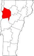 | |
| Towns | ||
| Villages | ||
| CDPs | ||
| Unincorporated communities | ||