Huisduinen
| Huisduinen | |
|---|---|
| Village | |
|
Huisduinen | |
 | |
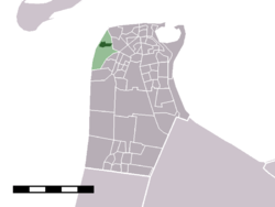 The village centre (darkgreen) and the statistical district (lightgreen) of Huisduinen in the municipality of Den Helder. | |
| Coordinates: 52°57′8″N 4°43′34″E / 52.95222°N 4.72611°ECoordinates: 52°57′8″N 4°43′34″E / 52.95222°N 4.72611°E | |
| Country | Netherlands |
| Province | Noord-Holland |
| Municipality | Den Helder |
| Elevation | 0 m (0 ft) |
| Population (2001) | |
| • Total | 513 |
| Time zone | CET (UTC+1) |
| • Summer (DST) | CEST (UTC+2) |

Huisduinen (Dutch pronunciation: [ˈɦœyzˌdœynə(n)]) is a village in the Dutch province of North Holland. It is a part of the municipality of Den Helder, and lies about 2 km west of Den Helder.
In 2001, the village of Huisduinen had 513 inhabitants. The built-up area of the village was 0.18 km², and contained 231 residences.[1] The statistical district "Huisduinen", which covers the village and the surrounding countryside, has a population of around 520.[2]
The fortress Kijkduin was built by Napoleon in Huisduinen. In Dutch, the Battle of Texel (1672) is named "Battle of Kijkduin" after this location.
References
- ↑ Statistics Netherlands (CBS), Bevolkingskernen in Nederland 2001, CBS.nl Statistics are for the continuous built-up area.
- ↑ Statistics Netherlands (CBS), Statline: Kerncijfers wijken en buurten 2003-2005 CBS.nl, as of 1 January 2005.
This article is issued from Wikipedia - version of the 2/27/2016. The text is available under the Creative Commons Attribution/Share Alike but additional terms may apply for the media files.