Hughes County, Oklahoma
| Hughes County, Oklahoma | |
|---|---|
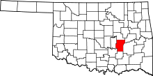 Location in the U.S. state of Oklahoma | |
 Oklahoma's location in the U.S. | |
| Founded | 1907 |
| Named for | W. C. Hughes |
| Seat | Holdenville |
| Largest city | Holdenville |
| Area | |
| • Total | 815 sq mi (2,111 km2) |
| • Land | 805 sq mi (2,085 km2) |
| • Water | 10 sq mi (26 km2), 1.3% |
| Population (est.) | |
| • (2013) | 13,823 |
| • Density | 17/sq mi (7/km²) |
| Congressional district | 2nd |
| Time zone | Central: UTC-6/-5 |
Hughes County is a county located in south central U.S. state of Oklahoma. As of the 2010 census, the population was 14,003.[1] Its county seat is Holdenville.[2] The county was named for W. C. Hughes, an Oklahoma City lawyer who was a member of the Oklahoma Constitutional Convention.[3]
History
The area now occupied by Hughes County was part of Indian Territory in the 19th Century. The Creeks settled in the northern part, while the Choctaws settled in the southern.[3] In 1834, Camp Holmes was established and used as a base for the Dodge-Leavenworth Expedition. It was near Edwards' Store on Little River, one of the first settlements in this area.
When the Choctaw, Oklahoma and Gulf Railroad built in 1895, the Edward's settlement was moved north for access to the railroad. The town established there was named Holden, for James Franklin Holder, a railroad official. However, the Post Office Department would not accept that name because it was too similar to the name Holder. The town was renamed Holdenville. The post office opened November 15, 1895. Holdenville incorporated in 1898.[3]
Hughes County was created at statehood and named for W. C. Hughes,[4] an Oklahoma City lawyer who was a member of the Oklahoma Constitutional Convention.[3]
Geography
According to the U.S. Census Bureau, the county has a total area of 815 square miles (2,110 km2), of which 805 square miles (2,080 km2) is land and 10 square miles (26 km2) (1.3%) is water.[5] The county is located in the Sandstone Hills physiographic region. It is drained by the North Canadian River, Canadian River, and Little River.[3]
The county includes Holdenville and Wetumka lakes.[6]
Major highways
Adjacent counties
- Okfuskee County (north)
- McIntosh County (northeast)
- Pittsburg County (east)
- Coal County (south)
- Pontotoc County (southwest)
- Seminole County (west)
Demographics
| Historical population | |||
|---|---|---|---|
| Census | Pop. | %± | |
| 1910 | 24,040 | — | |
| 1920 | 26,045 | 8.3% | |
| 1930 | 30,334 | 16.5% | |
| 1940 | 29,189 | −3.8% | |
| 1950 | 20,664 | −29.2% | |
| 1960 | 15,144 | −26.7% | |
| 1970 | 13,228 | −12.7% | |
| 1980 | 14,338 | 8.4% | |
| 1990 | 13,023 | −9.2% | |
| 2000 | 14,154 | 8.7% | |
| 2010 | 14,003 | −1.1% | |
| Est. 2015 | 13,735 | [7] | −1.9% |
| U.S. Decennial Census[8] 1790-1960[9] 1900-1990[10] 1990-2000[11] 2010-2013[1] | |||

As of the census[12] of 2000, there were 14,154 people, 5,319 households, and 3,675 families residing in the county. The population density was 18 people per square mile (7/km²). There were 6,237 housing units at an average density of 8 per square mile (3/km²). The racial makeup of the county was 72.77% White, 4.48% Black or African American, 16.18% Native American, 0.21% Asian, 0.02% Pacific Islander, 0.98% from other races, and 5.36% from two or more races. 2.49% of the population were Hispanic or Latino of any race. 94.3% spoke English, 2.6% Muskogee and 2.5% Spanish as their first language.
There were 5,319 households out of which 28.80% had children under the age of 18 living with them, 53.50% were married couples living together, 11.30% had a female householder with no husband present, and 30.90% were non-families. 28.60% of all households were made up of individuals and 16.00% had someone living alone who was 65 years of age or older. The average household size was 2.42 and the average family size was 2.96.
In the county, the population was spread out with 23.20% under the age of 18, 8.00% from 18 to 24, 27.20% from 25 to 44, 23.20% from 45 to 64, and 18.60% who were 65 years of age or older. The median age was 39 years. For every 100 females there were 105.80 males. For every 100 females age 18 and over, there were 105.50 males.
The median income for a household in the county was $22,621, and the median income for a family was $29,153. Males had a median income of $22,337 versus $18,029 for females. The per capita income for the county was $12,687. About 16.70% of families and 21.90% of the population were below the poverty line, including 27.40% of those under age 18 and 17.60% of those age 65 or over.
Politics
| Voter Registration and Party Enrollment as of January 15, 2016[13] | |||||
|---|---|---|---|---|---|
| Party | Number of Voters | Percentage | |||
| Democratic | 4,334 | 68.19% | |||
| Republican | 1,411 | 22.20% | |||
| Unaffiliated | 611 | 9.61% | |||
| Total | 6,356 | 100% | |||
| Year | Republican | Democrat |
|---|---|---|
| 2012 | 67.44% 2,838 | 32.56% 1,370 |
| 2008 | 64.71% 3,134 | 35.29% 1,709 |
| 2004 | 57.32% 3,066 | 42.68% 2,283 |
| 2000 | 47.90% 2,196 | 50.91% 2,334 |
Economy
Agriculture and cattle raising have long been important to the county economy. Primary crops have been cotton, wheat, corn, oats, peanuts, and soybeans. The most important other employers in the county are:Davis Correctional Center(which is operated by Corrections Corporation of America, Tyson Foods, Wes Watkins Technology Center, and Aquafarms(which has since gone out of business.[3]
Healthcare
Hughes County has one level 4 hospital, Holdenville General Hospital, a city-owned hospital (public trust) under the Holdenville Public Works Authority, opened in 1969 as a 55 licensed bed general medical-surgical hospital. The hospital experienced a fire on May 18, 2002. On June 30, 2002, the renovated hospital reopened with 25 licensed beds, and on July 1, 2002, was re-designated by CMS as a Critical Access Hospital. This designation effects the way Medicare reimburses the hospital. In 1998, the city formed the Holdenville Hospital Authority. In July 2011, the hospital became a Tier 1 Affiliate with St. Anthony Hospital. This allows collaboration between the hospitals to improve services and support for patient transfers to higher levels of care when needed.[15]
In 1979 Hughes County Commissioners established a 522 Ambulance Service Board, and Opened Hughes County EMS. Hughes County EMS is an ALS level service licensed by the State of Oklahoma, with Paramedics on every unit. The system operates 4 units, 2 out of Holdenville (EMS 1 and EMS 3) and Horntown (EMS 2 and EMS 4) during certain times of the year, Horntown functions as a posting point with the crews in Calvin and Wetumka.[3]
Communities
NRHP sites
The following sites are in Hughes County are listed on the National Register of Historic Places:
- Dustin Agricultural Building, Dustin
- Holdenville Armory, Holdenville
- Holdenville City Hall, Holdenville
- Levering Mission, Wetumka
- Moss School Gymnasium, Holdenville
- Spaulding School Gymnasium--Auditorium, Spaulding
- Stuart Hotel, Stuart
- John E. Turner House, Holdenville
- Wetumka Armory, Wetumka
- Wetumka Cemetery Pavilion and Fence, Wetumka
References
- 1 2 "State & County QuickFacts". United States Census Bureau. Retrieved February 21, 2015.
- ↑ "Find a County". National Association of Counties. Retrieved 2011-06-07.
- 1 2 3 4 5 6 7 James C. Milligan, "Hughes County." Encyclopedia of Oklahoma History and Culture. Retrieved January 18, 2013.
- ↑ "Origin of County Names in Oklahoma". Chronicles of Oklahoma. Oklahoma Historical Society. March 1924. pp. 75–82. Retrieved May 22, 2013.
- ↑ "2010 Census Gazetteer Files". United States Census Bureau. August 22, 2012. Retrieved February 21, 2015.
- ↑ "Hughes". Oklahoma Encyclopedia Online (PDF). Oklahoma Department of Libraries. 2005. Retrieved May 22, 2013.
- ↑ "County Totals Dataset: Population, Population Change and Estimated Components of Population Change: April 1, 2010 to July 1, 2015". Retrieved July 2, 2016.
- ↑ "U.S. Decennial Census". United States Census Bureau. Retrieved February 21, 2015.
- ↑ "Historical Census Browser". University of Virginia Library. Retrieved February 21, 2015.
- ↑ Forstall, Richard L., ed. (March 27, 1995). "Population of Counties by Decennial Census: 1900 to 1990". United States Census Bureau. Retrieved February 21, 2015.
- ↑ "Census 2000 PHC-T-4. Ranking Tables for Counties: 1990 and 2000" (PDF). United States Census Bureau. April 2, 2001. Retrieved February 21, 2015.
- ↑ "American FactFinder". United States Census Bureau. Retrieved 2008-01-31.
- ↑ https://www.ok.gov/elections/documents/20160115%20-%20Registration%20By%20County%20%28vr2420%29.pdf
- ↑ "Dave Leip's Atlas of U.S. Presidential Elections". Retrieved 2016-03-12.
- ↑ http://holdenvillehospital.com/
Further reading
- Womack, Craig, Rosemary McCombs Maxey, and Southern Spaces staff. "Fife Family Cemetery", Southern Spaces, September 15, 2008.
External links
- Encyclopedia of Oklahoma History and Culture - Hughes County
- Oklahoma Digital Maps: Digital Collections of Oklahoma and Indian Territory
Coordinates: 35°02′N 96°16′W / 35.04°N 96.26°W
 |
Okfuskee County | McIntosh County | | |
| Seminole County | |
Pittsburg County | ||
| ||||
| | ||||
| Pontotoc County | Coal County |
Municipalities and communities of Hughes County, Oklahoma, United States | ||
|---|---|---|
| Cities | | |
| Towns | ||
| Unincorporated communities |
| |
| Footnotes | ‡This populated place also has portions in an adjacent county or counties | |