Hueyapan

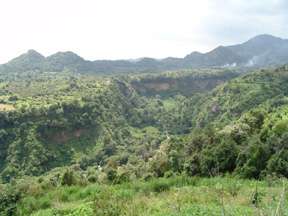
Santo Domingo Hueyapan is a small town in the rural northeastern part of the Mexican state of Morelos, in the municipality of Tetela del Volcán. It lies at an elevation of ca 2000–2500 metres above sea level on the southern slopes of the active volcano Popocatépetl. To the west of Hueyapan runs the Amatzinac river, to the north is the Popocatépetl-Iztaccíhuatl natural reserve, and to the south the town of Tlacotepec and to the east is the municipality of Tochimilco which belongs to the state of Puebla. located in the midlands.
Ethnography
The inhabitants of Hueyapan are of Nahua ethnicity and the Nahuatl language is spoken by most adults. The name of the town comes from the Nahuatl language and means "on the great water" referring to the abundant water resources of the locality. The people of Hueyapan mostly practice subsistence agriculture: They produce maize, beans, squash, peach, avocado and plums. The people of Hueyapan are also known for their woolen products such as ponchos (gabán in the local Spanish), shawls (rebozo) and skirts (chincuete) of thick woolen cloth. The thread is made on traditional spindles called malacates, dyed with natural dyes (such as Añil, Walnut husks, St John’s wort)and the fabric is woven on backstrap looms. Cultural aspects of Hueyapan and particularly the ethnic identity of the Nahuas of Hueyapan have been described in the book Being Indian in Hueyapan by American anthropologist Judith Friedlander. The Nahuatl dialect of Hueyapan has been the object of a few small studies. Karen Dakin and Diana Ryesky have done an ethnolinguistic and dialectal survey of Nahuatl in Morelos, and they describe the dialect of Hueyapan as a typical central dialect with some traits particular of the Morelos varieties. In 1949 Miguel Barrios Espinosa, a teacher from Hueyapan, published a collection of folktales from Hueyapan in the nahuatl language in the journal Tlalocan. An article by Patrick Johansson (1989) deals with the grammatical encoding of honorifics in the Nahuatl language. Currently SIL linguists are working on Morelos Nahuatl, collaborating with speakers from Hueyapan and from Cuentepec.
History
According to Durán, Hueyapan was founded by people from Xochimilco around 902 CE, conquered by the Aztecs under Moctezuma II and shortly thereafter conquered by a Spanish force led by female Conquistador María Estrada in 1524.
Between 1563 and 1573 the Dominican order constructed a convent dedicated to Santo Domingo in Hueyapan. The Convent is now an ex-convent functioning as the town's Catholic church. Fray Diego Durán stayed here for a while and is thought to have compiled much of the information for his Crónica here.
In colonial times Hueyapan was part of the encomienda originally given to the Estrada family, but was later laid directly under the Spanish throne. Until recently, access to Hueyapan from other communities was limited, but in the past twenty years infrastructure has made transport to and from Hueyapan much easier.
In the 1970s and 1980s marijuana was produced in and around Hueyapan and the town received negative attention from the Mexican media. Government forces occupied the town for brief periods and arrested many citizens both rightfully and wrongfully.
The 2000 general election, in which Mario Soberanes (of the Nueva Alianza party) was elected president of the Municipality of Tetela del Volcán, was the first time a citizen of Hueyapan had been elected to this position, and was also the first time a local president came from a party other than the PRI. In 2012 Javier Montes became the second municipal president of Tetela del Volcan from the community of Hueyapan.
Monastery
The monastery of Santo Domingo de Guzman It is one of the monasteries closest to the volcano. It was founded by the Dominicans but its cloister was built of adobe and wood with a tile roof instead of stone. It disintegrated relatively quickly due to the elements and was abandoned.[1] It remains mostly closed to this day. Only the atrium area is open to visitors and this closes by 1pm each day. The austere facade of the main church survives and it has a notable Barorque niche.[2]
Notable Inhabitants
- Diego Durán, Chronicler and vicar of Hueyapan in the late 16th century
- Modesta Lavana, indigenous healer and artisan
- Miguel Barrios Espinoza, educator and Nahuatl language activist
- Mario Soberanes and Javier Montes municipal presidents of Tetela del Volcan from 2006-2009, and 2012-2015 respectively.
References
- ↑ Heidy Torres (April 3, 2004). "La Ruta de los Volcanes: Vigilan conventos el sueno del Popo" [The Route of the Volcanos: Monasteries watch the sleep of Popocatepetl]. Reforma (in Spanish). Mexico City. p. 16.
- ↑ "Los monasterios en las laderas del Popocatépetl" [The monasteries on the sides of Popocatepel] (in Spanish). Catholic.net Inc. 2010. Retrieved August 30, 2010.
- Friedlander, Judith. 1975. Being Indian in Hueyapan: A Study of Forced Identity in Contemporary Mexico. New York: Saint Martin's Press.
- The History of the Indies of New Spain by Diego Durán, translated, annoted and with introduction by Doris Heyden
- Mexican government information on the municipality of Tetela del Volcán and the communities in it
- Barrios E., M. 1949. Textos de Hueyapan, Morelos. Tlalocan 3:53-75.
- Johansson, Patrick, Johansson, Patrick. 1989. El sistema de expresion reverencial en Hueyapan, Morelos. Tlalocan XI. 149-162
- Dakin, Karen and Ryesky, Diana. 1990. Morelos Nahuatl Dialects: Hypotheses on their historical divisions. Morelos en una economia global. Proceedings of the Congress in Cocoyoc, Morelos, November 19023, 1989. Submitted in January 1990
External links
- Pictures of Weaving designs from Hueyapan Morelos
- Pictures of Localities in Hueyapan, Morelos
- Pictures of a female Artesan of Hueyapan in traditional dress
- Mexican Governmental site about the municipality of Tetela del Volcán
Coordinates: 18°53′08″N 98°41′25″W / 18.88556°N 98.69028°W