Huancavelica Region
| Huancavelica Region | ||
|---|---|---|
| Region | ||
|
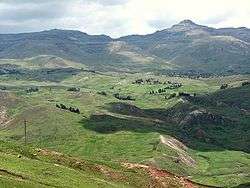
Landscape near the town Huancavelica | ||
| ||
.svg.png) Location of the Huancavelica Region in Peru | ||
| Coordinates: 13°01′S 75°05′W / 13.02°S 75.09°WCoordinates: 13°01′S 75°05′W / 13.02°S 75.09°W | ||
| Country | Peru | |
| Subdivisions | 7 provinces and 94 districts | |
| Capital | Huancavelica | |
| Government | ||
| • President | Federico Salas Guevara Schultz | |
| Area | ||
| • Total | 22,131.47 km2 (8,545.01 sq mi) | |
| Population (the 2007 census) | ||
| • Total | 454,797 | |
| • Density | 21/km2 (53/sq mi) | |
| UBIGEO | 09 | |
| ISO 3166 code | PE-HUV | |
| Website |
www | |
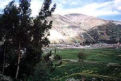
Huancavelica is a region in Peru with an area of 22,131.47 km² and a population of 454,797 (2007 census). The capital is the city Huancavelica. The region is bordered by Lima Region and Ica in the west, Junín in the north, and Ayacucho in the east.
Political division
The region is divided into seven provinces.
Province (Capital)
- Acobamba Province (Acobamba)
- Angaraes Province (Lircay)
- Castrovirreyna Province (Castrovirreyna)
- Churcampa Province (Churcampa)
- Huancavelica Province (Huancavelica)
- Huaytará Province (Huaytará)
- Tayacaja Province (Pampas)
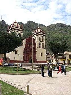
The main cities are Huancavelica, Pampas and Lircay. There are many little districts like Querco in Huancavelica. Querco is a nice little town. Most of the residents are agricultors. They own cattle, sheep, pigs, horses, mules, llamas, goats, chickens, and donkeys.
The People
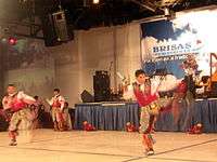
The region is mostly inhabited by indigenous people of Quechua descent.
Languages
According to the 2007 Peru Census, the language learnt first by most of the residents was Quechua (64.03%) followed by Spanish (35.67%). The Quechua variety spoken in Huancavelica is Chanka Quechua. The following table shows the results concerning the language learnt first in the Huancavelica Region by province:[1]
| Province | Quechua | Aymara | Asháninka | Another native language | Spanish | Foreign language | Deaf or mute | Total |
|---|---|---|---|---|---|---|---|---|
| Acobamba | 51,338 | 49 | 11 | 10 | 8,261 | - | 78 | 59,747 |
| Angaraes | 40,669 | 62 | 7 | 7 | 10,922 | - | 56 | 51,723 |
| Castrovirreyna | 4,093 | 14 | 1 | 3 | 14,168 | - | 73 | 18,352 |
| Churcampa | 33,025 | 27 | 4 | 19 | 8,542 | 3 | 127 | 41,747 |
| Huancavelica | 73,340 | 117 | 28 | 13 | 59,544 | 4 | 157 | 133,203 |
| Huaytara | 5,670 | 13 | 4 | 3 | 16,218 | 2 | 28 | 21,938 |
| Tayacaja | 63,950 | 91 | 23 | 15 | 33,900 | 1 | 242 | 98,222 |
| Total | 272,085 | 373 | 78 | 70 | 151,555 | 10 | 761 | 424,932 |
| % | 64.03 | 0.09 | 0.02 | 0.02 | 35.67 | 0.00 | 0.18 | 100.00 |
Education
The es:Universidad Nacional de Huancavelica is the only university in the region and it has branches in Pampas, Lircay, Acobamba and Castrovirreyna.
Health
The region has two hospitals located in Huancavelica and Pampas. There are clinics and medical post in most of the towns.
Transportation
The region is connected with the neighboring regions by national roads, which are paved in most cases. There are regional and local roads that are serving the towns of the regions. Huancavelica has a train service with the city of Huancayo.
Notable natives
- Lina Medina, world's youngest mother
See also
Sources
- ↑ inei.gob.pe INEI, Peru, Censos Nacionales 2007
External links
| Wikimedia Commons has media related to Huancavelica Region. |
Peru's Lima Province is not part of any region. |