Plaeng Yao District
| Plaeng Yao แปลงยาว | |
|---|---|
| Amphoe | |
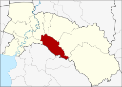 Amphoe location in Chachoengsao Province | |
| Coordinates: 13°35′5″N 101°17′3″E / 13.58472°N 101.28417°ECoordinates: 13°35′5″N 101°17′3″E / 13.58472°N 101.28417°E | |
| Country |
|
| Province | Chachoengsao |
| Seat | Wang Yen |
| Area | |
| • Total | 237.23 km2 (91.60 sq mi) |
| Population (2015) | |
| • Total | 43,247 |
| • Density | 182.29/km2 (472.1/sq mi) |
| Time zone | THA (UTC+7) |
| Postal code | 24190 |
| Geocode | 2409 |
Plaeng Yao (Thai: แปลงยาว) is a district (Amphoe) of Chachoengsao Province, central Thailand.
History
The minor district (King Amphoe) Plaeng Yao was established on October 16, 1978 with the three tambon Plaeng Yao, Hua Samrong and Wang Kaen from Bang Khla district. It was upgraded to a full district on March 15, 1985.[1]
Geography
Neighboring districts are (from the west clockwise) Ban Pho, Bang Khla, Ratchasan, Phanom Sarakham and Sanam Chai Khet of Chachoengsao Province, and Ko Chan, Phanat Nikhom and Phan Thong of Chonburi Province.
Administration
Central administration
The district Plaeng Yao is subdivided into 4 subdistrict (Tambon), which are further subdivided into 48 administrative villages (Muban).
| No. | Name | Thai | Villages | Pop.[2] |
|---|---|---|---|---|
| 1. | Plaeng Yao | แปลงยาว | 13 | 10,732 |
| 2. | Wang Yen | วังเย็น | 11 | 12,638 |
| 3. | Hua Samrong | หัวสำโรง | 12 | 10,911 |
| 4. | Nong Mai Kaen | หนองไม้แก่น | 12 | 7,217 |
Local administration
There are 4 subdistrict municipalities (Thesaban Tambon) in the district:
- Thung Sadao (Thai: เทศบาลตำบลทุ่งสะเดา) consisting of parts of the subdistricts Plaeng Yao, Wang Yen.
- Plaeng Yao (Thai: เทศบาลตำบลแปลงยาว) consisting of parts of the subdistricts Plaeng Yao, Wang Yen.
- Hua Samrong (Thai: เทศบาลตำบลหัวสำโรง) consisting of parts of the subdistrict Hua Samrong.
- Wang Yen (Thai: เทศบาลตำบลวังเย็น) consisting of parts of the subdistrict Wang Yen.
There are 3 subdistrict administrative organizations (SAO) in the district:
- Plaeng Yao (Thai: องค์การบริหารส่วนตำบลแปลงยาว) consisting of parts of the subdistrict Plaeng Yao.
- Hua Samrong (Thai: องค์การบริหารส่วนตำบลหัวสำโรง) consisting of parts of the subdistrict Hua Samrong.
- Nong Mai Kaen (Thai: องค์การบริหารส่วนตำบลหนองไม้แก่น) consisting of the complete subdistrict Nong Mai Kaen.
References
- ↑ พระราชกฤษฎีกาตั้งอำเภอเขาสวนกวาง อำเภอแปลงยาว อำเภอบ่อทอง อำเภอปะคำ และอำเภอบ้านฉาง พ.ศ. ๒๕๒๘ (PDF). Royal Gazette (in Thai). 102 (33 ก special): 7–9. March 15, 1985.
- ↑ "Population statistics 2013" (in Thai). Department of Provincial Administration. Retrieved 2014-10-07.