Hotwells
| Hotwells | |
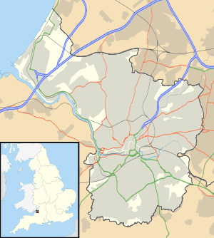
 The western part of Hotwells, with the bank of the River Avon and the A4 Hotwell Road in the foreground and the higher houses of Clifton Village above. The Clifton Suspension Bridge is just visible on the left. |
|
 Hotwells |
|
| Area | 0.155 sq mi (0.40 km2) |
|---|---|
| Population | 3,002 [1][2] |
| – density | 19,368/sq mi (7,478/km2) |
| OS grid reference | ST572727 |
| Unitary authority | Bristol |
| Ceremonial county | Bristol |
| Region | South West |
| Country | England |
| Sovereign state | United Kingdom |
| Post town | BRISTOL |
| Postcode district | BS8 |
| Dialling code | 0117 |
| Police | Avon and Somerset |
| Fire | Avon |
| Ambulance | South Western |
| EU Parliament | South West England |
| UK Parliament | Bristol West |
Coordinates: 51°27′N 2°37′W / 51.45°N 2.62°W
Hotwells is a district of the English port city of Bristol. It is located to the south of and below the high ground of Clifton, and directly to the north of the Floating Harbour. The southern entrance to the Avon Gorge, which connects the docks to the sea, lies at the western end of Hotwells. The eastern end of the area is at the roundabout where Jacobs Well Road meets Hotwell Road. Hotwells is split between the city wards of Clifton, and Hotwells and Harbourside.[3]
Location
Hotwells is approximately 1 mile (1.6 km) west of Bristol city centre lying just north of the Floating Harbour and the River Avon. To the north and some 300 feet (91 m) higher is the suburb of Clifton. Much of the built up area was originally salt marsh known as Rownham Mead. Nearly half of Rownham Mead was excavated in the early 19th century to construct the Cumberland Basin, part of the entrance lock system to the city docks. The west of the area marks the beginning of the Portway road which connects Bristol to Avonmouth, passing under the Clifton Suspension Bridge which lies about 0.25 miles (0.40 km) north of Hotwells.
History
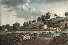
Hotwells takes its name from the hot springs which bubble up through the rocks of the Avon Gorge underneath the Clifton Suspension Bridge. The springs were documented in 1480 by William Worcester, the 15th century chronicler and antiquary. He described the waters as being milky and as warm as those at Bath.[4][5] In 1692 the Society of Merchant Venturers leased the springs and a pump room was built. The pump room of 1696 was demolished and replaced by Hotwells House in 1816 which was itself demolished when the river was widened in 1867.[6] In the Georgian era, Hotwells was developed as a spa including the building of Dowry Square in an attempt to compete with Bath. Many visitors came, including the diarist John Evelyn and the travel writer Celia Fiennes, who hunted for Bristol Diamonds in the gorge. The Jacobs Well Theatre, built in 1729, provided entertainment for visitors and Bristolians. Despite this, Hotwells never attained the same status as Bath, and eventually the waters were found to be polluted. A new pump room was built in 1822, but were demolished in 1867 to allow for widening of the River Avon.[4]
In 1799, the physician Thomas Beddoes opened the Pneumatic Institution in Dowry Square. Free treatment was advertised for those suffering from consumption, asthma, dropsy, "obstinate Venereal Complaints" and scrophula. The laboratory superintendent was Humphry Davy, who investigated nitrous oxide, also known as laughing gas, using equipment designed by James Watt. Under Davy's supervision laughing gas parties were held, attended by guests such as Robert Southey, Thomas Wedgwood and Samuel Taylor Coleridge.[7]
In the 20th century much of the housing in Hotwells was in a poor state of repair, but since the 1970s there has been refurbishment of the older Georgian properties and new housing built on derelict dockside wharves and along the Hotwell Road.
Architecture
Grenville Chapel, a Methodist church, was opened in 1839 in an Early English Style building. For many years it was used as a garage and is now housing association managed flats.
Hotwells has several of Bristol's Grade II* listed buildings, including the Church of Holy Trinity, designed by Cockrell, and Albemarle Row, a Georgian terrace. Also listed is the Pump House, formerly the power plant for Bristol Harbour's bridges and other machinery, now a public house.
Cultural references
Hotwells features in two 18th century novels. The Expedition of Humphry Clinker, by Tobias Smollett has scenes set at the spa.[8] Fanny Burney's Evelina is partly set in Hotwells, as the eponymous heroine visits Bristol during its spa-town years.[9]
Demographics
The 2001 UK Census recorded Hotwells as two Super Output Area Lower Layers, 034A, the western part of Hotwells[10] and 034C in the east. The latter layer included parts of Cliftonwood.[1] The figures recorded in the two areas were broadly similar with 034A recording a population of 1,485, with about 58% being described as economically active, 17% students and 7% retired. 42% of homes were owner occupied. 50% of residents had university degrees or equivalent. 50% described themselves as Christian and 44% as having no religion.[2] In 034C the figures were a population of 1,522 with about 66% being described as economically active, 12% students and 6.5% retired. 65% of homes were owner occupied. 55% of residents had university degrees or equivalent. 50% described themselves as Christian and 46% as having no religion.[11] 1,438 persons in 034A were described as white, with 28 of mixed race, 19 Asian, 17 black and 18 Chinese.[12] In 034C 1,374 were described as white, 33 of mixed race, 24 Asian, 24 black and 29 Chinese.[13]
Education
The area is served by two schools, Hotwells Primary School[14] and St George C of E Primary School.[15] The latter has been under threat of closure by Bristol City Council,[16] but is now to be re-evaluated in 2013.[17] The nearest secondary schools are Ashton Park School, Cotham School and Bristol Cathedral Choir School.[18]
Transport
Towards the end of the 19th century, the western end of the district was the location of a terminus of a Bristol Tramways route, Hotwells railway station was the city terminus of the Bristol Port Railway and Pier line to Avonmouth, the lower terminus of the Clifton Rocks Railway, the Rownham Ferry which crossed the River Avon to Bower Ashton, the locks giving access to the Floating Harbour, and the landing stages used by passenger steamers. In the 1920s, the A4 Portway Road was driven through the Avon Gorge to provide better access from the city to Avonmouth Docks, in the process removing all signs of the Bristol Port Railway and Pier's station. Since the 1960s, the western end of Hotwells has been dominated by a flyover complex, which enables traffic from the city centre and the A4 Portway to cross the river and harbour entrance locks to access the south west of the city.[19]
Public transport links include buses serving Weston-super-Mare, Clevedon and Portishead which pass through the area.[20] There is a ferry service to the city centre and Temple Meads railway station.[21][22]
Politics
Hotwells is part of the Bristol City Council wards of Clifton,[23] and Hotwells and Harbourside.[24]
Clifton is currently represented by two councillors from the Green Party.,[25] and Hotwells and Harbourside by a single Liberal Democrat councillor.[26] The Parliamentary constituency is Bristol West; the MP since 2015 is Thangam Debbonaire of the Labour Party.[27] Hotwells is represented in the European Parliament by the six MEPs of the South West England constituency.[28]
Community
Hotwells and Cliftonwood Community Association (HCCA),[29] is a registered charity run by volunteers to improve the quality of life for those who live and work locally. For many years HCCA ran the Hope Centre in the listed Georgian Hope Chapel, which provided a base for community groups and offered a programme of arts events. The Hope Centre closed in 2001 following a loss of funding and the lease was surrendered to the owners, the Congregational Federation.[30]
References
- 1 2 "About the Area: Bristol 034C (Super Output Area Lower Layer)". neighbourhood.statistics.gov.uk. Office for National Statistics. 2011. Retrieved 15 October 2011.
- 1 2 "Area: Bristol 034A (Lower Layer Super Output Area)". neighbourhood.statistics.gov.uk. Office for National Statistics. 2011. Retrieved 15 October 2011.
- ↑ Bristol City Council 2016 Ward Review
- 1 2 "Hotwells". National Monuments Record. Retrieved 22 December 2008.
- ↑ Dallaway, Rev. James (1834). Antiquities of Bristow in the middle centuries including the topography by William Wyrcestre, and the life of William Canynges. Bristol: Mirror Office. p. 54.
Fons est ibidem circa lowshot apud le blak rok in parte de Ghyston-clyff in fundo aquae, et est ita calidus sicut lac vel aqua Badonis
- ↑ Laws, Peter (1987). Bristol, Bath & Wells then & now. B.T. Batsford. p. 23. ISBN 0-7134-5259-5.
- ↑ Levere, Trevor H. (July 1977). "Dr Thomas Beddoes and the Establishment of His Pneumatic Institution: A Tale of Three Presidents". : Notes and Records of the Royal Society of London. 32 (1): 41–49. JSTOR 531764.
- ↑ Smollett, Tobias (1771). The Expedition of Humphry Clinker. pp. 16–19.
- ↑ Burney, Fanny (1778). Evelina. pp. 431–465.
- ↑ "About the Area: Bristol 034A (Super Output Area Lower Layer)". neighbourhood.statistics.gov.uk. Office for National Statistics. 2011. Retrieved 15 October 2011.
- ↑ "Area: Bristol 034C (Lower Layer Super Output Area)". neighbourhood.statistics.gov.uk. Office for National Statistics. 2011. Retrieved 15 October 2011.
- ↑ "Area: Bristol 034A (Lower Layer Super Output Area): Ethnicity". neighbourhood.statistics.gov.uk. Office for National Statistics. 2011. Retrieved 15 October 2011.
- ↑ "Area: Bristol 034C (Lower Layer Super Output Area): Ethnicity". neighbourhood.statistics.gov.uk. Office for National Statistics. 2011. Retrieved 15 October 2011.
- ↑ "Hotwells Primary School". Retrieved 22 December 2008.
- ↑ "St George C of E Primary School". Retrieved 22 December 2008.
- ↑ "Call in Panel, 18 November 2008, Public Forum" (PDF). bristol.gov.uk. Bristol City Council. 18 November 2008. Retrieved 22 December 2008.
- ↑ "Bristol – Future of primary schools decided". news.bbc.co.uk. BBC. 27 January 2009. Retrieved 27 January 2009.
- ↑ "List of schools by ward". bristol.gov.uk. Bristol City Council. 2011. Retrieved 15 October 2011.
- ↑ "Clifton Rocks Railway — FAQ". Clifton Rocks Railway special interest group. Retrieved 14 June 2006.
- ↑ "Bristol Overground" (PDF). firstgroup.com. First Group. 2011. Retrieved 15 October 2011.
- ↑ "Public Ferry Services". numbersevenboattrips.co.uk. Number Seven Boat Trips. 2011. Retrieved 15 October 2011.
- ↑ "Bristol Ferry – Timetables". bristolferry.com. Bristol Ferry Boat Company. 2011. Retrieved 15 October 2011.
- ↑ "Clifton Ward Map" (PDF). Bristol City Council. Archived from the original (PDF) on 20 August 2008. Retrieved 16 June 2006.
- ↑ Hotwells and Harbourside Ward Map
- ↑ "Bristol City Council Councillor search: Clifton ward". bristol.gov.uk. Bristol City Council. 2015. Retrieved 19 February 2016.
- ↑ Bristol City Council Ward Search
- ↑ "Thangam Debbonaire MP, Bristol West". theyworkforyou.com. UK Citizens Online Democracy. 2015. Retrieved 19 February 2016.
- ↑ "Results_breakdown". boroughofpoole.com. Borough of Poole. 2009. Archived from the original (PDF) on 16 July 2011. Retrieved 9 July 2011.
- ↑ "Hotwells and Cliftonwood Community Association". Retrieved 22 December 2008.
- ↑ Fells, Maurice (13 October 2007). "Centre's 'lifetime of fun' on display". Bristol Evening Post, archived at LexisNexis. Bristol United Press. Retrieved 16 October 2011.
External links
![]() Media related to Hotwells, Bristol at Wikimedia Commons
Media related to Hotwells, Bristol at Wikimedia Commons