Hostafrancs (Barcelona Metro)
Rocafort | |||||||||||
|---|---|---|---|---|---|---|---|---|---|---|---|
| Barcelona Metro rapid transit station | |||||||||||
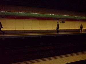 The station's platforms | |||||||||||
| Location | Barcelona (Sants-Montjuïc) | ||||||||||
| Coordinates | 41°22′31″N 2°8′37″E / 41.37528°N 2.14361°ECoordinates: 41°22′31″N 2°8′37″E / 41.37528°N 2.14361°E | ||||||||||
| Owned by | Transports Metropolitans de Barcelona | ||||||||||
| Platforms | 2 side platforms | ||||||||||
| Tracks | 2 | ||||||||||
| Construction | |||||||||||
| Structure type | Underground | ||||||||||
| Other information | |||||||||||
| Fare zone | 1 (ATM) | ||||||||||
| History | |||||||||||
| Opened | 1926 | ||||||||||
| Services | |||||||||||
| |||||||||||
| Location | |||||||||||
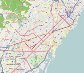 Location within Barcelona | |||||||||||
Hostafrancs (Catalan pronunciation: [ustəˈfɾaŋs]) is a Barcelona Metro station, named after the Hostafrancs neighbourhood, in the Sants-Montjuïc district of the city of Barcelona. The station is served by line L1.[1][2] The station's name is still occasionally written as Hostafranchs, following the old Catalan spelling, chiefly in Spanish-language contexts.
The station is located under the Carrer de la Creu Coberta between the Carrer Moianès and Carrer Consell de Cent. The station can be accessed from entrances on all three streets. It has twin tracks, flanked by two 88-metre (289 ft) long side platforms.[1][3]
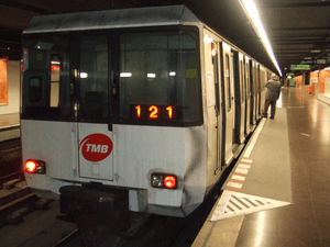
Hostafrancs is on the original section of line L1 (then the Ferrocarril Metropolitano Transversal de Barcelona) between Catalunya and Bordeta stations, which was opened in 1926.[2][3]
See also
References
- 1 2 "Plànolbcn" (in Catalan). Ajuntament de Barcelona. Retrieved 2015-01-19.
- 1 2 "Track map of the Barcelona Metro". carto.metro.free.fr. Retrieved 2015-01-19.
- 1 2 "Hostafrancs" (in Catalan). trenscat.com. Retrieved 2015-01-19.
External links
 Media related to Hostafrancs metro station at Wikimedia Commons
| Route |
|  | |||||
|---|---|---|---|---|---|---|---|
| Rolling stock |
| ||||||
| History |
| ||||||
| Future |
| ||||||