Horta (district)
| Horta | |
| Distrito Autónomo da Horta | |
| District | |
 | |
| Country | |
|---|---|
| Province | Ilhas Adjacentes |
| Region | Azores |
| Municipalities | Vila do Corvo, Horta, Lajes das Flores, Lajes do Pico, Madalena, São Roque do Pico |
| Highest point | Mount Pico |
| - location | Pico |
| - elevation | 2,351 m (7,713 ft) |
| - coordinates | PT 38°28′6″N 28°23′56″W / 38.46833°N 28.39889°W |
| Area | 776.17 km2 (300 sq mi) |
| Established | 28 March 1836 |
| - Extinguished | 22 August 1975 |
| Autonomous district | District administration |
| - location | Colégio da Companhia de Jesus, Horta |
| - elevation | 18 m (59 ft) |
| - coordinates | PT 38°32′12″N 28°37′36″W / 38.53667°N 28.62667°W |
| Civil Governor[1] | Rui Vasco de Vasconcelos e Sá Vaz |
| Timezone | Azores (UTC-1) |
| - summer (DST) | Azores (UTC0) |
The District of Horta was a district of the Ilhas Adjacentes (Adjacent Islands, the former collective name for the Azores and Madeira), consisting of the dependent western islands of the Azores, located in the Atlantic Ocean. The district of Horta, not to be confused with the modern municipality of Horta, existed from 1836 until 1976 when it was abolished in favour of the autonomy charter of the 1975 Portuguese Constitution.
History

Officially referred to as the Distrito Autónomo da Horta (Autonomous District of Horta) since 31 December 1940, it was originally established after the Liberal administrative reforms of Mouzinhos da Silveira on 28 March 1836. During these reforms the Azores were redesignated dependencies of Portugal as the constitutionally-designated Ilhas Adjacentes (Adjacent Islands). The district's creation resulted from the division of the Província Ocidental dos Açores (Western Province of the Azores), its seat in the district capital of Angra do Heroísmo, into two areas with the latter's seat in Horta.[2]
District autonomy was established during the Estado Novo regime of António de Oliveira Salazar in 1940.
The Autonomous District of Horta was extinguished, along with the Districts of Ponta Delgada and Angra do Heroísmo on 22 August 1975, with the establishment of the Junta Regional dos Açores (Regional Junta of the Azores), the provisional government that assumed the competencies of the administration during the region's transition to constitutional autonomy. With regional autonomy the districts were completely abolished: the 1976 Portuguese constitution defined in law the status of Autonomous Region without the existence of districts. Local government authority and administration fell to the upper-level local administrative units (the municipalities) and second-tier LAU IIs (the civil parishes (freguesias)).
Geography
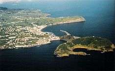
The district of Horta included the western and the southern central islands of the Azores: Corvo, Flores, Faial and Pico. This region includes a land area of 776.17 km² of islands and islets, and the following municipalities:
References
- ↑ Last civil governor of the District of Horta
- ↑ Estatísticas Históricas Portuguesas, INE 2001