Horsham District
| Horsham District | |
|---|---|
| Non-metropolitan district | |
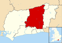 Horsham shown within West Sussex | |
| Sovereign state | United Kingdom |
| Constituent country | England |
| Region | South East England |
| Non-metropolitan county | West Sussex |
| Status | Non-metropolitan district |
| Admin HQ | Horsham |
| Incorporated | 1 April 1974 |
| Government | |
| • Type | Non-metropolitan district council |
| • Body | Horsham District Council |
| • Leadership | Leader & Cabinet (Conservative) |
| • MPs |
Nick Herbert Francis Maude |
| Area | |
| • Total | 204.73 sq mi (530.26 km2) |
| Area rank | 87th (of 326) |
| Population (mid-2014 est.) | |
| • Total | 134,158 |
| • Rank | 157th (of 326) |
| • Density | 660/sq mi (250/km2) |
| Time zone | GMT (UTC0) |
| • Summer (DST) | BST (UTC+1) |
| Website |
www |
Horsham is a local government district in West Sussex, England. Its council is based in Horsham. The district borders those of Crawley, Mid Sussex, Mole Valley, Chichester, Arun and Adur.
The district was formed on 1 April 1974, under the Local Government Act 1972, by the merger of Horsham urban district along with Chanctonbury Rural District and Horsham Rural District.
On a Channel 4 television programme, the Horsham district was classed as the ninth best district to live in the United Kingdom.[1]
Between the 2001 UK Census and the 2011 UK Census, the district's population grew by 7.4% from 122,300 to 131,300.[2]
Civil parishes
Within the Horsham District are the following civil parishes:
| Parish | Type | Area (Hectare) | Population (2001) | Pop Density /Hectare |
|---|---|---|---|---|
| Amberley | Parish Council | 1179.37 | 533 | 0.45 |
| Ashington | Parish Council | 805.15 | 2351 | 2.91 |
| Ashurst | Parish Council | 1009.41 | 226 | 0.22 |
| Billingshurst | Parish Council | 3219.31 | 6531 | 2.03 |
| Bramber | Parish Council | 719.06 | 757 | 1.05 |
| Broadbridge Heath | Parish Council | 215.64 | 3021 | 14.01 |
| Coldwaltham | Parish Council | 893.13 | 845 | 0.95 |
| Colgate | Parish Council | 2243.67 | 1119 | 0.50 |
| Cowfold | Parish Council | 1925.57 | 1864 | 0.97 |
| Henfield | Parish Council | 1734.75 | 5012 | 2.89 |
| Horsham | Unparished | 1170.63 | 23698 | 20.24 |
| Itchingfield | Parish Council | 1091.06 | 1477 | 1.35 |
| Lower Beeding | Parish Council | 1845.06 | 1001 | 0.54 |
| North Horsham | Parish Council | 1094.77 | 21348 | 19.50 |
| Nuthurst | Parish Council | 1696.76 | 1711 | 1.00 |
| Parham | Parish Council | 1586.23 | 214 | 0.13 |
| Pulborough | Parish Council | 2098.31 | 4685 | 2.23 |
| Rudgwick | Parish Council | 2468.98 | 2791 | 1.13 |
| Rusper | Parish Council | 2588.56 | 1389 | 0.54 |
| Shermanbury | Parish Council | 775.15 | 454 | 0.59 |
| Shipley | Parish Council | 3125.60 | 1075 | 0.34 |
| Slinfold | Parish Council | 1694.81 | 1647 | 0.97 |
| Southwater | Parish Council | 1400.20 | 10025 | 7.16 |
| Steyning | Parish Council | 1574.09 | 5812 | 3.69 |
| Storrington and Sullington | Parish Council | 1199.69 | 6074 | 5.06 |
| Thakeham | Parish Council | 1170.63 | 1794 | 1.53 |
| Upper Beeding | Parish Council | 1877.48 | 3798 | 2.02 |
| Warnham | Parish Council | 1980.21 | 1958 | 0.99 |
| Washington | Parish Council | 1275.90 | 1930 | 1.51 |
| West Chiltington | Parish Council | 1732.54 | 3315 | 1.91 |
| West Grinstead | Parish Council | 2583.65 | 2934 | 1.14 |
| Wiston | Parish Council | 1359.67 | 221 | 0.16 |
| Woodmancote | Parish Council | 848.72 | 478 | 0.56 |
| Horsham | Total | 53096.21 | 122088 | 2.30 |
Education
The Rikkyo School in England, a Japanese boarding school, is located in the Rudgwick community in Horsham District.[3]
References
- ↑ "Horsham: 9th Best Place To Live 2007".
- ↑ http://www.ons.gov.uk/ons/rel/mro/news-release/census-2011-result-shows-increase-in-population-of-the-south-east/censussoutheastnr0712.html|Office for National Statistics District Population changes in South East England
- ↑ "INFORMATION IN ENGLISH." (Archive) Rikkyo School in England. Retrieved on 8 January 2014. "Guildford Road,Rudgwick,W-Sussex RH12 3BE ENGLAND"
