Horseheads, New York
| Horseheads, New York | |
|---|---|
| Town | |
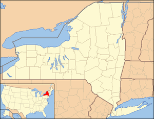 Horseheads Location within the state of New York | |
| Coordinates: 42°09′59″N 76°49′39″W / 42.16639°N 76.82750°WCoordinates: 42°09′59″N 76°49′39″W / 42.16639°N 76.82750°W | |
| Country | United States |
| State | New York |
| County | Chemung |
| Government | |
| • Type | Town Council |
| • Town Supervisor | Michael W. Edwards (R) |
| • Town Council |
Members
|
| Area | |
| • Total | 35.9 sq mi (93.0 km2) |
| • Land | 35.6 sq mi (92.2 km2) |
| • Water | 0.3 sq mi (0.8 km2) |
| Population (2010)[1] | |
| • Total | 19,485 |
| • Density | 547/sq mi (211.3/km2) |
| Time zone | Eastern (EST) (UTC-5) |
| • Summer (DST) | EDT (UTC-4) |
| Website |
townofhorseheads |
Horseheads is a town in Chemung County, New York, United States. The population was 19,485 at the 2010 census.[1] The name of the town is derived from the number of bleached horses' skulls once found there.
Horseheads is north of the city of Elmira, upon which it borders. There is a village named Horseheads within the town. It is part of the Elmira Metropolitan Statistical Area.
History
It was the first of September 1779. Under orders the forces of General John Sullivan, burdened down with heavy military equipment, marched north in their 450-mile (720 km) journey through a wooded wilderness from Easton, Pennsylvania, over to Wyoming, Pennsylvania, and on up the Susquehanna River to Newtown (Elmira). They continued north through what is now known as Horseheads to the Finger Lakes region and west to Genesee.[2] They returned about three weeks later, having accomplished the purpose for which they had set out. The larger portion of the army under the immediate command of General Sullivan returned by the way it went.
The journey had been particularly severe and wearing upon the animals, and their food supply was found insufficient. Arriving about 6 miles (10 km) north of Fort Reid on September 24, 1779, they were obliged to dispose of a large number of sick and disabled horses. The number of horses was so great that they were quite noticeable, and the native Iroquois collected the skulls and arranged them in a line along the trail. From that time forward, that spot was referred to as the "valley of the horses' heads" and is still known by the name given to it by the Iroquois.[3]
Around 1787, the first settlers arrived, making the area one of the first in the county to be populated. The town of Horseheads was formed from the towns of Elmira and Chemung in 1835. Fairport, the current village of Horseheads, set itself off from the town by becoming an incorporated village in 1837. The former Chemung Canal passed through the town.[4]
Geography
According to the United States Census Bureau, the town has a total area of 35.9 square miles (93.0 km2), of which 35.6 square miles (92.2 km2) is land and 0.31 square miles (0.8 km2), or 0.87%, is water.[1]
Newtown Creek, a tributary of the Chemung River, flows west then south through the center of the town. The Southern Tier Expressway (combined Interstate 86 and New York State Route 17) is a major east-west highway, with access from exits 52, 53, and 54. New York State Route 13 and New York State Route 14 are north-south highways through the town. The western end of New York State Route 223 is east of Horseheads village. The town is in the Southern Tier region of New York.[5]
Demographics
| Historical population | ||
|---|---|---|
| Year | Pop. | ±% |
| 1860 | 2,277 | — |
| 1870 | 2,961 | +30.0% |
| 1880 | 3,449 | +16.5% |
| 1890 | 3,482 | +1.0% |
| 1900 | 4,944 | +42.0% |
| 1910 | 5,376 | +8.7% |
| 1920 | 6,809 | +26.7% |
| 1930 | 8,420 | +23.7% |
| 1940 | 8,804 | +4.6% |
| 1950 | 11,118 | +26.3% |
| 1960 | 17,808 | +60.2% |
| 1970 | 20,552 | +15.4% |
| 1980 | 20,238 | −1.5% |
| 1990 | 19,926 | −1.5% |
| 2000 | 19,561 | −1.8% |
| 2010 | 19,485 | −0.4% |
| 2013 | 19,685 | +1.0% |
| 2014 | 19,613 | −0.4% |
| * Population estimate. 1890-1990: Source from Chemung County, not Census Bureau. Source: "American FactFinder". United States Census Bureau. | ||
As of the census[6] of 2000, there were 19,561 people, 7,960 households, and 5,253 families residing in the town. The population density was 545.5 people per square mile (210.6/km²). There were 8,350 housing units at an average density of 232.8 per square mile (89.9/km²). The racial makeup of the town was 95.89% White, 1.29% Black or African American, 0.12% Native American, 1.53% Asian, 0.01% Pacific Islander, 0.20% from other races, and 0.96% from two or more races. Hispanic or Latino of any race were 0.74% of the population.
There were 7,960 households out of which 29.8% had children under the age of 18 living with them, 51.3% were married couples living together, 11.3% had a female householder with no husband present, and 34.0% were non-families. 28.4% of all households were made up of individuals and 13.5% had someone living alone who was 65 years of age or older. The average household size was 2.38 and the average family size was 2.93.
In the town the population was spread out with 23.4% under the age of 18, 6.7% from 18 to 24, 26.9% from 25 to 44, 23.2% from 45 to 64, and 19.7% who were 65 years of age or older. The median age was 41 years. For every 100 females there were 87.1 males. For every 100 females age 18 and over, there were 84.0 males.
The median income for a household in the town was $37,444, and the median income for a family was $46,827. Males had a median income of $36,546 versus $24,197 for females. The per capita income for the town was $19,795. About 5.6% of families and 8.3% of the population were below the poverty line, including 9.5% of those under age 18 and 7.6% of those age 65 or over.
Sister city program
Starting in 1990, Horseheads was the sister city of Bato in Tochigi Prefecture in Japan, a town that could be translated as Horseheads. However, in 2005 Bato merged with Ogawa to form a new town called Nakagawa. Nakagawa inherited the title of sister city, and the two cities continue to exchange student and adult delegates.
Communities and locations in Horseheads
- Breesport – A hamlet by the east town line on NY-223, named after settler Azariah Breese.
- Horseheads – The village of Horseheads is a northern suburb of Elmira, located on NY-17.
- Elmira Heights – The village of Elmira Heights is a northern suburb of Elmira. Most of the village is inside the town of Horseheads.
- Elmira Heights North – A suburb of Elmira.
- Orchard Knoll – A hamlet southeast of Horseheads village on County Road 51.
- Ormiston – A location south of Breesport.
- Slabtown – A location by the north town line between NY-13 and NY-14.
See also
- Horseheads North, a census-designated place in the northern part of the town
References
- 1 2 3 "Geographic Identifiers: 2010 Demographic Profile Data (G001): Horseheads town, Chemung County, New York". U.S. Census Bureau, American Factfinder. Retrieved November 3, 2014.
- ↑ "Sullivan Expedition Against the Iroquois Indians 1779" (PDF). Bucknell University. Retrieved December 27, 2013.
- ↑ "History of Horseheads NY". Horseheads NY Historical Society. Retrieved December 27, 2013.
- ↑ "Village History". Village of Horseheads. Retrieved December 27, 2013.
- ↑ "Demographics". Village of Horseheads. Retrieved December 27, 2013.
- ↑ "American FactFinder". United States Census Bureau. Retrieved 2008-01-31.
External links
- Town of Horseheads official website
- Tri-Counties Genealogy & History, Town & Village of Horseheads, Chemung County New York; accessed May 7, 2014.
- "A timeline of Horseheads from 1776-1963"; accessed May 7, 2014.
Municipalities and communities of Chemung County, New York, United States | ||
|---|---|---|
| City | 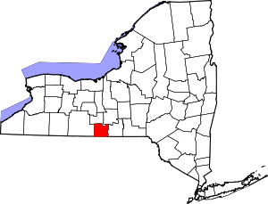 | |
| Towns | ||
| Villages | ||
| CDPs | ||
| Hamlets | ||