Horom, Armenia
Coordinates: 40°39′15″N 43°52′56″E / 40.65417°N 43.88222°E
| Horom Հոռոմ | |
|---|---|
 Horom | |
| Coordinates: 40°39′15″N 43°52′56″E / 40.65417°N 43.88222°E | |
| Country | Armenia |
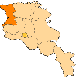
| Marz (Province) | Shirak |
| Population (2008) | |
| • Total | 2,056 |
| Time zone | (UTC+4) |
| • Summer (DST) | (UTC+5) |
Horom (Armenian: Հոռոմ, also Romanized as Orom and Horrom) is a village in the Shirak Province of Armenia. Located 1 km east of Horom and situated upon two large hills south of the main road and opposite of the dam and reservoir is the ancient Bronze Age through Urartian Citadel of Horom.
Not far from this location in Ghak and Shvaghtapa are two Urartian cyclopean forts.
Population
Population per years is the following.[1]
| Year | 1831 | 1897 | 1926 | 1939 | 1949 | 1970 | 1979 | 2001 | 2004 |
|---|---|---|---|---|---|---|---|---|---|
| Pop. | 459 | 1939 | 1564 | 1867 | 1660 | 1949 | 1841 | 2166 | 1570 |
References
- ↑ "Dictionary of Armenian residences (Հայաստանի հանրապետության բնակավայրերի բառարան), page 122" (PDF). Retrieved April 18, 2014.
- Horom, Armenia at GEOnet Names Server
- World Gazeteer: Armenia – World-Gazetteer.com
- Report of the results of the 2001 Armenian Census, National Statistical Service of the Republic of Armenia
This article is issued from Wikipedia - version of the 10/24/2015. The text is available under the Creative Commons Attribution/Share Alike but additional terms may apply for the media files.