Horodenka Raion
| Horodenkivskyi Raion Городенківський район | ||
|---|---|---|
| Raion | ||
| ||
 | ||
| Coordinates: 48°42′23″N 25°25′12″E / 48.70639°N 25.42000°ECoordinates: 48°42′23″N 25°25′12″E / 48.70639°N 25.42000°E | ||
| Country |
| |
| Region | Ivano-Frankivsk Oblast | |
| Established | ? | |
| Admin. center | Horodenka | |
| Subdivisions |
List
| |
| Government | ||
| • Governor | Vasyl Yemchuk | |
| Area | ||
| • Total | 747 km2 (288 sq mi) | |
| Population | ||
| • Total | 53,786 | |
| • Density | 72/km2 (190/sq mi) | |
| Time zone | EET (UTC+2) | |
| • Summer (DST) | EEST (UTC+3) | |
| Postal index | 285800 | |
| Area code | ? | |
| Website | Raion Profile | |

The Horodenka Raion (Ukrainian: Городенківський район) is a raion (district) of Ivano-Frankivsk Oblast (region). The town of Horodenka is the administrative center of the raion. Population: 53,786 (2016 est.)[1].
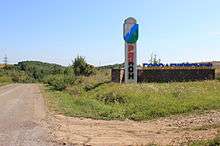
Raion border near Nezvysko
References
- ↑ "Чисельність наявного населення України (Actual population of Ukraine)" (PDF) (in Ukrainian). State Statistics Service of Ukraine. Retrieved 19 July 2016.
| Cities | ||
|---|---|---|
| Urban-type settlements | ||
| Villages |
| |
| Raions | |||||||
|---|---|---|---|---|---|---|---|
| Cities |
| ||||||
| |||||||
This article is issued from Wikipedia - version of the 7/20/2016. The text is available under the Creative Commons Attribution/Share Alike but additional terms may apply for the media files.