Horn River Formation
| Horn River Formation Stratigraphic range: Middle to Late Devonian | |
|---|---|
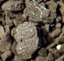 Drill cuttings sample seen through microscope | |
| Type | Geological formation |
| Sub-units | Muskwa Member, Otter Park Member, Evie Member |
| Underlies | Fort Simpson Formation |
| Overlies | Pine Point Formation |
| Thickness | up to 320 metres (1,050 ft)[1] |
| Lithology | |
| Primary | Shale |
| Other | Limestone |
| Location | |
| Coordinates | 61°44′00″N 117°45′00″W / 61.73333°N 117.75000°WCoordinates: 61°44′00″N 117°45′00″W / 61.73333°N 117.75000°W |
| Region |
|
| Country |
|
| Type section | |
| Named for | Horn River |
| Named by | Whittaker, 1922 |
The Horn River Formation (also Horn River Shale) is a stratigraphic unit of Devonian (early Givetian to late Frasnian) age in the Western Canadian Sedimentary Basin.[2]
It is a thick sequence of marine sediments that was first described in outcrop on the banks of the Horn River, a tributary of the Mackenzie River, in the Northwest Territories (at the time District of Mackenzie) by Whittaker in 1922,[3] and it takes its name from that river. In 1963 it was redefined in the subsurface of the Fort Nelson area of British Columbia (well Fort Nelson a-95-J/94-J-10) by F.F. Gray and J.R. Kassube.[4] It is significant for its shale gas resources.
Lithology
The Horn River Formation is composed of dark siliceous and calcareous shale, and argillaceous bitumenous limestone. [1]
Stratigraphy
The Horn River Formation is included in the Beaverhill Lake Group.[2] It is subdivided into the following members, from top to base:
- Muskwa Member: bituminous, mildly radioactive shale[5]
- Otter Park Member: grey calcareous shale[6]
- Evie Member: black silty limestone[7]
Distribution
The Horn River Formation is present in the subsurface in northeastern British Columbia and extends to Great Slave Lake in the Northwest Territories, where it outcrops.[2] It reaches a maximum thickness of 320 metres (1,050 ft) in the subsurface of the Fort Nelson area.[1]
Relationship to other units
The Horn River Formation is overlain by the Fort Simpson Formation and underlain by the limestones of the Lonely Bay Formation, Nahanni Formation or Pine Point Formation.[1] It is equivalent to the Slave Point Formation.[2] In the Northwest Territories it includes the Muskwa Formation, and the Waterways Member of the Hay River Formation. It includes the pinnacle reefs of the Horn Plateau Formation.
Hydrocarbon production
Shale gas is present in the siliceous shales of all three members of the Horn River Formation in northeastern British Columbia, and it is produced in the Greater Sierra oil field north of Fort Nelson. Horizontal drilling and fracturing techniques are used to extract the gas from the low permeability shales.[8] The original-gas-in-place volumes are estimated to be up to 500 Tcf,[9] making it the third largest North American natural gas accumulation discovered prior to 2010.[10] Companies involved in the extraction of natural gas from the Horn River Shale include EnCana, Apache, EOG, Stone Mountain Resources, Exxon, Quicksilver Resources, Nexen and Devon Energy.
Hydraulic fracturing in Canada
Massive hydraulic fracturing has been widely used in Alberta since the late 1970s.[11]:1044 The method is currently used in development of the Cardium, Duvernay, Montney and Viking formations in Alberta, Bakken formation in Saskatchewan, Montney and Horn River formations in British Columbia.
References
- 1 2 3 4 Lexicon of Canadian Geologic Units. "Horn River Formation". Retrieved 2009-03-25.
- 1 2 3 4 Mossop, G.D. and Shetsen, I., (compilers), Canadian Society of Petroleum Geologists (1994). "The Geological Atlas of the Western Canada Sedimentary Basin, Chapter 11: Devonian Beaverhill Lake Group of the Western Canada Sedimentary Basin". Retrieved 2013-09-07.
- ↑ Whittaker, E.J., 1922. Mackenzie River District between Great Slave Lake and Simpson. Geological Survey of Canada Summary Report 1921, Part B, p. 45-56.
- ↑ Gray, F.F. and Kassube, J R., 1963. Geology and stratigraphy of Clarke Lake gas field, northeastern British Columbia. American Association of Petroleum Geologists, v. 47, p. 467-483.
- ↑ Lexicon of Canadian Geologic Units. "Muskwa Member". Retrieved 2009-03-25.
- ↑ Lexicon of Canadian Geologic Units. "Otter Park Member". Retrieved 2009-03-25.
- ↑ Lexicon of Canadian Geologic Units. "Evie Member". Retrieved 2009-03-25.
- ↑ "The Horn River Basin". Retrieved 2009-05-21.
- ↑ "Encana estimates up to 500 trillion cubic feet in Horn River Basin". Retrieved 2010-01-25.
- ↑ Simon Mauger; Dana Bozbiciu (2011). "How Changing Gas Supply Cost Leads to Surging Production" (PDF). Retrieved 2011-05-10.
- ↑ Cant, Douglas J.; Ethier, Valerie G. (August 1984), "Lithology-dependent diagenetic control of reservoir properties of conglomerates, Falher member, Elmworth Field, Alberta,", Bulletin of the American Association of Petroleum Geologists, 68 (8)