Hopetoun Falls
| Hopetoun Falls | |
|---|---|
|
Hopetoun Falls | |
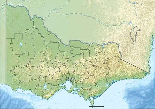 Location of the Hopetoun Falls in Victoria | |
| Location | Otway Ranges, Victoria, Australia |
| Coordinates | 38°40′04″S 143°34′13″E / 38.66778°S 143.57028°ECoordinates: 38°40′04″S 143°34′13″E / 38.66778°S 143.57028°E[1] |
| Type | Plunge |
| Elevation | 314 m (1,030 ft) |
| Total height | 45–49 m (148–161 ft) |
| Number of drops | 1 |
| Watercourse | Aire River |
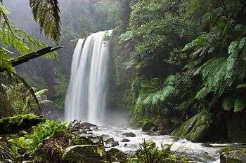
The Hopetoun Falls is a waterfall across the Aire River that is located in The Otways region of Victoria, Australia.
Location and features
The falls are located approximately 5 kilometres (3.1 mi) south of the locality of Beech Forest at an elevation of 314 metres (1,030 ft) above sea level and range between 45–49 metres (148–161 ft) in height.[2] Hopetoun Falls adjacent to the Apollo Bay – Beech Forest Road about 4 kilometres (2.5 mi) south of the Beauchamp Falls turnoff and roughly 20 kilometres (12 mi) northwest of the coastal town of Apollo Bay.
Much attention has been given to preserving the natural characteristics of Hopetoun Falls while allowing ample access for visitors. The falls have a large set of well-built and maintained stairs that lead down a natural patio to a viewing platform very close to the foot of the waterfall. Hopetoun Falls plunges 30 m in a rectangular shape. Many visitors come every year to look at its natural beauty.
See also
References
- ↑ "Hopetoun Falls: 3622". Vicnames. Government of Victoria. 2 May 1966. Retrieved 9 May 2014.
- ↑ "Map of Hopetoun Falls, VIC". Bonzle Digital Atlas of Australia. Retrieved 9 May 2014.
External links
 Media related to Hopetoun Falls at Wikimedia Commons