Hopedale, Massachusetts
| Hopedale, Massachusetts | ||
|---|---|---|
| Town | ||
|
Town Hall | ||
| ||
 Hopedale Pond | ||
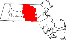
 Location in Worcester County and the state of Massachusetts. | ||
| Coordinates: 42°07′50″N 71°32′30″W / 42.13056°N 71.54167°WCoordinates: 42°07′50″N 71°32′30″W / 42.13056°N 71.54167°W | ||
| Country | United States | |
| State | Massachusetts | |
| County | Worcester | |
| Settled | 1660 | |
| Incorporated | 1886 | |
| Government | ||
| • Type | Open town meeting | |
| Area | ||
| • Total | 5.3 sq mi (13.8 km2) | |
| • Land | 5.2 sq mi (13.4 km2) | |
| • Water | 0.2 sq mi (0.4 km2) | |
| Elevation | 280 ft (85 m) | |
| Population (2010) | ||
| • Total | 5,911 | |
| • Density | 1,100/sq mi (430/km2) | |
| Time zone | Eastern (UTC-5) | |
| • Summer (DST) | Eastern (UTC-4) | |
| ZIP code | 01747 | |
| Area code(s) | 508 / 774 | |
| FIPS code | 25-30945 | |
| GNIS feature ID | 0618366 | |
| Website | www.hopedale-ma.gov | |


Hopedale is a town in Worcester County, Massachusetts, United States. The population was 5,911 at the 2010 census.
For geographic and demographic information on the census-designated place Hopedale, please see the article Hopedale (CDP), Massachusetts.
History

Hopedale was first settled in 1660. Benjamin Albee built a mill on what is now the south end of Hopedale in 1664. A 64-square-mile (170 km2) area of the Blackstone Valley was incorporated as the town of Mendon. In 1780, Milford separated from Mendon. On August 26, 1841, Adin Ballou, along with the Practical Christians, gave Hopedale its name, within the town of Milford. Ballou and the Practical Christians established the Hopedale Community based on Christian and socialist ideologies in 1842. The town was officially incorporated in 1886 when it separated from Milford. In 1905, women were granted permission to swim at the town beach.
Hopedale was once home to the Draper Corporation, once the largest maker of textile looms in the United States. The company was acquired by Rockwell International in 1967.
Hopedale is included in the Blackstone River Valley National Heritage Corridor and is an historic mill village of national significance.
Geography
According to the United States Census Bureau, the town has a total area of 5.3 square miles (14 km2), of which 5.2 square miles (13 km2) is land and 0.2 square miles (0.52 km2), or 3.20%, is water. The largest body of water is Hopedale Pond, located not far from the town center.[1]
Adjacent towns
Hopedale is located in central Massachusetts, bordered by 4 towns:
 |
Milford | | ||
| Upton | |
Bellingham | ||
| ||||
| | ||||
| Mendon |
| Historical population | ||
|---|---|---|
| Year | Pop. | ±% |
| 1890 | 1,176 | — |
| 1900 | 2,087 | +77.5% |
| 1910 | 2,188 | +4.8% |
| 1920 | 2,777 | +26.9% |
| 1930 | 2,973 | +7.1% |
| 1940 | 3,113 | +4.7% |
| 1950 | 3,479 | +11.8% |
| 1960 | 3,987 | +14.6% |
| 1970 | 4,292 | +7.6% |
| 1980 | 3,905 | −9.0% |
| 1990 | 5,666 | +45.1% |
| 2000 | 5,907 | +4.3% |
| 2010 | 5,911 | +0.1% |
| * = population estimate. Source: United States Census records and Population Estimates Program data.[2][3][4][5][6][7][8] | ||
Demographics
As of the census[9] of 2000, there were 5,907 people, 2,240 households, and 1,572 families residing in the town. The population density was 1,145.8 people per square mile (442.0/km²). There were 2,289 housing units at an average density of 444.0 per square mile (171.3/km²). The racial makeup of the town was 97.23% White, 0.56% Black or African American, 0.02% Native American, 0.71% Asian, 0.51% from other races, and 0.68% from two or more races. Hispanic or Latino of any race were 1.17% of the population.
There were 2,240 households out of which 35.8% had children under the age of 18 living with them, 58.8% were married couples living together, 8.8% had a female householder with no husband present, and 29.8% were non-families. 25.9% of all households were made up of individuals and 12.8% had someone living alone who was 65 years of age or older. The average household size was 2.58 and the average family size was 3.13.
In the town the population was spread out with 26.2% under the age of 18, 5.1% from 18 to 24, 30.8% from 25 to 44, 22.4% from 45 to 64, and 15.5% who were 65 years of age or older. The median age was 39 years. For every 100 females there were 90.9 males. For every 100 females age 18 and over, there were 87.7 males.
The median income for a household in the town was $60,176, and the median income for a family was $68,571. Males had a median income of $47,380 versus $31,144 for females. The per capita income for the town was $24,791. About 2.9% of families and 4.0% of the population were below the poverty line, including 2.7% of those under age 18 and 6.5% of those age 65 or over.
| County-level state agency heads | |
|---|---|
| Clerk of Courts: | Dennis P. McManus (D) |
| District Attorney: | Joseph D. Early, Jr. (D) |
| Register of Deeds: | Anthony J. Vigliotti (D) |
| Register of Probate: | Stephanie K. Fattman (R) |
| County Sheriff: | Lew Evangelidis (R) |
| State government | |
| State Representative(s): | John V. Fernandes (D) |
| State Senator(s): | Ryan Fattman (R) |
| Governor's Councilor(s): | Jen Caissie (R) |
| Federal government | |
| U.S. Representative(s): | Joseph P. Kennedy III (D-4th District), |
| U.S. Senators: | Elizabeth Warren (D), Ed Markey (D) |
Notable people
- Adin Ballou, noted 19th-century pacifist, socialist, and abolitionist
- Eben Sumner Draper, 44th Governor of Massachusetts
- Jason Myles Goss, singer/songwriter
- Dana Gould, comedian, voice of Gex
- Kevin Nee, professional strongman athlete
- Joe Perry of Aerosmith
Public schools
Students in grades K–6 go to the Memorial School. Hopedale Junior/Senior High is for grades 7–12.
Places of Worship
There are currently three houses of worship in Hopedale.
See also
References
- ↑ http://www.mass.gov/eea/docs/dfg/dfw/habitat/maps-ponds/dfwhope.pdf
- ↑ "TOTAL POPULATION (P1), 2010 Census Summary File 1, All County Subdivisions within Massachusetts". United States Census Bureau. Retrieved September 13, 2011.
- ↑ "Massachusetts by Place and County Subdivision - GCT-T1. Population Estimates". United States Census Bureau. Retrieved July 12, 2011.
- ↑ "1990 Census of Population, General Population Characteristics: Massachusetts" (PDF). US Census Bureau. December 1990. Table 76: General Characteristics of Persons, Households, and Families: 1990. 1990 CP-1-23. Retrieved July 12, 2011.
- ↑ "1980 Census of the Population, Number of Inhabitants: Massachusetts" (PDF). US Census Bureau. December 1981. Table 4. Populations of County Subdivisions: 1960 to 1980. PC80-1-A23. Retrieved July 12, 2011.
- ↑ "1950 Census of Population" (PDF). 1: Number of Inhabitants. Bureau of the Census. 1952. Section 6, Pages 21-10 and 21-11, Massachusetts Table 6. Population of Counties by Minor Civil Divisions: 1930 to 1950. Retrieved July 12, 2011.
- ↑ "1920 Census of Population" (PDF). Bureau of the Census. Number of Inhabitants, by Counties and Minor Civil Divisions. Pages 21-5 through 21-7. Massachusetts Table 2. Population of Counties by Minor Civil Divisions: 1920, 1910, and 1920. Retrieved July 12, 2011.
- ↑ "1890 Census of the Population" (PDF). Department of the Interior, Census Office. Pages 179 through 182. Massachusetts Table 5. Population of States and Territories by Minor Civil Divisions: 1880 and 1890. Retrieved July 12, 2011.
- ↑ "American FactFinder". United States Census Bureau. Retrieved 2008-01-31.
External links
| Wikimedia Commons has media related to Hopedale, Massachusetts. |