Honningsvåg Tunnel
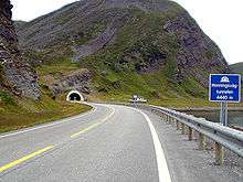 View of the tunnel | |
| Overview | |
|---|---|
| Location | Finnmark, Norway |
| Coordinates | 70°59′06″N 25°52′11″E / 70.9851°N 25.8697°ECoordinates: 70°59′06″N 25°52′11″E / 70.9851°N 25.8697°E |
| Status | In use |
| Route | E69 |
| Start | 70°58′40″N 25°50′30″E / 70.97778°N 25.84167°E |
| End | 70°59′20″N 25°55′00″E / 70.98889°N 25.91667°E |
| Operation | |
| Opened | 15 June 1999 |
| Technical | |
| Length | 4,443 metres (14,577 ft) |
| Number of lanes | 2 |
| Width | 9 metres (30 ft) |
The Honningsvåg Tunnel (Norwegian: Honningsvågtunnelen) is a road tunnel on the island of Magerøya in Nordkapp Municipality in Finnmark county, Norway. It is located slightly north of the undersea North Cape Tunnel, and it is part of the European route E69 highway.[1]
The 4,443-metre (14,577 ft) long tunnel opened in 1999, at the same time as the North Cape Tunnel, as part of a large project to connect the mainland of Norway to North Cape. This tunnel goes through a large mountain called "Honningsvåg fjellet" west of the town of Honningsvåg. It is the northernmost public road tunnel in the world.[2]
References
- ↑ Store norske leksikon. "Honningsvågtunnelen" (in Norwegian). Retrieved 2013-02-13.
- ↑ Merzagora, Eugenio A.; Lotsberg, Gunnar (eds.). "Road Tunnels in Norway > 3 000 m". Road Tunnels in Norway. Retrieved 2013-02-13.
This article is issued from Wikipedia - version of the 11/20/2016. The text is available under the Creative Commons Attribution/Share Alike but additional terms may apply for the media files.