Mount Hombori
| Mount Hombori | |
|---|---|
|
Hombori Tondo | |
| Highest point | |
| Elevation | 1,155 m (3,789 ft) [1] |
| Listing | Country high point |
| Coordinates | 15°15′26″N 1°40′08″W / 15.25722°N 1.66889°WCoordinates: 15°15′26″N 1°40′08″W / 15.25722°N 1.66889°W |
| Geography | |
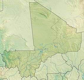 Mount Hombori Location of Mount Hombori in Mali | |
| Location | Mali |
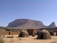
Mount Hombori (Hombori Tondo) is a mountain in Mali's Mopti Region, near the town of Hombori. At 1,153 meters, it is the highest point in Mali.
Mount Hombori is a significant archaeological site, with caves inhabited more than 2,000 years ago.
Images from Hombori: - Mount Hombori: - Main de Fatima:
References
- ↑ "Hombori Tondo" on Peakbagger.com Retrieved 2 October 2011
This article is issued from Wikipedia - version of the 5/13/2016. The text is available under the Creative Commons Attribution/Share Alike but additional terms may apply for the media files.