Holyrood, Newfoundland and Labrador
| Holyrood Hollyrode | ||
|---|---|---|
| Town | ||
| ||
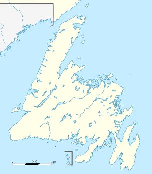 Holyrood Location of Holyrood in Newfoundland | ||
| Coordinates: 47°23′N 53°08′W / 47.383°N 53.133°WCoordinates: 47°23′N 53°08′W / 47.383°N 53.133°W | ||
| Country |
| |
| Province |
| |
| Census division | 1 | |
| Settled | 1689 | |
| Incorporated | 1961 | |
| Area | ||
| • Total | 125.57 km2 (48.48 sq mi) | |
| Population (2006) | ||
| • Total | 2,005 | |
| • Density | 16/km2 (41/sq mi) | |
| Time zone | Newfoundland Time (UTC– 3:30) | |
| • Summer (DST) | Newfoundland Daylight (UTC– 2:30) | |
| Area code(s) | 709 | |

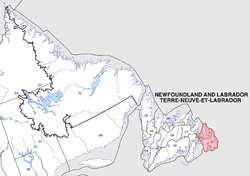
Holyrood is a town on the Avalon Peninsula in Newfoundland and Labrador, Canada. It is in Division 1, on Conception Bay. During King William's War, the village was destroyed in the Avalon Peninsula Campaign.
The town is famous for being at the bottom of the bay and having a large cross on the top of the predominant mountain "George Cove". Holyrood is also renowned for its squid fishery and caplin "rolling" which happens in late spring, early summer. "Rolling" refers to the mating of the caplin when they beach themselves and can be picked up by hand.
According to the 2006 Statistics Canada Census:
- Population: 2,005
- % Change (2001–2006): 5.2
- Dwellings: 832
- Area (km².): 125.57
- Density (persons per km².): 16.0
See also
- List of cities and towns in Newfoundland and Labrador
- Holyrood weather radar
- Monarchy in Newfoundland and Labrador
 |
Conception Bay South | | ||
| Harbour Main-Chapel's Cove-Lakeview, Subdivision 1O | |
Subdivision 1D | ||
| ||||
| | ||||
| Division No. 1, Subd. W |
This article is issued from Wikipedia - version of the 11/3/2016. The text is available under the Creative Commons Attribution/Share Alike but additional terms may apply for the media files.