Holloway's Station
|
Holloway's Station | |
 | |
  | |
| Nearest city | Red Oak, Oklahoma |
|---|---|
| Coordinates | 34°58′38.91″N 95°2′54.04″W / 34.9774750°N 95.0483444°WCoordinates: 34°58′38.91″N 95°2′54.04″W / 34.9774750°N 95.0483444°W |
| Built | 1858 |
| NRHP Reference # | [1] |
| Added to NRHP | April 13, 1972 |
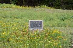
Holloway's Station was a stage stand on the old Butterfield Overland Mail route in Indian Territory. It was located near "The Narrows" at upper Brazil Creek in what is now Latimer County, Oklahoma. The station was named for William Holloway, the stage agent. In 1858, the Choctaw Council granted Holloway the right to construct a turnpike and tollbooth at "The Narrows".
Holloway's Station was added to the National Register of Historic Places (#72001070) in 1972.
Sources
- ↑ National Park Service (2007-01-23). "National Register Information System". National Register of Historic Places. National Park Service.
- Shirk, George H. Oklahoma Place Names. Norman: University of Oklahoma Press, 1987: ISBN 0-8061-2028-2 .
- Wright, Murial H.; George H. Shirk; Kenny A. Franks. Mark of Heritage. Oklahoma City: Oklahoma Historical Society, 1976.
- Wright, Muriel H. "The Butterfield Overland Mail One Hundred Years Ago", Chronicles of Oklahoma 35:1 (January 1957) 55-71 (accessed August 23, 2006).
| Butterfield Overland Mail in Indian Territory | ||||
| Next station West Riddle's Station |
18 miles |
Holloway's Station | 19 miles |
Next station East Trahern's Station |
This article is issued from Wikipedia - version of the 11/25/2016. The text is available under the Creative Commons Attribution/Share Alike but additional terms may apply for the media files.