Holder, Australian Capital Territory
| Holder Canberra, Australian Capital Territory | |||||||||||||
|---|---|---|---|---|---|---|---|---|---|---|---|---|---|
 | |||||||||||||
| Coordinates | 35°20′10″S 149°02′42″E / 35.336°S 149.045°ECoordinates: 35°20′10″S 149°02′42″E / 35.336°S 149.045°E | ||||||||||||
| Population | 2,711 (2011 census)[1] | ||||||||||||
| • Density | 1,430/km2 (3,700/sq mi) | ||||||||||||
| Established | 1970 | ||||||||||||
| Postcode(s) | 2611 | ||||||||||||
| Area | 1.9 km2 (0.7 sq mi) | ||||||||||||
| District | Weston Creek | ||||||||||||
| Territory electorate(s) | Murrumbidgee | ||||||||||||
| Federal Division(s) | Canberra | ||||||||||||
| |||||||||||||
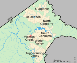
The suburb of Holder is a part of the Weston Creek District of Canberra, Australian Capital Territory, Australia, and is located 13 km to the southwest of the Canberra city centre. It sits on the western edge of the Canberra suburbs, and overlooks bare land towards Mount Stromlo to the west and Belconnen to the north.
History
Holder was gazetted in July 1970 and named after Sir Frederick William Holder (1850–1909), Premier of South Australia between 1899 and 1901, and first Speaker of the Federal House of Representatives from 1901 to 1909. Consistent with Canberra's concept of having themed streets in each suburb, all streets in Holder are named after prominent Australian surveyors.[2] The suburb is predominantly residential housing, with most houses constructed around 1970-1972.
Holder originally had its own High School and Primary School, but both have since closed down - the Primary School in 1991, and the High School in 1993. There are still two private schools in the suburb - St Jude's Catholic Primary and Canberra Montessori School - but the closest public school is now Duffy Primary School.
2003 bushfires
Holder was one of the hardest hit suburbs in the Canberra bushfire of 18 January 2003 when the fire came roaring out of the adjacent Stromlo Forest and across Dixon Drive into suburban housing. A total of 31 homes were destroyed in Holder, and 219 in adjacent Duffy. There was extensive damage to houses along Dixon Drive on the north of the suburb, but apart from occasional houses deeper into the suburb being ignited by floating embers, the fire generally did not penetrate into the suburb beyond one to two houses.
Geology
The geologic structure under the suburb of Holder mostly comprises Deakin Volcanics green grey and purple rhyodacite. A band of pink and green rhyolitic intrusive porphyry is situated on the south and southwest sides.[3]
Churches
- St Jude(Catholic church)
Government services
Footnotes
- ↑ Australian Bureau of Statistics (31 October 2012). "Holder (State Suburb)". 2011 Census QuickStats. Retrieved 13 February 2014.
- ↑ "Suburb Name search results". ACT Environment and Sustainable Development. Retrieved 13 February 2014.
- ↑ Henderson, G. A. M.; Matveev, G. (1980). Geology of Canberra, Queanbeyan and Environs (Map). 1:50000.
References
- ACT Bushfire CRC (2005), Investigation of bushfire attack mechanisms resulting in house loss in the ACT bushfire 2003. Retrieved 21 August 2010.
External links
| Wikimedia Commons has media related to Holder, Australian Capital Territory. |