Hohtälli
| Hohtälli | |
|---|---|
 View from the summit | |
| Highest point | |
| Elevation | 3,275 m (10,745 ft) |
| Prominence | 50 m (160 ft) [1] |
| Parent peak | Monte Rosa |
| Coordinates | 45°59′20.5″N 7°48′9.6″E / 45.989028°N 7.802667°ECoordinates: 45°59′20.5″N 7°48′9.6″E / 45.989028°N 7.802667°E |
| Geography | |
 Hohtälli Location in Switzerland | |
| Location | Valais, Switzerland |
| Parent range | Pennine Alps |
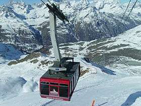
The Hohtälli is a mountain of the Swiss Pennine Alps, located southeast of Zermatt in the canton of Valais. It lies on the range that separates the Findel Glacier from the Gorner Glacier, between the Gornergrat and the Stockhorn. Its summit has an elevation of 3,275 metres and includes a cable car station. The Hohtälli is part of a ski area and features several ski runs leading down the mountain.
References
- ↑ Retrieved from the Swisstopo topographic maps and Google Earth. The key col is located east of the summit at 3,225 metres.
External links
This article is issued from Wikipedia - version of the 5/9/2016. The text is available under the Creative Commons Attribution/Share Alike but additional terms may apply for the media files.