Hoboken–33rd Street
 Hoboken-bound car at the 14th Street station | |||
| Overview | |||
| Type | Rapid transit | ||
| System | PATH | ||
| Status | Operational | ||
| Locale | Hoboken, New Jersey and Manhattan, New York | ||
| Termini |
Hoboken (west) 33rd Street (east) | ||
| Stations | 6 | ||
| Operation | |||
| Owner | Port Authority of New York and New Jersey | ||
| Operator(s) | Port Authority Trans Hudson | ||
| Character | Underground | ||
| Technical | |||
| Line length | 3.5 miles (5.6 km) | ||
| Track gauge | 1,435 mm (4 ft 8 1⁄2 in) | ||
| Electrification | Third rail | ||
| |||
Hoboken–33rd Street is a rapid transit service operated by the Port Authority Trans-Hudson (PATH). It is colored blue on the PATH service map and trains on this service display blue marker lights.[1] This service operates from the Hoboken Terminal in Hoboken, New Jersey by way of the Uptown Hudson Tubes to 33rd Street in Midtown Manhattan, New York.[1] The 3.5-mile (5.6 km) trip takes 14 minutes to complete.[2]
This service operates from 6:00 to 23:00 (11:00 PM) on weekdays only.[3] At other times, this service is replaced with the Journal Square-33rd Street (via Hoboken) service.[3] This route has the fewest handicapped accessible stations available; they are at the terminals only.
History
The Hoboken-33rd Street service originated as the Hoboken – 19th Street service operated by the Hudson and Manhattan Railroad (H&M) on February 26, 1908. It operated from Hoboken Terminal, but ran only as far north as 19th Street (H&M station) in Manhattan, until the line was expanded to 33rd Street (H&M station) on November 10, 1910. The 19th Street station was closed by H&M on August 1, 1954,[4] and the H&M itself was succeeded by Port Authority Trans-Hudson (PATH) in 1962. After the September 11 attacks destroyed the World Trade Center station, service on this branch was suspended during overnight hours with all service provided by the Newark - 33rd Street via Hoboken branch until Exchange Place reopened on June 29, 2003.
Station listing
| PATH Services | |
References
- 1 2 "PATH Maps". The Port Authority of New York and New Jersey. Retrieved March 31, 2011.
- ↑ "PATH Facts & Info". The Port Authority of New York and New Jersey. Retrieved March 31, 2011.
- 1 2 "PATH Full Schedules". The Port Authority of New York and New Jersey. Retrieved March 31, 2011.
- ↑ "The Hudson & Manhattan Railroad - Celebrating 100 Years of Service to the NY/NJ Metropolitan Region". Port Authority of New York & New Jersey. Archived from the original on 2011-07-21. Retrieved 2009-08-16.
| Services | 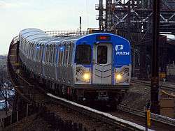 | |
|---|---|---|
| Stations | ||
| Infrastructure | ||
| Historical | ||
| Related | ||