Sint Maarten
| Sint Maarten |
||||||
|---|---|---|---|---|---|---|
|
||||||
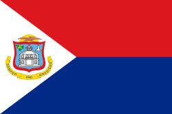
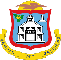
| Motto: "Semper progrediens" (Latin) "Always progressing" |
||||||
| Anthem: O Sweet Saint Martin's Land | ||||||
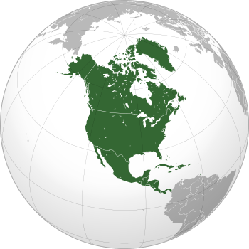
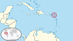 Location of Sint Maarten (circled in red) in the Caribbean (light yellow) |
||||||
 Sint Maarten is located on the southern half of
the island of Saint Martin. |
||||||
| Capital | Philipsburg 18°02′N 63°03′W / 18.033°N 63.050°W | |||||
| Largest city | Lower Prince's Quarter | |||||
| Official languages | ||||||
| Demonym | St. Maartener | |||||
| Sovereign state | ||||||
| Government | Unitary parliamentary representative democracy under constitutional monarchy | |||||
| • | Monarch | Willem-Alexander | ||||
| • | Governor | Eugene Holiday | ||||
| • | Prime Minister | William Marlin | ||||
| Legislature | Estates of Sint Maarten | |||||
| Autonomy within the Kingdom of the Netherlands | ||||||
| • | Established | 10 October 2010 (dissolution of the Netherlands Antilles) | ||||
| Area | ||||||
| • | Total | 37 km2 13.1 sq mi |
||||
| • | Water (%) | negligible | ||||
| Population | ||||||
| • | 2011 census | 33,609 | ||||
| • | Density | 1110/km2 (10th) 2,874.9/sq mi |
||||
| GDP (PPP) | 2003 estimate | |||||
| • | Total | $400 million | ||||
| • | Per capita | $11,400 | ||||
| Currency | Netherlands Antillean guilder (ANG) | |||||
| Time zone | AST (UTC−4) | |||||
| Drives on the | right | |||||
| Calling code | +1 721[2] | |||||
| ISO 3166 code | SX | |||||
| Internet TLD | .sx, .an a | |||||
| a. | ^ .an is to be discontinued[3] | |||||
Sint Maarten (Dutch pronunciation: [sɪnt ˈmaːrtə(n)]) is an island country in the Caribbean. It is a constituent country of the Kingdom of the Netherlands. With a population of 33,609 on an area of 34 km2 (13 sq mi), it encompasses the southern 40% of the divided island of Saint Martin, while the northern 60% of the island constitutes the French overseas collectivity of Saint-Martin. Its capital is Philipsburg.
Before 10 October 2010, Sint Maarten was known as the Island Territory of Sint Maarten (Dutch: Eilandgebied Sint Maarten), and was one of five island territories (eilandgebieden) that constituted the Netherlands Antilles.
History
In 1493, during Christopher Columbus' second voyage to the West Indies, upon first sighting the island he named it Isla de San Martín after Saint Martin of Tours because it was 11 November, St. Martin's Day. However, though he claimed it as a Spanish territory, Columbus never landed there, and Spain made the settlement of the island a low priority.
The French and Dutch, on the other hand, both coveted the island. While the French wanted to colonize the islands between Trinidad and Bermuda, the Dutch found San Martín a convenient halfway point between their colonies in New Amsterdam (present day New York) and Brazil. With few people inhabiting the island, the Dutch easily founded a settlement there in 1631, erecting Fort Amsterdam as protection from invaders. Jan Claeszen Van Campen became its first governor, and soon thereafter the Dutch West India Company began its salt mining operations. French and British settlements sprang up on the island as well. Taking note of these successful colonies and wanting to maintain their control of the salt trade, the Spanish now found St. Martin much more appealing. The Eighty Years' War which had been raging between Spain and the Netherlands provided further incentive to attack.
Spanish forces captured Saint Martin from the Dutch in 1633, seizing control and driving most or all of the colonists off the island. At Point Blanche, they built what is now Old Spanish Fort to secure the territory. Although the Dutch retaliated in several attempts to win back St. Martin, they failed. Fifteen years after the Spanish conquered the island, the Eighty Years' War ended. Since they no longer needed a base in the Caribbean and St. Martin barely turned a profit, the Spanish lost their inclination to continue defending it. In 1648, they deserted the island.
With St. Martin free again, both the Dutch and the French jumped at the chance to re-establish their settlements. Dutch colonists came from St. Eustatius, while the French came from St. Kitts. After some initial conflict, both sides realized that neither would yield easily. Preferring to avoid an all-out war, they signed the Treaty of Concordia in 1648, which divided the island in two. During the treaty's negotiation, the French had a fleet of naval ships off shore, which they used as a threat to bargain more land for themselves. In spite of the treaty, relations between the two sides were not always cordial. Between 1648 and 1816, conflicts changed the border sixteen times. The entire island came under effective French control from 1795 when Netherlands became a puppet state under the French Empire until 1815. In the end, the French came out ahead with 53 km2 (20 sq mi; 61%) against 34 km2 (13 sq mi; 39%) on the Dutch side.
With the new cultivation of cotton, tobacco, and sugar, the French and the Dutch imported a massive number of slaves to work on the plantations. The slave population quickly grew larger than that of the land owners. Subjected to cruel treatment, slaves staged rebellions, and their overwhelming numbers made them impossible to ignore. In 1848, the French abolished slavery in their colonies including the French side of St. Martin. Slaves on the Dutch side of the island protested and threatened to flee to the French side to seek asylum. The local Dutch authorities relented and emancipated the colonies' slaves. While this decree was respected locally, it was not until 1863 when the Dutch abolished slavery in all of their island colonies that the slaves became legally free.[4]
20th century
After abolition of slavery, plantation culture declined and the island's economy suffered. In 1939, St. Martin received a major boost when it was declared a duty-free port. In 1941, the island was shelled by a German U-boat during World War II. The Dutch side began focusing on tourism in the 1950s, with the French side following suit two decades later. Because of being split up into a Dutch and a French part, the tourist boom was heavier on Sint Maarten than on the surrounding islands. Its Princess Juliana International Airport became one of the busiest in the Eastern Caribbean. For much of this period, Sint Maarten was governed by business tycoon Claude Wathey of the Democratic Party.[5]
The island's demographics changed dramatically during this period as well. The island's population increased from a mere 5,000 people to around 60,000 people in the mid-1990s. Immigration from the neighbouring Lesser Antilles, Curaçao, Haiti, the Dominican Republic, the United States, Europe, and Asia turned the native population into a minority.[6]
Sint Maarten became an "island territory" (eilandgebied in Dutch) of the Netherlands Antilles in 1983. Before that date, Sint Maarten was part of the island territory of the Windward Islands, together with Saba and Sint Eustatius. The status of an island territory entails considerable autonomy summed up in the Island Regulation of the Netherlands Antilles. The island territory of Sint Maarten was ruled by an island council, an executive council, and a Lieutenant Governor (Dutch: gezaghebber) appointed by the Dutch Crown.
On 5 September 1995, Hurricane Luis hammered the islands causing extensive damage 35 years to the day after Hurricane Donna.
21st century
In 1994, the Kingdom of the Netherlands and France signed the Franco-Dutch treaty on Saint Martin border controls, which allows for joint Franco-Dutch border controls on so-called "risk flights". After some delay, the treaty was ratified in November 2006 in the Netherlands, and subsequently entered into force on 1 August 2007. Though the treaty is now in force, its provisions are not yet implemented as the working group specified in the treaty is not yet installed.
On 10 October 2010, Sint Maarten became a constituent country (Dutch: Land Sint Maarten) within the Kingdom of the Netherlands, making it a constitutional equal partner with Aruba, Curaçao, and the Netherlands proper. Sint Maarten has been assigned the ISO 3166-1 alpha-2 country codes of SXM and SX,[7] and the .sx Internet ccTLD became available to register on the 15th of November 2012.[8]
The combined population of the two territories has continued to grow, albeit at a slower rate, and is now (2013) around 75,000.
Government and politics


The Constitution of Sint Maarten was unanimously adopted by the island council of Sint Maarten on 21 July 2010. Elections for a new island council were held on 17 September 2010, since the number of seats was increased from 11 to 15. The newly elected island council became the Estates of Sint Maarten on 10 October.[9]
Eugene Holiday was appointed as the first Governor of Sint Maarten (Dutch: gouverneur) by the Council of Ministers of the Kingdom of the Netherlands in September 2010. He also assumed office on 10 October 2010.
Current composition of the Estates of Sint Maarten
| Parties | Party leader | Votes | % | Seats | +/– |
|---|---|---|---|---|---|
| United People's Party (UPP) | Theo Heyliger | 6,211 | 42.67 | 7 | +1 |
| National Alliance (NA) | William Marlin | 4,055 | 27.86 | 4 | -3 |
| Democratic Party (DP) | Sarah Wescot-Williams | 2,342 | 16.09 | 2 | 0 |
| United St. Maarten Party (USP) | Frans Richardson | 1,647 | 11.31 | 2 | New |
| One St. Maarten People Party (OSPP) | Lenny Priest | 169 | 1.16 | 0 | New |
| Social Reform Party (SRP) | Jacinto Mock | 132 | 0.91 | 0 | New |
| Invalid/blank votes | 271 | – | – | ||
| Total | 14,827 | 100 | 15 | – | |
| Source: Government of Sint Maarten | |||||
Corruption
In 1978, the government of the Netherlands Antilles installed a Research Committee on the Windward Islands (Dutch: Commissie van Onderzoek Bovenwindse Eilanden) to investigate claims of corruption in the island government. Even though the report issued by this commission was damaging for the island's government, measures were not put into place to curb corruption, arguably because the government of the Netherlands Antilles depended on the support of Wathey's Democratic Party in the Estates of the Netherlands Antilles. In August 1990, the public prosecutor of the Netherlands Antilles started an investigation into the alleged ties between the island government of Sint Maarten and the Sicilian Mafia, and in 1991 the Court of Audit of the Netherlands Antilles issued a report which concluded that the island government of Sint Maarten was ailing.[10]
In the government and parliament of the Netherlands, the call for measures became louder and louder. With Dutch pressure, the government of the Netherlands Antilles installed the Pourier Commission tasked with investigating the state of affairs of the island government of Sint Maarten in December 1991. Its report concluded that the island was in a severe financial crisis, that rules of democratic decision-making were continuously broken, and that the island government constituted an oligarchy. In short, the island government failed completely according to the report. After long negotiations, the Kingdom government enacted a General Measure of Kingdom Administration (Dutch: Algemene Maatregel van Rijksbestuur) in early 1993, placing Sint Maarten under direct supervision of the Kingdom. Although originally meant for one year, the Order-in-Council for the Kingdom was eventually extended until 1 March 1996.[11]
Though much has changed since, allegations of criminal activities continue to plague Sint Maarten. In 2004, the Minister of Justice of the Netherlands Antilles asked the Scientific Research and Documentation Centre (Dutch: Wetenschappelijk Onderzoek- en Documentatiecentrum (WODC)) of the Dutch Ministry of Justice to conduct research into organized crime in Sint Maarten. The report concluded that money laundering and cocaine trade are widespread on Sint Maarten. It also alleged that money from the island was used to finance Hamas, its associate Holy Land Foundation, and the Taliban.[5][12]
In April 2009, former Commissioner Louie Laveist was convicted, and sentenced to an 18-month prison sentence, by the Sint Maarten Court-of-First-Instance, on account of forgery, fraud, and bribery.[13] He was later acquitted of forgery and of fraud by the Common Court of Justice of the Netherlands Antilles and Aruba, but not of bribery.[14]
Demographics
In the 2011 Netherlands Antilles census, the population of the island territory was 33,609.[15]
Births and deaths [16]
| Year | Population (x1000) | Live births | Deaths | Natural increase | Crude birth rate | Crude death rate | Rate of natural increase | TFR |
|---|---|---|---|---|---|---|---|---|
| 2013 | 511 | 171 | 340 | 14.0 | 4.7 | 9.3 | ||
Settlements


- Philipsburg (1,327 inhabitants).
- Lower Prince's Quarter (8,143 inhabitants).
- Cul de Sac (7,593 inhabitants).
- Cole Bay (5,594 inhabitants).
- Upper Prince's Quarter (3,139 inhabitants).
- Little Bay (Fort Amsterdam) (3,093 inhabitants).
- Simpson Bay (596 inhabitants).
- Lowlands (348 inhabitants).
Religion
Languages
Culture

The official languages are Dutch and English.[1] A local English-based creole dialect is also spoken. An annual regatta is also held over 3 days culminating in the first weekend in March. Among the leading cultural artists of the island are Isidore "Mighty Dow" York, kaisonian, panman; Roland Richardson, Impressionist painter; Nicole de Weever, dancer, broadway star; Susha Hien, choreographer; Lasana M. Sekou, poet, author, independence advocate; Clara Reyes, choreographer; Tanny and The Boys, string band music group. The annual Saint Maarten Carnival starts in April and ends in May. The Grand Carnival parade takes place on the Dutch side and is dedicated to the Queen of the Netherlands. The annual St. Martin Book Fair takes place during the first weekend of June, featuring emerging and famous authors from the island, the Caribbean region, and from around the world.[18]
Sport and recreation
Popular team sports in Sint Maarten include baseball, cricket, and soccer (or football). Recreational fishing, golf, and water sports (including diving, kayaking, snorkelling, and yachting) are popular amongst tourists.[19]
The Sint Maarten Soccer Association was founded in 1986. The organisation is not a member of FIFA, but became an associate member of CONCACAF in 2002, and a full member in 2013.[20] The national soccer team debuted in 1989, and plays its home games at the Raoul Illidge Sports Complex, which has a 3,000-spectator capacity. After an initial period of popularity during the 1990s, including an appearance at the 1993 Caribbean Cup, interest in soccer declined, with the national team playing its last official match in 2000 (against Dominica).[21] However, Sint Maarten is scheduled to return to international competition in March 2016, in the 2017 Caribbean Cup qualification tournament.[22]
The Sint Maarten Cricket Association is a member of the Leeward Islands Cricket Association (LICA), which is in turn a member of the West Indies Cricket Board (WICB). With rare exceptions (for instance, the Stanford 20/20), the national cricket team plays only against other LICA members, though Sint Maarteners may go on to play for the Leeward Islands team at regional level and for the West Indies team internationally. The primary venue for cricket is the Charles Vlaun Cricket Field.[23] Colin Hamer was the first Sint Maartener to play first-class cricket,[24] while Keacy Carty was the first islander to play at international level (for the West Indies under-19s).[25] Carty was the man of the final at the 2016 Under-19 World Cup, and was later described by the prime minister, William Marlin, as having "brought the name of St Maarten to international acclaim".[26]
Prior to cricket becoming popular, baseball was preferred. No national team existed, although Sint Maarteners were eligible to play for the Netherlands Antilles baseball team before its dissolution.[27] Several Sint Maarteners have passed through the American baseball system, playing at college level or in the minor leagues. Allen Halley played college baseball for the South Alabama Jaguars and was drafted by the Chicago White Sox in the 30th round of the 1995 draft, reaching Class A-Advanced in the minor leagues. Three others, Rene Leveret, Marc Ramirez, and Rafael Skeete, were signed as free agents by major league teams during their careers, but played only in the minor leagues.[28]
Popular culture
The island is famous for its runway at Princess Juliana International Airport, in which landing aircraft pass within less than 35 meters of Maho Beach below, due to the close proximity of the runway to the ocean. The planes appear to land dangerously close to beach goers. Therefore, this beach and airport has become a popular place for people to view airplane landings.
Education
The Caribbean International Academy founded in 2003 is now the only top preparatory private boarding and day school on the island of St. Maarten. Catering to children from Kindergarten to Grade 12, CIA is also the only school offering Canadian/Ontario High School Diploma (OSSD) and 90% of their graduates go on to attend universities in Europe, Canada and the United States.[29]
The American University of the Caribbean School of Medicine (AUC), founded in 1978, was previously located on Montserrat. Because of the eruption of the Soufrière Hills volcano in 1995, AUC moved its campus to St. Maarten later that year. A permanent campus was completed in 1998 in Cupecoy.
The University of St. Martin (USM) is located in Philipsburg.
The University of Sint Eustatius School of Medicine, founded in 1999, was previously located on Sint Eustatius. In September 2013, the University of Sint Eustatius moved its campus to Cole Bay, St. Maarten.
Transportation and economy
Air transportation to Sint Maarten and the whole island is served by Princess Juliana International Airport, which is well known for its very low final approach landings close to a popular beach at the end of the runway.[30] Winair (Windward Islands Airways) has its headquarters on the grounds of the airport.[31]
There are no railroads on the island.
St. Maarten's economy is mostly based on tourism, either from tourists staying on the island or day tourists from the many cruise lines that dock in the Philipsburg Harbour.
In 2014, St. Maarten had more gaming machines per resident than any other country in the world.[32]
See also
Notes
- 1 2 According to Art. 1 para 2. Constitution of Sint Maarten: "The official languages are Dutch and English"
- ↑ Sint Maarten joined the North American Numbering Plan on 30 September 2011; it previously shared the country code +599 with Curaçao and the Caribbean Netherlands."PL-423: Updated Information - Introduction of NPA 721 (Sint Maarten)" (PDF). North American Numbering Plan Administration. 2011-07-27. Retrieved 2011-07-29. Permissive dialing, allowing the use of +599, will be in place until 30 September 2012.
- ↑ "Registering .CW Domains". University of Curaçao. Retrieved 29 August 2014.
- ↑ Lampe, Armando (2001). Mission Or Submission?: Moravian and Catholic Missionaries in the Dutch Caribbean During the 19th Century. Otto Harrassowitz Verlag. p. 154. ISBN 9783525559635.
- 1 2 NRC.nl - Sint Maarten bloeit, politici leven in luxe
- ↑ Oostindie 1998:126-127
- ↑ "ISO 3166-1 decoding table". International Organization for Standardization. Retrieved 2010-12-16.
- ↑ 123-reg Blog - Let's talk about .SX!
- ↑ RNW.nl - Eilandsraad Sint Maarten unaniem achter staatsregeling
- ↑ Oostindie and Klinkers 2001:188-189
- ↑ Oostindie and Klinkers 2001:189-191
- ↑ NRC.nl - Sint Maarten vrijhaven voor criminele gelden
- ↑ NRC.nl - Gedeputeerde Sint Maarten veroordeeld voor corruptie
- ↑ The Daily Herald - Louie Laveist partially vindicated on appeal
- ↑ "GeoHive - St. Maarten population". geohive.com. Retrieved 2015-10-27.
- ↑ http://unstats.un.org/unsd/demographic/products/vitstats/serATab3.pdf
- 1 2 "Central America and Caribbean ::SINT MAARTEN". CIA The World Factbook.
- ↑ The St. Martin Book Fair – House of Nehesi Publishers. Retrieved 14 August 2016.
- ↑ ST. MARTIN AND ST. MAARTEN SPORTS & ACTIVITIES – Fodor's Travel. Retrieved 22 February 2016.
- ↑ April 21, 2002: The national associations of Saint-Martin and Sint Maarten were welcomed as the newest (associate) members to the Confederation during the CONCACAF Ordinary Congress in Miami Beach, Florida (USA) "This Week in CONCACAF History: April 17–23". CONCACAF.com (2011). Archived from the original on January 1, 1970. Retrieved 22 February 2016.
|archive-url=is malformed: timestamp (help) - ↑ (Dutch) Sint Maarten - List of International Matches – Rec.Sport.Soccer Statistics Foundation. Retrieved 22 February 2016.
- ↑ "St. Maarten draws US Virgin Islands, Grenada in first round Caribbean Cup". The Daily Herald (Sint-Maarten). 17 January 2016.
- ↑ Carib Lumber Ball Park – CricketArchive. Retrieved 22 February 2016.
- ↑ Colin Hamer – Biggin’ Up We Island. Retrieved 22 February 2016.
- ↑ (21 December 2015). "Carty on WI U19 team for Youth World Cup" – 721 News. Retrieved 14 February 2016.
- ↑ (19 February 2016). "Keacy Carty gets a fitting hero’s welcome" – Today (Sint Maarten). Retrieved 22 February 2016.
- ↑ (5 September 2009). Netherlands Antilles reveal final Baseball World Cup Roster – Mister Baseball. Retrieved 22 February 2016.
- ↑ St. Maarten, Netherlands – The Baseball Cube. Retrieved 22 February 2016.
- ↑ "Caribbean International Academy :: Top Boarding & Day School in SXM". Caribbean International Academy :: Top Boarding & Day School in SXM.
- ↑ "Airport of st. Marteen, one of the most dangerous in the world". facebook.com. Retrieved 26 August 2015.
- ↑ "Directory: World Airlines." Flight International. 30 March–5 April 2004. 96.
- ↑ "The World Count of Gaming Machines, 2014" (PDF). Retrieved 2015-10-19.
References
- Gert Oostindie (1998) paradijs overzee: de 'Nederlandse' Caraïben en Nederland. Amsterdam: Bert Bakker.
- Gert Oostindie and Inge Klinkers (2001) Knellende koninkrijksbanden: het Nederlandse dekolonisatiebeleid in de Caraïben, 1940–2000. Amsterdam: Amsterdam University Press.
- Joseph H. Lake, Jr. (2004) Friendly Anger - The rise of the labor movement in St. Martin. St. Martin: House of Nehesi Publishers. http://www.amazon.com/Friendly-Anger-Labor-Movement-Martin/dp/0913441414.
- Lasana M. Sekou, ed. (1997, Third printing) National Symbols of St. Martin - A Primer. St. Martin: House of Nehesi Publishers.
- Louis Duzanson (2000, 2004) An Introduction to Government - Island territory of St. Maarten. St. Martin: House of Nehesi Publishers. http://www.amazon.com/Louis-Duzanson/e/B001KMLHEA/ref=dp_byline_cont_book_1.
- Rhoda Arrindell (2014) Language, Culture, and Identity in St. Martin. St. Martin: House of Nehesi Publishers. http://www.spdbooks.org/Products/9780988825222/language-culture-and-identity-in-st-martin.aspx.
External links
| Wikimedia Commons has media related to Sint Maarten. |
- Government
- Organizations
- Philipsburg Jubilee Public Library
- St. Maarten Chamber of Commerce and Industry (official site).
- St. Maarten Hospitality and Trade Association (official trade association site).
- House of Nehesi Publishers (book publishing/research/PR foundation).
- Universities
- Secondary education
- Milton Peters College
- Caribbean International Academy
- Learning Unlimited Preparatory School
- St. Dominic High School
- St. Maarten Academy
- Sundial School
- Tourism
 Sint Maarten travel guide from Wikivoyage
- "Sint Maarten". The World Factbook. Central Intelligence Agency.
- St. Maarten Tourist Bureau (official site).
- St. Maarten Hospitality and Trade Association (visitor information)
- St. Maarten Tourism Map (visitor information)
- Princess Juliana International Airport (official site).
- St. Maarten Excursions.
- News and opinion
- The Today Newspaper, local daily newspaper.
- St. Maarten Daily Herald, local newspaper.
- St. Maarten Island Times
- St. Martin News Network
| Geographic locale | ||||||||||||||||||||||||||||||||||||||||||||||||||
|---|---|---|---|---|---|---|---|---|---|---|---|---|---|---|---|---|---|---|---|---|---|---|---|---|---|---|---|---|---|---|---|---|---|---|---|---|---|---|---|---|---|---|---|---|---|---|---|---|---|---|
| ||||||||||||||||||||||||||||||||||||||||||||||||||
| International membership and history | |||||||||||||||||||||||||||||||||||||||||||||||||||||||||||||||||||||||||||||||||||||||||||||||||||||||||||||||
|---|---|---|---|---|---|---|---|---|---|---|---|---|---|---|---|---|---|---|---|---|---|---|---|---|---|---|---|---|---|---|---|---|---|---|---|---|---|---|---|---|---|---|---|---|---|---|---|---|---|---|---|---|---|---|---|---|---|---|---|---|---|---|---|---|---|---|---|---|---|---|---|---|---|---|---|---|---|---|---|---|---|---|---|---|---|---|---|---|---|---|---|---|---|---|---|---|---|---|---|---|---|---|---|---|---|---|---|---|---|---|---|
| |||||||||||||||||||||||||||||||||||||||||||||||||||||||||||||||||||||||||||||||||||||||||||||||||||||||||||||||
Countries.png)
Coordinates: 18°03′N 63°03′W / 18.050°N 63.050°W