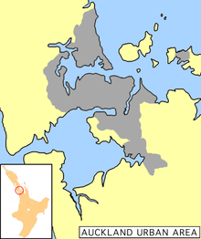
History of Auckland

The human history of the Auckland metropolitan area stretches from early Māori settlers in the 14th century to the first European explorers in the late 18th century, over a short stretch as the official capital of (European-settled) New Zealand in the middle of the 19th century to its current position as the fastest-growing and commercially dominating metropolis of the country.
Māori occupation
Pre-European occupation
Tāmaki Makau Rau ('Isthmus of one thousand lovers', also translated as 'Tamaki-the bride sought by a hundred suitors'),[1] now known as Auckland, was first settled by Māori people around 1350. The narrow Auckland isthmus was a strategic location with its two harbours providing access to the sea on both the west and east coasts. It also had fertile soils which facilitated horticulture and the two harbours provided plentiful kai moana (seafood). Māori constructed terraced pā (fortified villages) on the volcanic peaks. The Māori population in the region is estimated to have peaked at 20,000 in pre-European settlement times. Earthworks are still evident today around some of the larger volcanoes such as Mount Albert, Maungawhau and Maungakiekie.
Arrival of Europeans
Ngāti Whātua and Tainui were the main tribes living in the area when Europeans arrived, having captured it by conquest several generations previously. The arrival of Europeans in New Zealand changed the balance of power between iwi, as European settlement to the north enabled traditional rivals Ngāpuhi and allied northern iwi to acquire muskets by trade. Initially no military advantage accrued; despite lacking muskets, Ngāti Whātua defeated musket-equipped Ngāpuhi in the battle of Moremonui, killing 2,000. However once Ngāpuhi became skilled with muskets, they displaced Māori from the Auckland area in a series of campaigns over the 1820s.
Āpihai Te Kawau (c. 1790-1869), leader of the Ngāti Taou hapu, was a good friend of Samuel Marsden. Over a ten-month period in 1821-1822 he conducted a principal part in the 1,000-mile (1,600 km) Amiowhenua expedition. This series of battles raged through much of the central and southern North Island. It ended when Te Kawau's Ngāti Whātua forces, uniting with the Taranaki they were embattled with, jointly defended the Tainui Matakitaki pā from Hongi Hika's Ngāpuhi forces.
In January 1832, Joseph Brooks Weller, merchant of Otago and Sydney bought land, including the sites of the modern cities of Auckland and North Shore and part of Rodney District. This was part of a New Zealand-wide mercantile operation although this territory did not become settled or productive in the 1830s.
Europeans also brought new diseases (notably smallpox and tuberculosis) which, as elsewhere, lead to significant mortality and morbidity amongst immunologically naive Māori. The result was the Auckland isthmus remained a virtually vacated buffer zone between iwi, with a population probably under 500 in 1840.
As the Musket Wars drew to a close, pressure for British intervention to quell lawlessness, in large part driven by missionary pressure to protect the Māori, led to the annexation of New Zealand and the despatch of Lt Governor Hobson to sign the Treaty of Waitangi in 1840. (James Cook had claimed New Zealand for Britain by right of discovery, and it was part of New South Wales until 1840.[2])
By 1840 Te Kawau had become the paramount chief of Ngāti Whātua. Cautious of reprisals from the Ngāpuhi defeated at Matakitaki, Te Kawau found it most convenient to offer Governor Hobson land around the present central city. He and six other chiefs travelled to the Bay of Islands to make the offer and signed the Treaty of Waitangi on 20 March.[3]
As the Māori population declined for nearly a century, so did the quantity of land held by Ngāti Whātua. Within 20 years, 40% of their lands were lost, some through government land confiscation. At close to the lowest level of population, Ngāti Whātua land holding was reduced to a few acres at Orakei, land which Te Kawau had declared "a last stand". By the end of the 1840s, Māori were a minority in the Auckland area. Despite scares during the New Zealand wars, Māori re-emerged as a cultural and political force only after the Bastion Point occupation and Māori cultural revival of the late 20th century.[4][5]
Birth of the city
Capital of New Zealand

After the signing of the Treaty of Waitangi in February 1840 the new Governor of New Zealand, William Hobson, had the task of choosing a capital for the colony. At the time, the main European settlements were in the Bay of Islands and on the Otago Harbour in the South Island. However, the Bay of Islands' geographical position made it very remote, inaccessible and off-centre from the rest of the New Zealand archipelago and Hobson knew little about the South Island and its populations. Auckland was officially declared New Zealand's capital in 1841,[6] and the transfer of the administration from Russell in the Bay of Islands was completed in 1842.
Even in 1840 Port Nicholson (now Wellington Harbour) seemed the obvious choice for an administrative capital. Centrally situated at the south of the North Island, close to the South Island and growing fast, it had a lot to commend it. But the New Zealand Company and the Wakefield brothers had founded and continued to dominate Port Nicholson.
On the initial recommendation of the missionary Henry Williams, supported by the Surveyor General, Felton Mathew, and the offer of land from Ngāti Whātua, Hobson selected the south side of Waitematā Harbour as his future capital, while setting up a temporary capital at Okiato (also known now as Old Russell) in the Bay of Islands. The Chief Magistrate, Captain William Cornwallis Symonds, soon purchased the further land from Ngāti Whātua, The sale price for the initial 3,000 acres (12 km2) was for cash and goods to the value of £341.
Ngāti Whātua would certainly have expected from British colonialism increased security and trading benefits. This would include greater access via the quickly developed port facilities for the lucrative trade in produce grown in Tainui's fertile Waikato and Hauraki Plains for the Australian prison colonies and Sydney market.
Hobson's barque, the Anna Watson, arrived in Auckland Harbour on 15 September 1840. By coincidence, three days before the Platina had arrived looking for Hobson. This ship carried 130 colonists and a prefabricated Governor's residence, which was similar to the house built to house Napoleon Bonaparte on St Helena during his exile [although he actually refused to move into it].
A foundation ceremony took place at 1:00 pm on 18 September 1840, probably on the higher ground at the top end of present-day Queen Street. Hobson named the new settlement in honour of George Eden, 1st Earl of Auckland, a patron and his friend. The New Zealand Government Gazette announced royal approval of the name on 26 November 1842.
From the outset a steady flow of new arrivals from within New Zealand and from overseas came to the new capital. The first European settlers in Auckland, William Brown and Logan Campbell, had arrived a month earlier on a hunch about Hobson's intentions and bought Browns Island. Soon after Hobson founded Auckland, they built the city's first house, Acacia Cottage, which can still be seen on the side of One Tree Hill, in the park that Campbell donated to the city in his old age.
Initially settlers from New South Wales predominated. Amongst the first settlers were some Catholics and in 1841 they established a school for boys, which was Auckland's first school of any sort.[7][8][9] The Anglicans started Auckland's first church in 1841.[10]
The first immigrant ships sailing directly from Britain started to arrive as early as 1842. From early times the eastern side of the settlement remained reserved for government officials while mechanics and artisans, the so-called "unofficial" settlers, congregated on the western side, in areas like Freemans Bay. This social division still persists somewhat in modern Auckland, with the eastern suburbs generally being more upscale. Sir George Grey was determined that the capital would not be attacked, as the first capital Russell had been. Between 1847 and 1852 large numbers of retired British soldiers,called fencibles, and their families came to Auckland to create a ring of outlying villages to protect the capital. Each soldier had to be under 48 and of good character. The fencibles made new villages at Howick Panmure, Otahuhu and Onehunga. They exercised for 12 days per year and mustered for a church parade, fully equipped in military attire, each Sunday. 681 fencibles arrived in 10 ships over 5 years. In addition in 1849 Grey sold land in Mangere to the leading Maori chief Te Wherowhero and 149 members of the Ngati Mahuta tribe from Tamahere in the Waikato. They were employed on the same basis as the British fencibles. They had British officers but supplied their own arms. In April 1851 a large group of 350-450 Ngati Paoa from Thames arrived to attack Auckland in some 20 waka. By the time they landed at Mechanics Bay, Auckland, a British regiment had been called out to defend the city. The Onehunga fencibles were marched to the city as reinforcements and all the other fencible forces were alerted and stood to arms at their villages. HMS Fly went to Mechanics Bay and trained its guns on the Ngati Paoa. The reason for the attack was the arrest of a Ngati Paoa chief for stealing a shift at a Shortland St shop. After negotiation Ngato Paoa were given some tobacco and they left. Later they gave Grey a greenstone Mere to signal their acceptance of his authority.[11] Auckland was the seat of Auckland Province from 1853 until the abolition of provinces in 1876.
Loss of capital status
Eventually in 1865, Port Nicholson became the capital and, now known as Wellington, remains so today. The advantages of a central position became even more obvious as the South Island grew in prosperity with the discovery of gold in Otago, and with the development of sheep farming and refrigeration, especially refrigerated ships which allowed chilled meat to be safely shipped to Britain. Parliament met for the first time in Wellington in 1862. In 1868 Government House in Wellington became the primary residence of the Governor although moves to dispense with one in Auckland have never succeeded, in fact for a while the Government maintained a third residence in Christchurch. The return of the Vice-regal household to Auckland was regarded as the start of the Social Season in Auckland and until the turn of the 20th century marked by a parade from the dockside up Queen Street to Government House.
Aucklanders reacted to the loss of the status of Capital by a campaign of redevelopment and rebuilding; including the replacement third Government House, built in 1856 in an attempt to retain the status. The house was in use until 1962 when the fourth Government House in Mt Eden was established.[12] Money was flowing into the city from the goldfields in the Coromandel and resulted in the construction of several public buildings and facilities. Throughout the latter part of the 19th century Auckland continued to have a major part to play in the cultural landscape of the country. This was largely due to it continuing to be a major Port and in particular the location of the Devonport Naval Base; both the 1902 Royal Tour and especially the 1908 visit by the American Fleet underscored this status. Prior to the opening of the Panama Canal the sea route from Britain was via South Africa and Australia, the opening of the Canal in 1914 altered this and Auckland's Port became one of the most important features of the New Zealand economy.
Growth of the city

Auckland formed a base for Governor George Grey's operations against the Māori King Movement in the early 1860s. Grey's modus operandi involved opening up the Waikato and King Country by building roads, most notably Great South Road (a large part of which now forms State Highway 1). This enabled rapid movement, not only of soldiers, but also civilian settlers. It also enabled the extension of Pākehā influence and law to the South Auckland region. Auckland grew fairly rapidly, from 1,500 in 1841 to 12,423 by 1864, with most growth occurring in close proximity to the port area in Commercial Bay, as well as some small developments towards Onehunga (another port), and at a few favoured spots beside the harbour. During the mid 19th century, European settlement of New Zealand was predominantly in the South Island. Auckland however gradually became the commercial capital. Market gardens were planted on the outskirts, while kauri tree logging and gum digging, mainly by Thomas Henderson, opened up the Waitakere Ranges.
Throughout the 19th century Auckland’s intense urban growth concentrated around the port in a very similar manner to most other mercantile cities. At this time Auckland experienced many of the pollution and overcrowding problems that plagued other 19th century cities, although as primarily a port rather than a manufacturing centre it avoided large-scale industrialisation, and by 1900, Auckland was the largest New Zealand city. The overcrowding of the inner city had by then created a strong demand for the city to expand, which was made possible when trams appeared in New Zealand around this time, supported by ferry services, mostly to what would become North Shore City.
A Russian scare at the end of the 19th century had caused coastal guns to be bought and fortifications built, notably at North Head and on Waiheke Island, where they can still be seen.
Twentieth century
New transport and urban sprawl
While trams and railway lines shaped Auckland's rapid extension in the early first half of the 20th century, they were soon overtaken by motor vehicles, with Auckland boasting one of the highest car-ownership rates of the world even before World War II. Their growing popularity meant that urban development was freed from narrow corridors, and could occur anywhere new roads were built, leading to a rapid decentralisation, with urban growth spreading all over the isthmus. In 1959 the new Auckland Harbour Bridge linked North Shore with the city, further extending its reach.
In World War II the city was overflown by a Japanese seaplane, chased ineffectually by a Royal New Zealand Air Force De Havilland Tiger Moth. Again, coastal fortifications were built or extended, with a large military base on Rangitoto Island storing mines supposed to block the inner Hauraki Gulf in the event of an impending Japanese invasion, which never eventuated.
Following the initiative of Michael Joseph Savage's New Zealand Labour Party large numbers of state houses were constructed through the late 1930s, '40s and '50s, usually on quarter-acre (1,000 m²) sections — a tradition that survives despite frequent subdivision. To this day, a large percentage of the houses in Auckland only have one full story. Due to these factors, Auckland is a largely suburban city.
1985 Rainbow Warrior bombing
The Greenpeace flagship craft, the Rainbow Warrior, was docked in the Port of Auckland in July 1985 awaiting departure to lead a flotilla of yachts protesting against French nuclear testing at Mururoa Atoll in the Tuamotu Archipelago of French Polynesia. Just before midnight NZST on 10 July 1985, two explosive devices attached to the hull by operatives of the French intelligence service (DGSE) were detonated, creating a gaping hole in the side of the vessel. The ship began to sink rapidly, the crew were evacuated but one crew member, Fernando Pereira, drowned on the sinking ship. Two of the French agents were subsequently arrested by the New Zealand Police on passport fraud and immigration charges.
Problems in infrastructure
In 1993, the Police Eagle helicopter and a traffic-spotting plane collided in mid-air, falling to the packed motorway below during Friday night rush hour. Four people died and traffic became grid-locked over much of the inner city.[13]
All four electrical power cables supplying the Central Business District failed on 20 February 1998, causing the 1998 Auckland power crisis. It took five weeks before an emergency overhead cable was completed to restore the power supply to the Central Business District. For much of that time, about 60,000 of the 74,000 people who worked in the area worked from home or from relocated offices in the suburbs. Many of the 6,000 apartment dwellers in the area had to find alternative accommodation. Mercury Energy, operators of the cable that failed, had to spend many millions of dollars on the temporary cable, and compensation for local businesses.
The 2006 Auckland Blackout showcased the fact that Auckland's power-supply infrastructure is still very vulnerable to disruption. A faulty powerline shackle caused a short-circuit at the Otahuhu substation, with the blackout affecting wide parts of the conurbation, including the CBD, but sparing most of Waitakere City and North Shore City. While the blackout lasted only about half a day, it reignited political pressure aiming to improve the national electricity grid.
See also
References
- ↑ Historical Context (from the Auckland City Council website, Victoria Park Management Plan)
- ↑ See History of New Zealand.
- ↑ Te Kawau, Apihai (from Te Ara: The Encyclopaedia of New Zealand, 1966)
- ↑ Ngati Whatua (from Te Ara: The Encyclopaedia of New Zealand, 1966)
- ↑ Ngāti Whātua history (from the Auckland City Council website)
- ↑ Russell Stone (2002). From Tamaki-Makau-Rau to Auckland. University of Auckland Press. ISBN 1-86940-259-6.
- ↑ A. G Butchers, Young New Zealand, Coulls Somerville Wilkie Ltd, Dunedin, 1929, pp. 124 - 126.
- ↑ Auckland's First Catholic School - And its Latest", Zealandia, Thursday, 26 January 1939, p. 5
- ↑ E.R. Simmons, In Cruce Salus, A History of the Diocese of Auckland 1848 - 1980, Catholic Publication Centre, Auckland 1982, pp. 53 and 54.
- ↑ "St Paul's Church (Anglican)". New Zealand Historic Places Trust. Retrieved 17 January 2015.
- ↑ The Royal New Zealand Fencibles 1847-1852.R. Alexander. G Gibson. A. LaRoche. Deed. Waiuku .1997.pp717,108,64,71,80,110
- ↑ "Other Government Houses". Retrieved 14 December 2013.
- ↑ "Our History - Responses". Auckland Operational Support.
Further reading
- "Auckland City", Brett's New Zealand and South Pacific Pilot, Auckland, N.Z: Printed by H. Brett, 1880
- "Auckland", New Zealand Handbook (14th ed.), London: E. Stanford, 1879
- "Auckland", Pictorial New Zealand, London: Cassell and Co., 1895, OCLC 8587586
- "Auckland", New Zealand as a Tourist and Health Resort, Auckland: T. Cook & Son, 1902, OCLC 18158487
- "Auckland", The Encyclopaedia Britannica (11th ed.), New York: Encyclopaedia Britannica, 1910, OCLC 14782424
- C. N. Baeyertz (1912), "Auckland", Guide to New Zealand, Wellington: New Zealand Times Co., OCLC 5747830
- John Barr (1922), The city of Auckland, New Zealand, 1840-1920, Auckland: Whitcombe & Tombs