Hirakud Dam
| Hirakud Dam | |
|---|---|
 Floodgates of Hirakud Dam | |
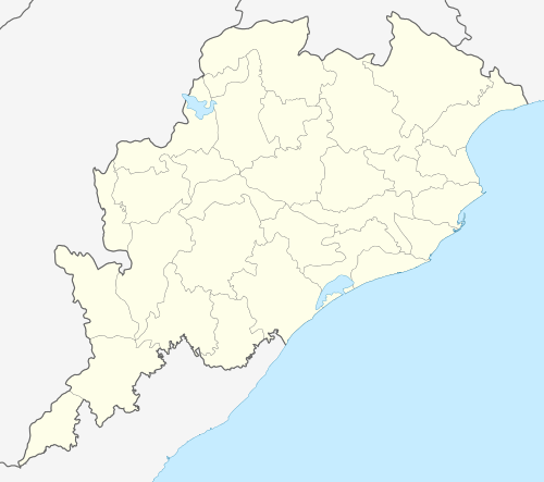 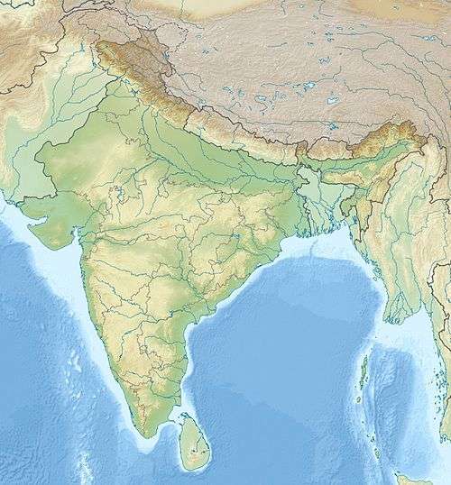 Location of Hirakud Dam in India Odisha#India | |
| Official name | Hirakud dam |
| Location | 15 km from Sambalpur, Odisha |
| Coordinates | 21°34′N 83°52′E / 21.57°N 83.87°ECoordinates: 21°34′N 83°52′E / 21.57°N 83.87°E |
| Construction began | 1948 |
| Opening date | 1957 |
| Construction cost | 1.01 billion Rs in 1957 |
| Dam and spillways | |
| Type of dam | Composite Dam and Reservoir |
| Impounds | Mahanadi River |
| Height | 60.96 m (200 ft) |
| Length |
4.8 km (3 mi) (main section) 25.8 km (16 mi) (entire dam) |
| Spillways | 64 sluice-gates, 34 crest-gates |
| Spillway capacity | 42,450 cubic metres per second (1,499,000 cu ft/s) |
| Reservoir | |
| Total capacity | 5,896,000,000 m3 (4,779,965 acre·ft) |
| Catchment area | 83,400 km2 (32,201 sq mi) |
| Power station | |
| Turbines |
Power House I (Burla): 2 x 49.5 MW , 3 x 37.5 MW, 2 x 32 MW Kaplan-type Power House II (Chiplima): 3 x 24 MW[1] |
| Installed capacity | 347.5 MW[1] |
Hirakud Dam (Odia: ହୀରାକୁଦ ବନ୍ଧ) is built across the Mahanadi River, about 15 km from Sambalpur in the state of Odisha in India. Behind the dam extends a lake, Hirakud Reservoir, 55 km long. It is one of the first major multipurpose river valley projects started after India's independence. [sambalpur,odisha]
Construction history
Before the devastating floods of 1936, Sir M. Visveswararya proposed a detailed investigation for storage reservoirs in the Mahanadi basin to tackle the problem of floods in the Mahanadi delta. In 1945, under the chairmanship of Dr. B. R. Ambedkar, the Member of Labour, it was decided to invest in the potential benefits of controlling the Mahanadi for multi-purpose use. The Central Waterways, Irrigation and Navigation Commission took up the work.[2] On 15 Mar 1946, Sir Hawthrone Lewis, the Governor of Odisha, laid the foundation stone of the Hirakud Dam. A project report was submitted to the government in June 1947. Pandit Jawaharlal Nehru laid the first batch of concrete on 12 April 1948. The dam was completed in 1953 and was formally inaugurated by Prime Minister Jawaharlal Nehru on 13 January 1957. The total cost of the project was Rs.1000.2 millions in 1957. Power generation along with agricultural irrigation started in 1956, achieving full potential in 1966.[2]
Technical details


- Length Total = 25.79 Kilometers [2]
- Length = 4.8 Kilometers [2]
- Artificial Lake = 743 Sq. Kilometers [2]
- Irrigated Area (both crop) = 235477 Hectares [2]
- Area lost in construction of Dam = 147,363 acres (596.36 km2) [2]
- Power Generation = 347.5 MW(Installed capacity) [2]
- Cost = Rs.1000.2 million (in 1957) [2]
- Top dam level = R.L 195.680 Mtr [2]
- F.R.L/ M.W.L = R.L 192.024 Mtr [2]
- Dead storage level = R.L 179.830 Mtr [2]
- Total quantity of earth work in Dam = 18,100,000 m³ [2]
- Total quantity of concrete = 1,070,000 m³ [2]
- Catchment = 83400 Sq. Kilometers [2]
Structure
The Hirakud Dam is a composite structure of earth, concrete and masonry. 10 km (6 mi) north of Sambalpur, it is the longest major earthen dam in India, measuring 25.8 km (16 mi) including dykes, and stands across the river Mahanadi. The main dam has an overall length of 4.8 km (3 mi)[2] spanning between two hills; the Lamdungri on the left and the Chandili Dunguri on the right. The dam is flanked by 21 km (13 mi) of earthen dykes on both the left and right sides, closing the low saddles beyond the adjoining hills. The dam and dykes together measure 25.8 km (16 mi).[2] It also forms the biggest artificial lake in India, with a reservoir holding 743 km2 (287 sq mi) at full capacity, with a shoreline of over 639 km (397 mi). There are two observation towers on the dam one at each side. One is "Gandhi Minar" and the other one is"Nehru Minar". Both the observation towers present breathtaking views of the lake.
Power houses
The dam supports two different hydroelectric power houses. Power House I is located at the base (toe) of the main dam section and contains 3 x 37.5 MW Kaplan turbine and 2 x 24 MW Francis turbine generators for an installed capacity of 259.5 MW. Power Station II is located 19 km (12 mi) southeast of the dam 21°21′10″N 83°55′00″E / 21.35278°N 83.91667°E at Chipilima. It contains 3 x 24 MW generators. The entire installed capacity of the dam's power houses is 307.5 MW. Power House I and II were built in three stages. During stage I, four generators were installed at PH I and in stage II, the power channel two and Power House II was constructed. All three generators were installed at PH II along with two more at PH I by 1963. Between 1982 and 1990, the seventh and final generator was installed at PH I.[1]
Purpose


In the upper drainage basin of the Mahanadi River, centered on the Chhattisgarh Plain, periodic droughts contrast with the situation in the lower delta region where floods may damage crops. The dam was constructed to help alleviate these problems by creating a reservoir and controlling river flow through the drainage system. The dam regulates the flow of the Mahanadi River and produces hydroelectricity through several hydroelectric plants.[3]
The dam helps control floods in the Mahanadi delta and irrigates 75,000 square kilometres of land. Hydroelectricity is also generated. The Hirakud Dam regulates 83,400 km² (32,200 mi²) of Mahanadi's drainage. The reservoir has a storage capacity of 5.818 km³ with gross of 8.136 km³.[2]
It drains an area of 133,090 km², more than twice the area of Sri Lanka. The amount of earth, concrete and masonry materials used to build the dam is sufficient to make a road 8 metres wide and pave it from Kanyakumari to Kashmir and from Amritsar to Dibrugarh in Assam. With successful irrigation provided by the dam, Sambalpur is called the rice bowl of Odisha.
The project provides 1,556 km² of kharif and 1,084 km² of rabi irrigation in districts of Sambalpur, Bargarh, Bolangir, and Subarnpur. The water released by the power plant irrigates another 4360 km² of CCA in Mahanadi delta. The dam can generate up to 307.5 MW of electrical power through its two power plants at Burla, on the dam's right bank and Chiplima, 22 km downstream from the dam. In addition, the project provides flood protection to 9500 km² of delta area in district of Cuttack and Puri.
Chiplima has gained prominence as the second hydroelectric project of the Hirakud Dam. A natural fall of 80 to 120 feet (25 to 40 m) in the river Mahanadi is used to generate electricity. The place is mostly inhabited by fishermen, whose deity Ghanteswari is very popular in the neighbouring area. The State Livestock Breeding Farm and Agricultural Farm are located here.
Canal System
Hirakud Dam has three canals, namely Bargarh Main Canal, Sason Canal and Sambalpur Canal. Bargarh Main canal has a water discharge rate of 4000 cusecs.
Industrial Use
Water from Hirakud Dam at a later stage was allocated to various industries, primarily for mineral processing and coal fired thermal power plants in Jharsuguda and Sambalpur districts.[4]
Siltation
As per statistics published by the dam authority, water holding capacity of the dam has been reduced by 28% due to siltation. [5]
Water Conflict
The major conflict for water was reported when over 30,000 farmers gathered around the dam making human chain, protesting the allocation of water to the industries and there was no water for the canal system due to low water level. [6]
Inter-basin Water Transfer
There has been plans for inter-basin water transfer, as per plans of the water resource dept of Odisha as part of India's ambitious Indian Rivers Inter-link.
Lost temples
These are remnants of temples submerged after the dam was completed in 1957. In the summer season, the receding water of the dam makes the structures become visible. The hidden treasures have finally caught the attention of historians, and steps are being taken to understand the historical significance of these temples, which periodically go under water, only to resurface again. Many temples have been destroyed after 58 years of underwater existence. However, some remain intact.[7][8]
Interest in these lost temples has been rekindled after two stones, etched with writing ('Shila Lekha'), were recovered from what is believed to be the Padmaseni temple of submerged Padmapur village.[9] The temples located inside the reservoir area were part of the then Padmapur, one of the oldest and most populous in the region prior to the dam construction.[7] More than 200 temples were submerged by the dam, nearly 150 temples have either perished or are underwater and about 50 are visible during summer. The lost temples present excellent opportunities for scuba diving enthusiasts to explore the underbelly of Hirakud Dam. The temple are visible to visitors on boat only during the summer months of May and June.
Cattle Island

Cattle Island is located in one of the extreme points of Hirakud Reservoir, a natural wonder. Completely inhabited by wild cattle, without any trace of humans. It is near Kumarbandh village of Belpahar-Banharpali range which is about 90 km from Sambalpur. It can be reached by launch from Hirakud Dam, it is closer by 10 km via the river. The island is a submerged hill, and before the construction of Hirakud Dam it was a developed village. During the resettlement period, villagers left some of their cattle behind; when the dam construction was over, the cattle settled on the hilltop. With the passage of time the nearby area filled up with the reservoir water, turning the hilltop into an island. Being away from mankind, the cattle are now wild, very swift and not easily caught. Living on a hilltop with dense forest, they are larger than tame cattle, almost all of which are white in colour. Nearby residents attempt to capture these animals from time to time, but these hunts are rarely successful. Though descended from tame cattle, these animals provide a contrasting picture of this breed of animal returning to life in the wild.[10]
Wildlife
The dam with the channel provides an ideal environment for the wildlife. The Debrigarh wildlife sanctuary is located here.[11] Several species of migratory birds visit the reservoir during winter. Nearly 20-25 species of birds are seen in the reservoir and common among them are common pochard, red-crested pochard, great crested grebe and several others.[12]
People affected by the dam construction
The main purpose of the Hirakud Dam was to check the massive floods that were affecting a large part of coastal Odisha. But, the construction of the dam greatly affected the natives of the western part of Odisha. Nearly 150,000 people were affected by the Hirakud project and nearly 22,000 families were displaced.
In the original estimate, an amount of Rs120 million was provided for payment of compensation to the affected people. After revision, the amount was reduced to Rs95 million and the total compensation paid to the people was, in reality, only Rs33.2 million. A large number of families were evacuated from their hearth and homes without compensation from 1956 onwards.[13]
Stamps and notes
A commemorative stamp on Hirakud Dam was released on 29 Oct 1979 by the Department of Posts, with denomination Rs 0.30, 30,00,000 stamps issued.[14] A hundred rupee note was issued on 26 December 1960 by RBI Governor H.V.R. Iyengar. The size of this note is 109x172 mm. On the back side of this note there are thirteen regional languages along with an image of the Hirakud Dam and Hydro-Electric station.


See also
References
- 1 2 3 "Hirakud Power System". Odisha Hydro Power Corporation. Retrieved 3 March 2011.
- 1 2 3 4 5 6 7 8 9 10 11 12 13 14 15 16 17 18 Hirakud Dam
- ↑ "Mahanadi River". Retrieved 2006-09-22.
- ↑ http://webcache.googleusercontent.com/search?q=cache:QJyqeniT9B0J:infochangeindia.org/water-resources/features/industry-vs-agriculture-the-battle-over-water-in-hirakud.html%3FItemid%3D+&cd=5&hl=en&ct=clnk
- ↑ http://www.telegraphindia.com/1160809/jsp/frontpage/story_101435.jsp#.V8I5K_l96Hs
- ↑ http://www.downtoearth.org.in/coverage/30000-farmers-demand-hirakud-dam-water--7037
- 1 2 http://timesofindia.indiatimes.com/City/Bhubaneswar/Temples-resurface-in-Hirakud-bed/articleshow/38304307.cms
- ↑ http://kddfonline.com/category/agriculture-and-irrigation/hirakud/
- ↑ http://odishasuntimes.com/65966/ancient-rock-edicts-discovered-odisha/
- ↑ Cattle Island
- ↑ Debrigarh wildlife sanctuary
- ↑ Migratory birds in Hirakud
- ↑ Hirakud dam: Displaced families seek rehabilitation
- ↑ http://www.indianpost.com/viewstamp.php/Alpha/H/HIRAKUND%20DAM
http://www.hirakuddam.com/places-to-go/
External links
| Governance |
|  |
|---|---|---|
| Topics | ||
| GI Products | ||
| Districts | ||
| Cities | ||