Himachal Pradesh
| Himachal Pradesh (हिमाचल प्रदेश) | ||
|---|---|---|
| State | ||
| ||
 Location in India | ||
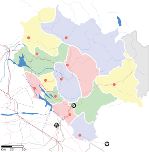 State map | ||
| Coordinates (Shimla): 31°6′12″N 77°10′20″E / 31.10333°N 77.17222°ECoordinates: 31°6′12″N 77°10′20″E / 31.10333°N 77.17222°E | ||
| Country |
| |
| Formation | 25 January 1971† | |
| Capital | Shimla | |
| Largest city | Shimla | |
| Districts | 12 | |
| Government | ||
| • Governor | Acharya Dev Vrat[1] | |
| • Chief Justice | Justice Mansoor Ahmad Mir | |
| • Chief Minister | Virbhadra Singh[2] (INC) | |
| • Legislature | Unicameral[3] (68 seats) | |
| • Parliamentary constituency | 4 | |
| Area | ||
| • Total | 55,673 km2 (21,495 sq mi) | |
| Area rank | 18th[4] | |
| Elevation | 2,319 m (7,608 ft) | |
| Population (2011) | ||
| • Total | 6,864,602[5] | |
| • Rank | 21st | |
| • Density | 123/km2 (320/sq mi) | |
| Languages | ||
| • Official(s) | Hindi, English[6] | |
| • Regional | Pahari[6] | |
| Time zone | IST (UTC+05:30) | |
| ISO 3166 code | IN-HP | |
| HDI |
| |
| HDI rank | 3rd (2011) | |
| Literacy | 82.80%[5] | |
| Website | himachal.nic.in | |
| † It was elevated to the status of State by the State of Himachal Pradesh Act, 1970 | ||
Himachal Pradesh ([ɦɪmaːtʃəl prəd̪eːʃ]; literally "Snow-laden Province") is a state of India located in Northern India. It is bordered by Jammu and Kashmir on the north, Punjab and Chandigarh on the west, Haryana on the south-west, Uttarakhand on the south-east and by the Tibet Autonomous Region on the east. Hima means snow in Sanskrit, and the literal meaning of the state’s name is "in the lap of the Himalayas." It was named by Acharya Diwakar Datt Sharma, one of the most eminent Sanskrit scholars of Himachal Pradesh.[7]
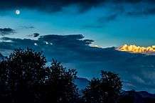
Himachal Pradesh is famous for its natural beauty, hill stations, and temples.[8] Himachal Pradesh has been ranked fifteenth in the list of the highest per capita incomes of Indian states and union territories for year 2013-14.[9] Many perennial rivers flow in the state, and numerous hydroelectric projects set up. Himachal produces surplus hydroelectricity and sells it to other states such as Delhi, Punjab, and Rajasthan.[10] Hydroelectric power projects, tourism, and agriculture form important parts of the state's economy.[10]
The state has several valleys,[11] and more than 90% of the population living in rural areas.[12] Practically all houses have a toilet and 100% hygiene has been achieved in the state.[13] The villages have good connectivity with roads, public health centres, and now with high-speed broadband.
Shimla district has maximum urban population of 25%. It has incorporated environmental protection and tourism development has been aided with a government ban on the use of polyethylene bags, reducing litter, and tobacco products, to aid people's health.[14] According to a 2005 Transparency International survey, Himachal Pradesh was ranked the second-least corrupt state in the country, after Kerala.[15]
History
The history of the area that now constitutes Himachal Pradesh dates to the Indus valley civilisation that flourished between 2250 and 1750 BCE.[16] Tribes such as the Koili, Hali, Dagi, Dhaugri, Dasa, Khasa, Kinnar, and Kirat inhabited the region from the prehistoric era.[17]
During the Vedic period, several small republics known as Janapada existed which were later conquered by the Gupta Empire. After a brief period of supremacy by King Harshavardhana, the region was divided into several local powers headed by chieftains, including some Rajput principalities. These kingdoms enjoyed a large degree of independence and were invaded by Delhi Sultanate a number of times.[16] Mahmud Ghaznavi conquered Kangra at the beginning of the 10th century. Timur and Sikander Lodi also marched through the lower hills of the state and captured a number of forts and fought many battles.[16] Several hill states acknowledged Mughal suzerainty and paid regular tribute to the Mughals.[18]
The Gurkha people, a martial tribe, came to power in Nepal in the year 1768.[16] They consolidated their military power and began to expand their territory.[16] Gradually, the Gorkhas annexed Sirmour and Shimla. Under the leadership of Amar Singh Thapa, the Gurkha laid siege to Kangra. They managed to defeat Sansar Chand Katoch, the ruler of Kangra, in 1806 with the help of many provincial chiefs. However, the Gurkha could not capture Kangra fort which came under Maharaja Ranjeet Singh in 1809. After the defeat, the Gurkha began to expand towards the south of the state. However, Raja Ram Singh, Raja of Siba State, captured the fort of Siba from the remnants of Lahore Darbar in Samvat 1846,[16] during the First Anglo-Sikh War.
They came into direct conflict with the British along the tarai belt after which the British expelled them from the provinces of the Satluj.[16] The British gradually emerged as the paramount power in the region.[16] In the revolt of 1857, or first Indian war of independence, arising from a number of grievances against the British,[16] the people of the hill states were not as politically active as were those in other parts of the country.[16] They and their rulers, with the exception of Bushahr, remained more or less inactive.[16] Some, including the rulers of Chamba, Bilaspur, Bhagal and Dhami, rendered help to the British government during the revolt.

The British territories came under the British Crown after Queen Victoria's proclamation of 1858. The states of Chamba, Mandi and Bilaspur made good progress in many fields during the British rule.[16] During World War I, virtually all rulers of the hill states remained loyal and contributed to the British war effort, both in the form of men and materials. Among these were the states of Kangra, Jaswan, Datarpur, Guler, Nurpur, Chamba, Suket, Mandi, and Bilaspur.[16]
After independence, the Chief Commissioner's Province of H.P. was organized on 15 April 1948 as a result of integration of 28 petty princely states (including feudal princes and zaildars) in the promontories of the western Himalaya. These were known as the Simla Hills States and four Punjab southern hill states under the Himachal Pradesh (Administration) Order, 1948 under Sections 3 and 4 of the Extra-Provincial Jurisdiction Act, 1947 (later renamed as the Foreign Jurisdiction Act, 1947 vide A.O. of 1950). The State of Bilaspur was merged into Himachal Pradesh on 1 April 1954 by the Himachal Pradesh and Bilaspur (New State) Act, 1954.
Himachal became a part C state on 26 January 1950 with the implementation of the Constitution of India and the Lieutenant Governor was appointed. The Legislative Assembly was elected in 1952. Himachal Pradesh became a union territory on 1 November 1956.[16] Some areas of Punjab State—namely Simla, Kangra, Kulu and Lahul and Spiti Districts, Nalagarh tehsil of Ambala District, Lohara, Amb and Una kanungo circles, some area of Santokhgarh kanungo circle and some other specified area of Una tehsil of Hoshiarpur District, besides some parts of Dhar Kalan Kanungo circle of Pathankot tehsil of Gurdaspur District—were merged with Himachal Pradesh on 1 November 1966 on enactment by Parliament of Punjab Reorganisation Act, 1966. On 18 December 1970, the State of Himachal Pradesh Act was passed by Parliament, and the new state came into being on 25 January 1971. Himachal was the 18th state of the Indian Union.[16]
Geography and climate
Himachal is in the western Himalayas. Covering an area of 55,673 square kilometres (21,495 sq mi),[4] it is a mountainous state. Most of the state lies on the foothills of the Dhauladhar Range. At 6,816 m Reo Purgyil is the highest mountain peak in the state of Himachal Pradesh.[19]
The drainage system of Himachal is composed both of rivers and glaciers. Himalayan rivers criss-cross the entire mountain chain. Himachal Pradesh provides water to both the Indus and Ganges basins.[20] The drainage systems of the region are the Chandra Bhaga or the Chenab, the Ravi, the Beas, the Sutlej, and the Yamuna. These rivers are perennial and are fed by snow and rainfall. They are protected by an extensive cover of natural vegetation.[20]
Due to extreme variation in elevation, great variation occurs in the climatic conditions of Himachal . The climate varies from hot and subhumid tropical in the southern tracts to, with more elevation, cold, alpine, and glacial in the northern and eastern mountain ranges.[21] The state has areas like Dharamsala that receive very heavy rainfall, as well as those like Lahaul and Spiti that are cold and almost rainless. Broadly, Himachal experiences three seasons: summer, winter, and rainy season. Summer lasts from mid-April till the end of June and most parts become very hot (except in the alpine zone which experiences a mild summer) with the average temperature ranging from 28 to 32 °C (82 to 90 °F). Winter lasts from late November till mid March. Snowfall is common in alpine tracts (generally above 2,200 metres (7,218 ft) i.e. in the higher and trans-Himalayan region).
Flora and fauna


According to 2003 Forest Survey of India report, legally defined forest areas constitute 66.52% of the area of Himachal Pradesh.[22] Vegetation in the state is dictated by elevation and precipitation. The state endows with a high diversity of medicinal and aromatic plants.[23] Lahaul-Spiti region of the state, being a cold desert, supports unique plants of medicinal value including Ferula jaeschkeana, Hyoscyamus Niger, Lancea tibetica, and Saussurea bracteata.[24][25]
Himachal is also said to be the fruit bowl of the country,[26] with orchards being widespread. Meadows and pastures are also seen clinging to steep slopes. After the winter season, the hillsides and orchards bloom with wild flowers, while gladiolas, carnations, marigolds,[27] roses, chrysanthemums, tulips and lilies are carefully cultivated. The state government is gearing up to make Himachal Pradesh as the flower basket of the world.
Himachal Pradesh has around 463 bird[28] 77 mammalian, 44 reptile and 80 fish species.[29] Great Himalayan National Park, a UNESCO World Heritage Site and Pin Valley National Park are the national Parks located in the state.[29][30] The state also has 30 wildlife sanctuaries and 3 conservation reserves.[30]
Government
The Legislative Assembly of Himachal Pradesh has no pre-Constitution history. The State itself is a post-Independence creation. It came into being as a centrally administered territory on 15 April 1948 from the integration of thirty erstwhile princely states.[31]
Himachal Pradesh is governed through a parliamentary system of representative democracy, a feature the state shares with other Indian states. Universal suffrage is granted to residents. The legislature consists of elected members and special office bearers such as the Speaker and the Deputy Speaker who are elected by the members. Assembly meetings are presided over by the Speaker or the Deputy Speaker in the Speaker's absence. The judiciary is composed of the Himachal Pradesh High Court and a system of lower courts. Executive authority is vested in the Council of Ministers headed by the Chief Minister, although the titular head of government is the Governor. The Governor is the head of state appointed by the President of India. The leader of the party or coalition with a majority in the Legislative Assembly is appointed as the Chief Minister by the Governor, and the Council of Ministers are appointed by the Governor on the advice of the Chief Minister. The Council of Ministers reports to the Legislative Assembly. The Assembly is unicameral with 68 Members of the Legislative Assembly (MLA).[32] Terms of office run for 5 years, unless the Assembly is dissolved prior to the completion of the term. Auxiliary authorities known as panchayats, for which local body elections are regularly held, govern local affairs.
In the assembly elections held in November 2012, the Congress secured an absolute majority.[33] The Congress won 36 of the 68 seats while the BJP won only 26 of the 68 seats. Virbhadra Singh was sworn-in as Himachal Pradesh's Chief Minister for a record sixth term in Shimla on 25 December 2012. Virbhadra Singh who has held the top office in Himachal five times in the past, was administered the oath of office and secrecy by Governor Urmila Singh at an open ceremony at the historic Ridge Maidan in Shimla.[34]
Administrative Divisions
The state of Himachal Pradesh is divided into 12 districts[35] which are grouped into three divisions, Shimla, Kangra and Mandi.[36] The districts are further divided into 62 subdivisions, 78 blocks and 149 Tehsils.[35]
| Divisions | Districts[37] |
|---|---|
| Kangra | Chamba, Kangra, Una |
| Mandi | Bilaspur, Hamirpur, Kullu, Lahaul and Spiti, Mandi |
| Shimla | Kinnaur, Shimla, Sirmaur, Solan |
| Administrative Structure | |
|---|---|
| Districts | 12 |
| Divisions | 3 |
| Sub-Divisions | 62 |
| Blocks | 78 |
| Tehsils | 149 |
| Urban Local Bodies | 49 |
| Towns | 59 |
| Gram Panchayats | 3226 |
| Villages | 20690 |
| Police Stations | 125 |
| Lok Sabha Seats | 4 |
| Rajya Sabha Seats | 3 |
| Assembly Constituencies | 68 |
Economy
| Year | Gross State Domestic Product |
|---|---|
| 1980 | 794 |
| 1985 | 1,372 |
| 1990 | 2,815 |
| 1995 | 6,698 |
| 2000 | 13,590 |
| 2005 | 23,024 |
| 2007 | 25,435 |
| 2010 | 57,452 |
| 2013 | 82,585 |
| 2016 | 110,511[38] |
The era of planning in Himachal Pradesh started in 1948 along with the rest of India. The first five-year plan allocated ₹52.7 million to Himachal. More than 50% of this expenditure was incurred on road construction since it was felt that without proper transport facilities, the process of planning and development could not be carried to the people, who mostly lived an isolated existence in faraway areas. Himachal now ranks fourth in per capita income among the states of the Indian Union.
Agriculture contributes over 45% to the net state domestic product. It is the main source of income and employment in Himachal. Over 93% of the population in Himachal depends directly upon agriculture, which provides direct employment to 71% of its people. The main cereals grown are wheat, maize, rice and barley.[39] Apple is the principal cash crop of the state grown principally in the districts of Shimla, Kinnaur, Kullu, Mandi, Chamba and some parts of Sirmaur and Lahaul-Spiti with an average annual production of 5 lakh tonnes and per hectare production of 8 to 10 tonnes.[40] The apple cultivation constitute 49 per cent of the total area under fruit crops and 85% of total fruit production in the state with an estimated economy of ₹3500 crore.[40] Apples from Himachal are exported to other Indian states and even other countries.[41][42] In 2011-12, the total area under apple cultivation was 1.04 lakh hectares, increased from 90,347 hectares in 2000-01.[42]
Hydropower is also one of the major sources of income generation for the state.[43] The identified Hydroelectric Potential for the state is 27,436 MW in five river basins and annual hydroelectricity production is 8,418 MW.[10]
As per the current prices, the total GDP was estimated at ₹ 254 billion as against ₹ 230 billion in the year 2004–05, showing an increase of 10.5%.[44]
Agriculture

Land husbandry initiatives such as the Mid-Himalayan Watershed Development Project, which includes the Himachal Pradesh Reforestation Project (HPRP), the world's largest clean development mechanism (CDM) undertaking, have improved agricultural yields and productivity, and raised rural household incomes.[45]
Heritage
Himachal has a rich heritage of handicrafts. These include woolen and pashmina shawls, carpets, silver and metal ware, embroidered chappals, grass shoes, Kangra and Gompa style paintings, wood work, horse-hair bangles, wooden and metal utensils and various other house hold items. These aesthetic and tasteful handicrafts declined under competition from machine made goods and also because of lack of marketing facilities. But now the demand for handicrafts has increased within and outside the country.
Tourism

Tourism in Himachal Pradesh is a major contributor to the state's economy and growth. The mountainous state with its diverse and beautiful Himalayan landscapes attracts tourists from all over the world. Hill stations like Shimla, Manali, Dalhousie, Chamba, Dharamsala and Kullu are popular destinations for both domestic and foreign tourists.[46] The state has many important pilgrimage centres with prominent Hindu temples like Naina Devi Temple, Vajreshwari Devi Temple, Jwala Ji Temple, Chintpurni, Chamunda Devi Temple, Baijnath Temple, Bhimakali Temple, Bijli Mahadev, Renuka Lake and Jakhoo Temple.[47] Like Uttarakhand, the state is also referred to as "Dev Bhoomi" (literally meaning Abode of Gods) due to its mention in ancient holy texts and occurrence of large number of historical temples in the state.[48]
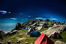
The state is also known for its adventure tourism activities like ice skating in Shimla, paragliding in Bir-billing and Solang valley, rafting in Kullu, skiing in Manali boating in Bilaspur and trekking, horse riding and fishing in different parts in the state. Spiti Valley in Lahaul & Spiti District situated at an altitude of over 3000 metres with its picturesque landscapes is an important destination for adventure seekers. The region also has some of the oldest Buddhist Monasteries in Asia.[49]
The state is also a famous destination for film shooting. Movies like Roja, Henna, Jab We Met, Veer-Zaara, Yeh Jawaani Hai Deewani and Highway have been filmed in Himachal Pradesh.
Himachal hosted the first Paragliding World Cup in India from 24 October to 31 October in 2015.[50][51] Venue for paragliding world cup was Bir Billing, which is 70 km from famous tourist town Macleod ganj, located in the heart of Himachal in Kangra District. Bir Billing is the centre for aero sports in Himachal and considered as best for paragliding.[50] Buddhist monasteries, trekking to tribal villages, mountain biking are other activities to do here.
Transportation

- Air
Himachal has three domestic airport in Kangra, Kullu and Shimla districts. The air routes connect the state with Delhi and Chandigarh.
- Bhuntar Airport is in Kullu district, around 10 kilometres (6 mi) from district headquarters.
- Gaggal Airport is in Kangra district, which is around 10 kilometres from Kangra
- Shimla Airport is around 21 kilometres (13 mi) west of the city.
- Railway
Himachal is famous for its narrow-gauge railways. One is the Kalka-Shimla Railway, a UNESCO World Heritage Site, and another is the Pathankot-Jogindernagar Railway. The total length of these two tracks is 259 kilometres (161 mi). The Kalka-Shimla Railway passes through many tunnels, while the Pathankot–Jogindernagar meanders through a maze of hills and valleys. It also has broad-gauge railway track, which connects Amb (Una district) to Delhi. A survey is being conducted to extend this railway line to Kangra (via Nadaun). Other proposed railways in the state are Baddi-Bilaspur, Dharamsala-Palampur and Bilaspur-Manali-Leh.
- Road
Roads are the major mode of transport in the hilly terrains. The state has road network of 28,208 kilometres (17,528 mi),[52] including eight National Highways (NH) that constitute 1,234 kilometres (767 mi) and 19 State Highways with a total length of 1,625 kilometres (1,010 mi).[52] Some roads get closed during winter and monsoon seasons due to snow and landslides. Hamirpur has the highest road density in the state.[53]
Population
Demographics

| Population Growth | |||
|---|---|---|---|
| Census | Pop. | %± | |
| 1951 | 2,386,000 | — | |
| 1961 | 2,812,000 | 17.9% | |
| 1971 | 3,460,000 | 23.0% | |
| 1981 | 4,281,000 | 23.7% | |
| 1991 | 5,171,000 | 20.8% | |
| 2001 | 6,077,900 | 17.5% | |
| 2011 | 6,864,602 | 12.9% | |
| Source:Census of India 2011 | |||
| Literacy Rate | |||
|---|---|---|---|
| Census | Pop. | %± | |
| 1971 | 31.96 | — | |
| 1981 | 42.48 | 32.9% | |
| 1991 | 63.86 | 50.3% | |
| 2001 | 76.48 | 19.8% | |
| 2011 | 82.80 | 8.3% | |
| Source:[54] | |||
Himachal Pradesh has a total population of 6,864,602 including 3,481,873 males and 3,382,729 females as per the final results of the Census of India 2011. This is only 0.57 per cent of India's total population, recording a growth of 12.81 per cent.[5][54] The total fertility rate (TFR) per woman is 1.8, one of lowest in India.
In the census, the state is placed 21st on the population chart, followed by Tripura at 22nd place. Kangra district was top ranked with a population strength of 1,507,223 (21.98%), Mandi district 999,518 (14.58%), Shimla district 813,384 (11.86%), Solan district 576,670 (8.41%), Sirmaur district 530,164 (7.73%), Una district 521,057 (7.60%), Chamba district 518,844 (7.57%), Hamirpur district 454,293 (6.63%), Kullu district 437,474 (6.38%), Bilaspur district 382,056 (5.57%), Kinnaur district 84,298 (1.23%) and Lahaul Spiti 31,528 (0.46%).
The life expectancy at birth in Himachal Pradesh is 62.8 years (higher than the national average of 57.7 years) for 1986–1990. The infant mortality rate stood at 40 in 2010, and the crude birth rate has declined from 37.3 in 1971 to 16.9 in 2010, below the national average of 26.5 in 1998. The crude death rate was 6.9 in 2010.[55] Himachal Pradesh's literacy rate almost doubled between 1981 and 2011 (see table to right).
Languages
Hindi is both the official language and the lingua franca of Himachal Pradesh. However, most of the population speaks Pahari in everyday conversation, which includes nearly all Western Pahari dialects. There are a total of 32 languages in Himachal.[56][57] English also has official status for government work.
Religion

Hinduism is the main religion in Himachal Pradesh, which ranks first in India in terms of the proportion of Hindus present within it. More than 95% of the total population belongs to the Hindu faith, the distribution of which is evenly spread throughout the state.[59] Himachal Pradesh thus has the one of the highest proportions of Hindu population in India (95.17%).
Other religions that form a small percentage are Islam, Buddhism and Sikhism. Muslims are mainly concentrated in Sirmaur, Chamba, Kangra and Una districts where they form 1.31-6.27% of the population.[59] The Lahaulis of Lahaul and Spiti region are mainly Buddhists. Sikhs mostly live in towns and cities and constitute 1.16% of the state population. The Buddhists, who constitute 1.15%, are mainly natives and tribals from Lahaul and Spiti, where they form a majority of 62%, and Kinnaur, where they form 21.5%.[59]
Culture


Himachal Pradesh was one of the few states that had remained largely untouched by external customs, largely due to its difficult terrain. With the technological advancements, the state has changed very rapidly. Himachal Pradesh is a multireligional, multicultural as well as multilingual state like other Indian states. Some of the most commonly spoken languages are Hindi, Punjabi, Pahari, Dogri, Mandeali, Kangri and Kinnauri.[60] The Hindu communities residing in Himachal include the Brahmins, Rajputs, Kannets, Rathis and Kolis. There are also tribal population in the state which mainly comprise Gaddis, Kinnars, Gujjars, Pangawals and Lahaulis.[61]
Himachal is well known for its handicrafts. The carpets, leather works, shawls, paintings, metalware, woodwork and paintings are worth appreciating. Pashmina shawl is one of the products which is highly in demand not only in Himachal but all over the country. Himachali caps are also famous art work of the people.
Local music and dance reflects the cultural identity of the state. Through their dance and music, they entreat their gods during local festivals and other special occasions.
Apart from the fairs and festivals that are celebrated all over India, there are number of other fairs and festivals, including the temple fairs in nearly every region that are of great significance to Himachal Pradesh.
The day to day food of Himachalis is very similar to the rest of the north India. They too have lentil, broth, rice, vegetables and bread. As compared to other states in north India non-vegetarian cuisine is more preferred. Some of the specialities of Himachal include Manee,Madeera,Pateer, Chouck, Bhagjery and chutney of Til.
Shimla, the state capital, is home to Asia's only natural ice skating rink.[62]
Notable people
Prominent people associated with Himachal include:
- Shanta Kumar (member of Lok Sabha)
- Jagat Prakash Nadda (member of Lok Sabha)
- Anurag Thakur (member of Lok Sabha and President of Board of Control for Cricket in India)
- Sobha Singh (Painter)
- The Great Khali, professional wrestler
- Dev Anand, an Indian actor studied here.
- Anupam Kher, an Indian actor
- Amrish Puri (who studied here),
- Prem Chopra (brought up here),
- Subhash Chander, News Personality
- Mohit Chauhan, an Indian singer
- Anand Sharma (member of Rajya Sabha and former Union Cabinet Minister for Commerce and Industry[63] of the Government of India),
- Mehr Chand Mahajan Third Supreme Court Chief-Justice and former chief Minister of Kashmir in 1947,
- Shahid Javed Burki economist and former vice-president of World Bank,
- Pritam Singh, is the brand ambassador of the state
- Preity Zinta, Bollywood actress
- Kangana Ranaut, Bollywood actress,
- Yami Gautam, Bollywood actress,
- Siddharth Chauhan, Independent Filmmaker[64]
- Namrata Singh Gujral, an American actress
- Satyananda Stokes who introduced apples to the region,
- Idries Shah writer, Sufi teacher and sage,
- Allan Octavian Hume ornithologist had his home here,
- Muhammad Zia-ul-Haq former general of Pakistan who studied here,
- Hamid Karzai president of Afghanistan who studied here,
- Vijay Kumar won silver medal in 25m shooting in 2012 Summer Olympics,
- Ms. Suman Rawat Mehta,Arjuna Awardee.Won a bronze medal in the 1986 Asian Games in 3000m race.
- Major Som Nath Sharma, PVC (1923–1947) was the first recipient of the Param Vir Chakra,
- Captain Vikram Batra PVC (9 September 1974 – 7 July 1999) posthumously awarded with the Param Vir Chakra,
- Captain Saurabh Kalia (1976–1999) posthumously awarded with the Maha Vir Chakra
- Naib Subedar Sanjay Kumar , PVC ( 3 March 1976) is an Indian Army soldier, a Junior Commissioned Officer and recipient of the Param Vir Chakra, India's highest military award.
- Shyam Saran Negi, named as the first voter of independent India.
- Ram Kumar, abstract artist.
Education
Hamirpur District is among the top districts in the country for literacy.[65] Education rates among women are quite encouraging in the state.[65] The standard of education in the state has reached a considerably high level as compared to other states in India[65] with several reputed educational institutes for higher studies.
The Indian Institute of Technology Mandi, Himachal Pradesh University Shimla, Institute of Himalayan Bioresource Technology (IHBT, CSIR Lab), Palampur, the National Institute of Technology, Hamirpur, Indian Institute of Information Technology Una, the Central University Dharamshala, AP Goyal (Alakh Prakash Goyal) Shimla University, the Bahra University (Waknaghat, Solan), the Baddi University of Emerging Sciences and Technologies Baddi, IEC University, Shoolini University of Biotechnology and Management Sciences, Solan, Manav Bharti University Solan, the Jaypee University of Information Technology Waknaghat, Eternal University, Sirmaur & Chitkara University Solan are some of the pioneer universities in the state. CSK Himachal Pradesh Krishi Vishwavidyalya Palampur is one of the most renowned hill agriculture institutes in world. Dr. Yashwant Singh Parmar University of Horticulture and Forestry has earned a unique distinction in India for imparting teaching, research and extension education in horticulture, forestry and allied disciplines. Further, state-run Jawaharlal Nehru Government Engineering College started in 2006 at Sundernagar.[65]
There are over 10,000 primary schools, 1,000 secondary schools and more than 1,300 high schools in Himachal.[66] The state government has decided to start three major nursing colleges to develop the health system in the state.[65] In meeting the constitutional obligation to make primary education compulsory, Himachal has become the first state in India to make elementary education accessible to every child.[67]
The state has Indira Gandhi Medical College and Hospital, Homoeopathic Medical College & Hospital, Kumarhatti. Besides that there is Himachal Dental College which is the state's first recognised dental institute.[68]
State profile
| Animal | Snow leopard बर्फीला तेंदुआ |
|---|---|
| Bird | Jujurana जुजुराणा |
| Flower | Rhododendron बुरांस |
| Tree | Deodar देवदार |


Source: Department of Information and Public Relations.[69]
| Area | 55673 km2 |
| Total population | 6,864,602[70] |
| Males | 3,481,873[71] |
| Females | 3,382,729[71] |
| Population density | 123 |
| Sex ratio | 972[72] |
| Rural population | 6,176,050[72] |
| Urban population | 688,552[72] |
| Scheduled Caste population | 1,729,252 |
| Scheduled Tribe population | 392,126 |
| Literacy rate | 83.78%[71] |
| Male literacy | 90.83%[71] |
| Female literacy | 76.60%[71] |
| Districts | 12 |
| Sub-divisions | 62 |
| Tehsils | 149 |
| Sub-tehsils | 35 |
| Developmental blocks | 78 |
| Towns | 59 |
| Panchayats | 3,226 |
| Panchayat smities | 77 |
| Zila parishad | 12 |
| Urban local bodies | 49 |
| Nagar nigams | 2 |
| Nagar parishads | 25 |
| Nagar panchayats | 23 |
| Census villages | 20,690 |
| Inhabited villages | 17,495 |
| Health institutions | 3,866 |
| Educational institutions | 17,000 |
| Motorable roads | 33,722 km |
| National highways | 8 |
| Identified hydroelectric potential | 23,000.43 MW in five rivers basins i.e. (Yamuna, Satluj, Beas, Ravi, Chenab and Himurja) |
| Potential harnessed | 10,264 MW[38] |
| Food grain production | 1579,000 tonnes |
| Vegetable production | 900,000 tonnes |
| Fruit production | 1,027,000 tonnes |
| Per capita income | 130,067 (2015–16)[38] |
| Social Security pensions | 237,250 persons, annual expenditure: over ₹ 600 million |
| Investment in industrial areas | ₹ 273.80 billion, employment opportunities: Over 337,391 |
| Employment generated in government sector | 80,000 |
Census 2011-
Largest District (km²) (1) Lahul and Spiti 13841 (2) Chamba 6522 (3) Kinnaur 6401 (4) Kangra 5739 (5) Kullu 5503
Percentage of Child (1) Chamba 13.55% (2) Sirmaur 13.14% (3) Solan 11.74% (4) Kullu 11.52% (5) Una 11.36%
High Density (1) Hamirpur 407 (2) Una 338 (3) Bilaspur 327 (4) Solan 300 (5) Kangra 263
Top Population Growth (1) Una 16.26% (2) Solan 15.93% (3) Sirmaur 15.54% (4) Kullu 14.76% (5) Kangra 12.77%
High Literacy (1) Hamirpur 89.01% (2) Una 87.23% (3) Kangra 86.49% (4) Blaspur 85.87% (5) Solan 85.02%
High Sex Ratio (1) Hamirpur 2042 (2) Kangra 1012 (3) Mandi 1007 (4) Chamba 986 (5) Bilaspur 981
See also
Notes
- ↑ "Kalyan Singh takes oath as Governor of Himachal Pradesh". The Economic Times. 28 January 2015.
- ↑ "Himachal Pradesh Chief Minister". Himachal.gov.in. Retrieved 18 December 2015.
- ↑ "Himachal Pradesh Vidhan Sabha". Hpvidhansabha.nic.in. 18 April 2011. Retrieved 15 June 2011.
- 1 2 Statistical Facts about India, indianmirror.com, retrieved 26 October 2006
- 1 2 3 "Himachal Pradesh Profile" (PDF). Census of India. Retrieved 27 May 2016.
- 1 2 http://nclm.nic.in/shared/linkimages/NCLM50thReport.pdf
- ↑ "HIMACHAL PRADESH GLIMPS". Laureate it. Retrieved 12 March 2012.
- ↑ Shankar (12 October 2012). "HIMACHAL PRADESH – THE LAND OF ABUNDANT BEAUTY". Perfect Indian Tourism. Retrieved 31 May 2016.
- ↑ "Indian states by GDP per capita". Statistics Times. 20 August 2015. Retrieved 31 May 2016.
- 1 2 3 "While others sweat, Himachal struggles to sell its surplus power". Hindustan Times. 5 August 2013. Retrieved 31 May 2016.
- ↑ "Famous Valleys in Himachal Pradesh". Discovered India. Retrieved 1 June 2016.
- ↑ "In Himachal, where 90 per cent people live in villages, female literacy rate touches 80 per cent". India Today. 26 May 2013. Retrieved 31 May 2016.
- ↑ Soutik Biswas (16 March 2012). "Is India's lack of toilets a cultural problem?". BBC News. Retrieved 31 May 2016.
- ↑ "Himachal imposes complete ban on polythene bags". Deccan Herald. 2 October 2009. Retrieved 31 May 2016.
- ↑ "India Corruption Study" (PDF). Transparency International. 2005. p. 11. Archived from the original (PDF) on 24 March 2012. Retrieved 29 May 2007.
- 1 2 3 4 5 6 7 8 9 10 11 12 13 14 15 "History of Himachal Pradesh". National informatics center, Himachal Pradesh. Archived from the original on 2006-11-21. Retrieved 31 March 2008.
- ↑ Bhatt, SC; Bhargava, Gopal (2006). Land and People of Indian States and Union Territories Vol. X. Kalpaz publications. p. 2. ISBN 81-7835-366-0.
- ↑ Verma 1995, pp. 28–35, Historical Perspective.
- ↑ "Reo Purgyil, 6816 m".
- 1 2 "Rivers in Himachal Pradesh". Suni Systems (P). Retrieved 28 April 2006.
- ↑ "Climate of Himachal Pradesh". himachalpradesh.us. Retrieved 26 October 2006.
- ↑ Himachal Pradesh Forest Department. "The Forests". National Informatics Center, Himachal Pradesh. Archived from the original on 2013-05-10. Retrieved 3 April 2008.
- ↑ Kala, C.P. (2002) Medicinal Plants of Indian Trans-Himalaya: Focus on Tibetan Use of Medicinal Resources. Bishen Singh Mahendra Pal Singh, Dehradun, India. 200 pp.
- ↑ Kala, C.P. (2000) Status and conservation of rare and endangered medicinal plants in the Indian trans-Himalaya. Biological Conservation, 93 (3): 371-379.
- ↑ Kala, C.P. (2005) Health traditions of Buddhist community and role of amchis in trans-Himalayan region of India. Current Science, 89 (8): 1331-1338.
- ↑ http://hpmc.gov.in/himachal.htm
- ↑ "In Himachal Pradesh Striking gold with marigold". Indianexpress. 2 July 2004. Retrieved 15 June 2011.
- ↑ Goutam Pal, Dipak K S, Indusnettechnologies. "Wild Life: Himachal Pradesh Forest Department".
- 1 2 "Wildlife in Himachal Pradesh". Tour my India. Retrieved 19 July 2016.
- 1 2 "Protected Area Network". Himachal Pradesh Forest Department. Retrieved 19 July 2016.
- ↑ "Himachal Pradesh (gov) Introduction". National informatics center. Computer Centre, Lok Sabha Secretariat. Retrieved 3 May 2007.
- ↑ "Legislative Assembly". Legislative Bodies in India. National Informatics Centre. Retrieved 28 October 2006.
- ↑ "Congress gets absolute majority in Himachal". The Statesman. Archived from the original on 2013-05-11. Retrieved 20 December 2012.
- ↑ "Virbhadra Singh sworn in as Himachal CM for a record 6th time". Indian Express. 25 December 2012.
- 1 2 "Himachal Pradesh at a Glance". Official Website of Himachal Pradesh. Retrieved 4 July 2016.
- ↑ "DIVISIONAL COMMISSIONER, Kangra Division, Dharamshala". Retrieved 4 July 2016.
- ↑ "State of Himachal Pradesh At a Glance" (PDF). Department of Land Records, Government of Himachal Pradesh. Retrieved 4 July 2016.
- 1 2 3 "Economic Survey projects Himachal Pradesh's growth rate at 7.7% - Times of India". Retrieved 2016-09-02.
- ↑ Economy of Himachal by Agriculture @ webindia123.com Suni System (P) Ltd. Retrieved on- 2015-07-28
- 1 2 Kanwar Yogendra (3 August 2015). "Apple season begins in Himachal Pradesh". The Hindu. Retrieved 1 June 2016.
- ↑ "APPLE". National Horticulture Board. Retrieved 1 June 2016.
- 1 2 "Himachal Pradesh headed for good Apple crop this year". Business Today. 19 October 2015. Retrieved 1 June 2016.
- ↑ "Independence Day-2013 Speech by Virbhadra Singh". shimlatimes.in. Retrieved 18 August 2013.
- ↑ "Current GDP". H. K. Dua, The Tribune House. Retrieved 23 May 2007.
- ↑ "$37 Million Additional Financing for Himachal Pradesh Mid Himalayan Watershed Development Project, India – 18000 Farmer Households to Benefit". Worldbank.org. 27 September 2012. Retrieved 7 February 2014.
- ↑ "Himachal Pradesh Tourism". India Tourism. Retrieved 1 June 2016.
- ↑ "Temples of Himachal Pradesh". Maps of India. Retrieved 1 June 2016.
- ↑ "Himachal Pradesh: Dev Bhoomi, The Land of Gods". Sanskriti Magazine. Retrieved 1 June 2016.
- ↑ "Top 15 Places To Visit In Himachal Pradesh". Trans India Travels. Retrieved 31 May 2016.
- 1 2 "Paragliding World Cup 2015 will be held in India: All you need to know". India Today. 10 September 2015. Retrieved 31 May 2016.
- ↑ "India hosts the first ever Paragliding World Cup". Red Bull. 4 November 2015. Retrieved 31 May 2016.
- 1 2 "Himachal Pradesh: Infrastructure". Public Private Partnerships in India. Ministry of Finance, Government of India. Archived from the original on 2010-02-07. Retrieved 6 April 2008.
- ↑ "Hamirpur road density". Hari Jaisingh, Published from The Tribune House. Retrieved 22 May 2007.
- 1 2 "Census 2011:Population size and Decadal change" (PDF). Census of India. Retrieved 27 May 2016.
- ↑ "Highlights of Himachal Pradesh HDR (2002)" (PDF). Government of Himachal Pradesh (2002), Himachal Pradesh Human Development Report 2002, Government of Himachal Pradesh, pp. 40. Retrieved 26 May 2007.
- ↑ Masica, Colin P. (1993). The Indo-Aryan Languages. Cambridge University Press. ISBN 0-521-29944-6.
- ↑ Itagi, N. H. (1994). Spatial Aspects of Language. Central Institute of Indian Languages. p. 70. ISBN 81-7342-009-2.
- ↑ "Population by religion community - 2011". Census of India, 2011. The Registrar General & Census Commissioner, India. Archived from the original on 25 August 2015.
- 1 2 3 "Himachal Pradesh Districts - Religion 2011". Census2011. Retrieved 31 May 2016.
- 1 2 "The people and tribes". www.123himachal.com. Retrieved 2007-05-20.
- ↑ "Culture of Himachal Pradesh". Indialine (2007). Retrieved 2007-05-03.
- ↑ "Ice-skating rink completes 100 sessions again". The Tribune, Chandigarh, India. Retrieved 11 February 2001.
- ↑ "Minister of Commerce of India Anand Sharma to visit Finland, Embassy of Finland, Washington, Consulate Generals of Finland, New York, Los Angeles: Current Affairs: Ministry for Foreign Affairs News". Finland.org. 23 March 2010. Retrieved 15 June 2011.
- ↑ "Shimla boy bags award at international short film festival". Hindustan Times. Retrieved 14 January 2014.
- 1 2 3 4 5 "Educational Profile of Himachal Pradesh". General Overview of Education in Himachal. Archived from the original on 2008-02-02. Retrieved 16 March 2007.
- ↑ "Factual source on Education in Himachal". Government of India. Archived from the original on 2007-04-30. Retrieved 16 March 2007.
- ↑ Dua, H.K. "Educational updates- Himachal". The Tribune Trust, 2006. The Tribune House. Retrieved 16 March 2007.
- ↑ "IGMC-home". Igmcshimla.org. Retrieved 7 February 2014.
- ↑ "Himachal At A Glance". Himachalpr.gov.in. Archived from the original on 2013-08-16. Retrieved 15 June 2011.
- ↑ "HP Census 2011". Census 2011.
- 1 2 3 4 5 "Provisional Population Totals" (PDF). Census of India. Retrieved 7 February 2014.
- 1 2 3 census 2011
References
- Ahluwalia, M.S. (1998). Social, Cultural and Economic History of Himachal Pradesh. Indus Publishing. ISBN 81-7387-089-6. Retrieved 31 March 2008.
- Batta, R.N. (2000). Tourism and the Environment: A Quest for Sustainability. Indus Publishing. ISBN 81-7387-110-8. Retrieved 31 March 2008.
- Singh, Mian Goverdhan (2000). C.L. Gupta & Kulbhushan Chandel, eds. Himachal Pradesh: History, Culture & Economy (extensively revised ed.). Shimla.: Minerva Publishers & Distributors.
- Singh, Sarina (2005). India. Lonely Planet. ISBN 1-74059-694-3. Retrieved 31 March 2008.
- Tiwari, A.K. (2000). Infrastructure and Economic Development in Himachal Pradesh. Indus Publishing. ISBN 81-7387-105-1. Retrieved 31 March 2008.
- Verma, V. (1995). The Emergence of Himachal Pradesh: A Survey of Constitutional Developments. Himachal Pradesh (India): Indus Publishing. ISBN 81-7387-035-7. Retrieved 15 June 2011.
- United Nations Development Programme (UNDP) (2002). Himachal Pradesh Human Development Report 2002. Government of Himachal Pradesh. ISBN 0-19-521915-5. Retrieved 31 March 2008.
- Statistics and Data, Planning Department, Government of Himachal Pradesh
External links
| Wikimedia Commons has media related to Himachal Pradesh. |
| Wikivoyage has a travel guide for Himachal Pradesh. |
 |
|
| ||
| Punjab | |
Tibet Autonomous Region, | ||
| ||||
| | ||||
| Haryana | Uttar Pradesh | Uttarakhand |