Hilton, Ontario
| Hilton | |
|---|---|
| Township (single-tier) | |
| Township of Hilton | |
 | |
 Hilton | |
| Coordinates: 46°13′N 83°53′W / 46.217°N 83.883°WCoordinates: 46°13′N 83°53′W / 46.217°N 83.883°W | |
| Country |
|
| Province |
|
| District | Algoma |
| Government | |
| • Type | Township |
| • Reeve | Rodney Wood |
| • Governing Body | Hilton Township Council |
| • MP | Bryan Hayes (CPC) |
| • MPP | Michael Mantha (NDP) |
| Area[1] | |
| • Total | 115.78 km2 (44.70 sq mi) |
| Population (2011)[1] | |
| • Total | 261 |
| • Density | 2.3/km2 (6/sq mi) |
| Time zone | EST (UTC-5) |
| • Summer (DST) | EDT (UTC-4) |
| Postal code | P0R 1G0 |
| Area code(s) | 705 |
| Website | www.hiltontownship.ca |
Hilton is a township in the Canadian province of Ontario, comprising the southeast quadrant of St. Joseph Island in the Algoma District. It surrounds, but does not include, the independent village of Hilton Beach.
Demographics
| Canada census – Hilton, Ontario community profile | |||
|---|---|---|---|
| 2011 | 2006 | 2001 | |
| Population: | 261 (7.4% from 2006) | 243 (-5.8% from 2001) | 258 (1.2% from 1996) |
| Land area: | 115.78 km2 (44.70 sq mi) | 115.78 km2 (44.70 sq mi) | 115.78 km2 (44.70 sq mi) |
| Population density: | 2.3/km2 (6.0/sq mi) | 2.1/km2 (5.4/sq mi) | 2.2/km2 (5.7/sq mi) |
| Median age: | 55.6 (M: 56.0, F: 55.1) | 51.6 (M: 51.5, F: 51.7) | |
| Total private dwellings: | 367 | 334 | 300 |
| Median household income: | $45,428 | ||
| References: 2011[2] 2006[3] 2001[4] | |||
See also
References
- 1 2 "Hilton census profile". 2011 Census of Population. Statistics Canada. Retrieved 2012-02-16.
- ↑ "2011 Community Profiles". Canada 2011 Census. Statistics Canada. July 5, 2013. Retrieved 2012-02-16.
- ↑ "2006 Community Profiles". Canada 2006 Census. Statistics Canada. March 30, 2011. Retrieved 2012-02-16.
- ↑ "2001 Community Profiles". Canada 2001 Census. Statistics Canada. February 17, 2012. Retrieved 2012-02-16.
External links
 |
St. Joseph Township | Johnson St. Joseph Channel Hilton Beach |
Plummer Additional, Bruce Mines St. Joseph Channel |
|
| Jocelyn | |
North Channel of Lake Huron | ||
| ||||
| | ||||
| Potagannissing Bay |
| Cities | 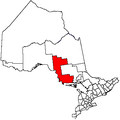 | |
|---|---|---|
| Towns | ||
| Townships | ||
| Villages | ||
| First Nations | ||
| Indian reserves | ||
| Local services boards | ||
| Unorganized areas | ||
| ||
This article is issued from Wikipedia - version of the 7/27/2016. The text is available under the Creative Commons Attribution/Share Alike but additional terms may apply for the media files.